Arizona Strip Area

dsrtrat

Senior Member
Joined
Sep 20, 2007
Messages
259
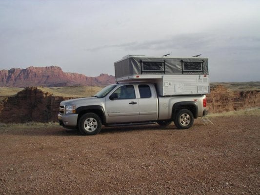
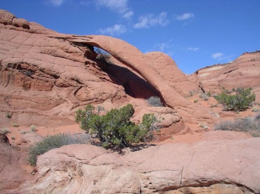
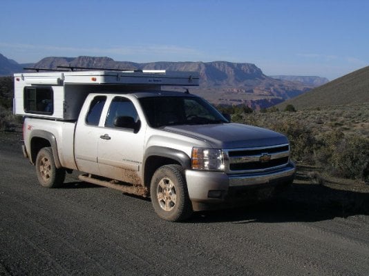
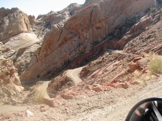
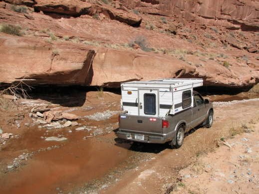
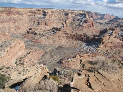
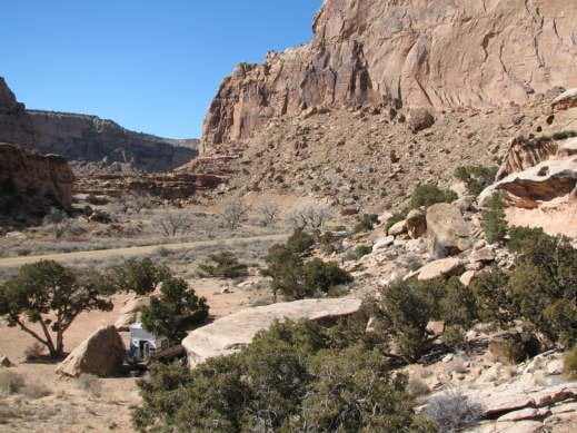
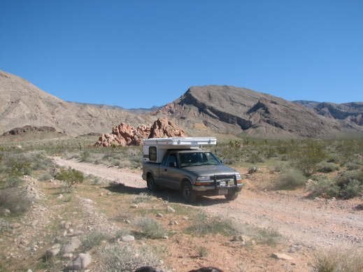
I spent 10 days in the Arizona Strip and Southern Utah area. Nice remote areas with great scenery. Weather was changable as it usually is this time of year. Some rain,snow and wind but many nice days as well.
I visited the North Rim of the Grand Canyon in several places as well as hiking in the Paria Canyon area.
My All Terrain Panther kept me warm in dry in all these conditions and functioned flawlessly.
Desertrat
 

Attachments

  • Road trip 3-12 sites truck 066.jpg
    Road trip 3-12 sites truck 066.jpg
    67.3 KB · Views: 363
  • Road trip 3-12 sites truck 035.jpg
    Road trip 3-12 sites truck 035.jpg
    122.7 KB · Views: 365
  • Road trip 3-12 sites truck 028.jpg
    Road trip 3-12 sites truck 028.jpg
    117.1 KB · Views: 368
I just spent a couple weeks "geologizing" in the San Rafael Swell and Arizona Strip areas. Any time I would see a good campsite I'd save the GPS coordinates for a future trip. I've been camping in these areas before in a Honda Civic and a small Toyota motorhome but the combination of a lightweight truck camper and 4x4 is definitely the ultimate!! Being able to take off on atv tracks let me find a lot of cool nooks and crannies in the desert.

The small amount of rain and snow I encountered lent a whole new meaning to the numerous "Impassable when wet" signs I encountered. No big deal tho', I'd just wait a couple hours for the "grease" covered tracks to get tacky again.

The worst part of the whole trip was my extremely bad tire karma! The almost new Firestone A/Ts I had turned out to be suitable only for pavement. The first flat tire occurred on a gnarly stretch of track near Gold Butte - cactus spines. The phony "donut" spare I put on lasted about 10 miles but got me back onto a gravel road before it exploded. I put the flat tire back on and used a can of fix-a-flat and my walmart compressor to get to a tire shop in Mesquite. The next day I was back in the Arizona strip with another rear tire flat, sharp rock in the tread this time. More fix-a-flat and compressor time got me 70 miles to the pavement near Colorado City UT where the other rear tire blew out half a mile from the tire shop. The four new heavier LT tires I bought performed great for the rest of my explorations (~500 miles of gravel and atv tracks).

Now I'm back home in Montana and it seems that there is more of the snow here that I wanted to escape than when I left. Hopefully spring will arrive soon allowing more access to "local" camp spots.

Rob
 

Attachments

  • Copy of IMG_0005.jpg
    Copy of IMG_0005.jpg
    36.9 KB · Views: 369
  • Copy of IMG_0064.JPG
    Copy of IMG_0064.JPG
    34.7 KB · Views: 356
  • Copy of IMG_0326.JPG
    Copy of IMG_0326.JPG
    41 KB · Views: 365
  • Copy of IMG_0375.JPG
    Copy of IMG_0375.JPG
    41.6 KB · Views: 359
  • Copy of IMG_0467.JPG
    Copy of IMG_0467.JPG
    26.4 KB · Views: 354
Terrific pix Rocky. How about sharing those GPS coordinates so we all can go. Especially that stand of trees between the rocks where you camped and ofcourse the arch.
 
Nice pics. Thanks for sharing, its one of my favorite areas.

How about sharing those GPS coordinates so we all can go.

Thats an interesting idea. We could create a database with GPS coords and descriptions, organized by state, available to WTW members. I've been doing this on my own travels (mostly in UT, NV) but it might be great to benefit from others as well. Of course, then your secret spots wouldn't be so secret. Thoughts?
 
I think a database of campspots would be a great idea with a few qualifications. It shouldn't be accessable to everybody, i.e. members only, and not available on internet search engines. Perhaps a geocache system if anybody is into that "sport".

A lot of the areas I've explored have numerous camp sites and half the fun is finding the perfect spot. Some I wouldn't want to post but would be glad to send descriptions etc thru private mail.

It'd be nice to have regions with camping possibilities available. It would certainly take a lot of the guess work out of travelling by being able to plan trips. I always like to be seeking a camping "area" by late afternoon. And it really sucks when you're in an area that has only paved "designated" pay campsites and thats heavily patrolled by the ranger gestapo.

Conversely I met a BLM ranger last week who pointed me toward a great spot. Technically it was a bit inside a non-motorized vehicle area but he said there wouldn't be any problem as long as I stayed only on existing tracks. Wish they were all that helpful.

I'll be doing a broad writeup on the San Rafael Swell area soon once I get some maps etc finished. A great place to explore, even in the winter.

Rob
 
Thats an interesting idea. We could create a database with GPS coords and descriptions, organized by state, available to WTW members. I've been doing this on my own travels (mostly in UT, NV) but it might be great to benefit from others as well. Of course, then your secret spots wouldn't be so secret. Thoughts?

I'm going to be adding a GPS database later this year, hopefully integrated with Google Maps. The private DB is an interesting idea. We'll have to throw some ideas around.
 
Back
Top Bottom