Big Bend to Baja

Vic Harder

Doctor Electric
Site Team
Joined
Nov 14, 2015
Messages
5,238
Location
Calgary, Alberta
Dreaming of a trip in the fall of 21 or 22... leaving from Calgary in early October, heading south through Moab to Big Bend, and from there to Baja and then back home along the west coast to BC. Planning on taking 2-4 months for this trip.

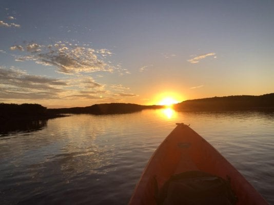
We like hiking, mountain biking (blue trails) and flat water canoeing. We prefer dry camping, but will do campgrounds if they are relatively quiet.

I've already identified Canyons of the Ancients and Hovenweep as places we want to stop on the way to Big Bend (both SP and NP), and Colossal Cave on the way to Baja.

Looking for suggestions south of Utah for routes, campsites, places to see and things to do.

Thanks in advance
 
I like Valley of the Gods
Beef Basin
Canyon Lands
Escalante
Bear Ears
Toroweap
Lake Powell-great paddling
All of Baja-especially south of Mulege
 
Great hiking in the Needles District of Canyonlands. Nice dispersed camping on Lockhart Road just before the entrance to Needles District.

Before Canyon of the Ancients, detour by the Moki Dugway. Quiet dispersed camping in Valley of the Gods. More dispersed camping and a nice hike at Honaker Trail then head in to Hovenweep from the west.

After Canyon of the Ancients and Hovenweep is Mesa Verde.Then south and west to Canyon de Chelly then take 180 to Gila Cliff Dwellings. Lots of hot springs here and in Truth or Consequences.

Next on to White Sands with a detour around Ruidiso with a stop at Three Petroglyphs BLM. Then to Carlsbad Caverns and Guadeloupe Mountains NP for good hiking. To Fort Davis and Fort Davis State Park then to Big Bend NP. Then Big Bend State Park .

After both Big Bends, Back up through Las Cruces, a few dispersed camping sites with great views at Sierra Vista Trailhead. Over to Chiricahua National Monument, lots of dispersed camping in the surrounding National Forest. Then Saguaro NP and maybe check out Arizona Sonora Desert Museum. Then Organ Pipe NM (camp at Alamo Canyon Campground) and KOFA NWR. If you want to play on the water, head up to Parker and Lake Havasu. Through Joshua Tree NP then Anza Borrego State Park before heading to Baja.

So many more places in Arizona, Utah, and New Mexico that it's hard to choose.

What route are you talking from Calgary to Moab?
 
Going all the way from Big Bend to Yuma to head south into Baja seems long. What about going south into mainland Mexico from Big Bend, hit the coast and drive south to Topolobampo, then taking the ferry across to La Paz in Baja. Then explore Baja as you head north from there? I know nothing about the mainland route, just a thought from looking at the map. Having made a few Baja trips, I'll get back to you on that. Several WTW members (Camelracer, Tomas Tierra, and Suni come to mind) are Baja regulars. They would likely have good advice. Baja Nomads forum is also a good source.
 
Thanks folks! To fill in some more detail, we've done lots in Utah, so that's why I'm asking about south of Utah. Also done Mesa Verde, but I could be talked into doing that again. We stopped in Bandelier, NM when we drove down from Calgary to get our Puma.

Russ, thanks for the links to GCNP stuff. We've done the North Rim, but that's all. Lots more to see here!

Wango, Toroweap looks interesting! What's the difference in Baja north/south of Mulege?

Sleddog, we've camped off Lockhart Road! Great sunsets! Plus the Moki Dugway and VotG are great. And yes, the hiking in Canyonlands is some of our favourite! Knowing you like these too, you have me hooked on the other places you suggested. Much appreciated. Calgary to Moab is pretty much a straight shot down through Helena, Idaho Falls, bypassing SLC on the east using 84 from Ogden to Provo, then 6 to Green River, and south on 191 to Monticello. This will be the fastest we've ever gotten down that far, as we usually meander more. This will be a LONG trek though, and I'd rather save my slow time for when we get there.

Ted, I looked at the ferry idea. It's expensive, I don't know how much travelling I want to do on mainland Mexico. Plus I read that the ferry from Topolobampo is no longer running, and you have to go all the way south to Mazatlan to catch that ferry. That would mean only traveling down/up Baja once, vs exploring both up and down.

Looking at the roads and Google Earth, it seems there are some main roads (highways 1 & 5). Do people stick to the main roads or travel side roads? Is it possible to drive down on side roads on the east side and up on the west? I see lots of people kayaking in the Gulf, what about canoeing?
 
Hi Vic

I second the thought that you are maybe rushing a trip to cover all that ground in that short a time.

Baja is slow going...not only because its inadvisable to travel after dark...short days in the winter...but also because there is so very much to see and do.....much of it in the southern state, Baja California Sur.

Everyone travels differently, of course, but for us a month in Baja Sur is just a delightful time enough to explore history and natural history.

Nevertheless, its fun to plan and lets all hope we can make some of these plans real in the next year or so.

David Graves
 
We've done 1.5 months in Baja, 2 months in the mainland. My suggestion is to not over do it. If you want to do Baja however you want to get there, just beeline it once you get close to the border then take your time. If you head down mainland you may get "sidetracked" and then hit Baja and wish you had more time. If you can stay focused and get to the ferry that'd be great; we just wouldn't be able to make it. The other thing to consider and research is the ferry. When we were down there it seemed like it was canceled sometimes, other times on schedule or ? Just the way it goes. You could have a few days waiting for it. We didn't take it btw, we did 2 separate trips (as above). I kind of like the idea of the ferry as in Baja there's basically one route except northern Baja where you can chose to go via Ensenada or up near San Felipe (crossing from one coast to the other). Oh, btw, if you are a wine drinker, go to the wine region north east of Ensenada! It's has great wine and food.
 
Vic, If you end up going to Baja I've got some good info- particularly for the northern half.. Baja can soak up as little or as much time as you have got. My personal preference is to avoid the border towns and basically "start" my trip south of Ensenada or south of San Felipe. At those points you miss 90% of the bad apples (my opinion). Baja nomads forum is a great resource although every post seems to devolve into members with long standing grudges - sniping at each other. ;-). Still some great info over there.

We did Bay of LA in Oct and it was perfect, days were cooler but water still warm for snorkeling with the whale sharks. By Jan or so Baja gets colder and windy on the east side. People say that Oct is the best month for Baja.

One hair brained idea to consider is breaking your trip into 2 parts. Do this trip to the Mex border, store your RV for a couple months, fly back down and then do Baja for a month or two.

Steve
 
Personally, I’d also skip the mainland and head south through San Felipe and the Gulf to the tip, then north along the Pacific Coast back to AB. The tip re: Baja Nomads is right on.
 
Vic- Most of Arizona is BLM or National Forest, so there are lots of dispersed camping options. The military has significant holdings, Barry Goldwater Bombing Range and the Yuma Proving grounds are huge and not open to the public. There are also several large Reservations, and they have their own restrictions. Most of the area along the southern border open, interesting, and safe, though wall construction can be pretty ugly in places.
You should be aware that there are Border Patrol checkpoints scattered all across Arizona, New Mexico, and California. Many are far from the border and the dogs they use are very good at sniffing out controlled substances. They typically only stop traffic coming from the south, but depending on your route you could end up getting stopped.
 
81BC201E-A113-455C-BEAD-D6EF7E6C4834.jpeg
Looking at the roads and Google Earth, it seems there are some main roads (highways 1 & 5). Do people stick to the main roads or travel side roads? Is it possible to drive down on side roads on the east side and up on the west? I see lots of people kayaking in the Gulf, what about canoeing?
We just spent two weeks in Baja for Christmas and New Years kayaking, fishing and surfing...plenty of options to spend time off road. We use the highways (both 1 and 5) as fast access to our jumping off points, which vary depending on your interests. You definitely cannot drive the length of Baja, on either side, completely off road, but there are several good stretches that exceed 50-200+ miles. Don’t see many canoes in Baja but you certainly could use one if it’s calm, be mindful that the winds can come up quickly and ferociously. I don’t think I’d personally venture too far offshore in one, an ocean kayak would be a wise investment if you planning on spending as much time as it appears down there.
 

Attachments

  • D1F1B956-6090-448E-A135-B2D41ADA9FFA.jpeg
    D1F1B956-6090-448E-A135-B2D41ADA9FFA.jpeg
    73.2 KB · Views: 83
Vic Harder said:
Thanks folks! To fill in some more detail, we've done lots in Utah, so that's why I'm asking about south of Utah. Also done Mesa Verde, but I could be talked into doing that again. We stopped in Bandelier, NM when we drove down from Calgary to get our Puma.

Russ, thanks for the links to GCNP stuff. We've done the North Rim, but that's all. Lots more to see here!

Wango, Toroweap looks interesting! What's the difference in Baja north/south of Mulege?

Sleddog, we've camped off Lockhart Road! Great sunsets! Plus the Moki Dugway and VotG are great. And yes, the hiking in Canyonlands is some of our favourite! Knowing you like these too, you have me hooked on the other places you suggested. Much appreciated. Calgary to Moab is pretty much a straight shot down through Helena, Idaho Falls, bypassing SLC on the east using 84 from Ogden to Provo, then 6 to Green River, and south on 191 to Monticello. This will be the fastest we've ever gotten down that far, as we usually meander more. This will be a LONG trek though, and I'd rather save my slow time for when we get there.

Ted, I looked at the ferry idea. It's expensive, I don't know how much travelling I want to do on mainland Mexico. Plus I read that the ferry from Topolobampo is no longer running, and you have to go all the way south to Mazatlan to catch that ferry. That would mean only traveling down/up Baja once, vs exploring both up and down.

Looking at the roads and Google Earth, it seems there are some main roads (highways 1 & 5). Do people stick to the main roads or travel side roads? Is it possible to drive down on side roads on the east side and up on the west? I see lots of people kayaking in the Gulf, what about canoeing?
Vic... rather than Mesa Verde, go just south. There's a native american geo site that does tours that is very nice. It's on the backside (south) of mesa verde and has some amazing cliff dwellings and it's more private, etc. You have to have a guide but when we went it was just 4 of us and 2 left early. I can't remember the name right now but will try to recall if you are interested.
 
I’ll second the recommendation from SunMan re: not venturing too far offshore with a canoe. Chubascos can scream across the gulf from east to west, carrying lots of sand/debris and churning up large waves. Full disclosure: we were once caught, in a canoe, during a 10-minute microburst in the middle of Lake Louise. Large waves, 34* water, 45 years later I still shudder with the thought of being swamped. Since that’s your backyard a little ‘ol chubasco may be child’s play for you!
 
kmcintyre said:
Vic... rather than Mesa Verde, go just south. There's a native american geo site that does tours that is very nice. It's on the backside (south) of mesa verde and has some amazing cliff dwellings and it's more private, etc. You have to have a guide but when we went it was just 4 of us and 2 left early. I can't remember the name right now but will try to recall if you are interested.
yes, interested!
 
Mighty Dodge Ram said:
I’ll second the recommendation from SunMan re: not venturing too far offshore with a canoe. Chubascos can scream across the gulf from east to west, carrying lots of sand/debris and churning up large waves. Full disclosure: we were once caught, in a canoe, during a 10-minute microburst in the middle of Lake Louise. Large waves, 34* water, 45 years later I still shudder with the thought of being swamped. Since that’s your backyard a little ‘ol chubasco may be child’s play for you!
hmm. My canoe accepts a cover for adverse conditions. May have to get one of those. Yes, "chinooks" can bring interesting squalls along the front ranges in the Rockies. I'm glad you didn't get swamped. The cold water would have killed you!
 
We are currently on our 4th trip to Baja. Lots of great info above which I will not repeat. We made the mistake of going thru Cabo San Lucas and San Jose Del Cabo. Those Touristy areas are not why we drove from Edmonton to Baja.

Re Baja: a month is nice. I would not make solid plans. You are going to meet so many great people, learn new things, and get recommendations for places to go see and camp. My experience has been that Baja sets the pace you don’t. You going to love it.

Also don’t miss the whales.
 
Ramblinman said:
We are currently on our 4th trip to Baja. Lots of great info above which I will not repeat. We made the mistake of going thru Cabo San Lucas and San Jose Del Cabo. Those Touristy areas are not why we drove from Edmonton to Baja.

Re Baja: a month is nice. I would not make solid plans. You are going to meet so many great people, learn new things, and get recommendations for places to go see and camp. My experience has been that Baja sets the pace you don’t. You going to love it.

Also don’t miss the whales.
Would love to chat, share beer and pictures sometime when you get back and Covid is less of an issue!
 
Hey Vic

We canoe too !

One thing you might consider in Baja Sur is to rent or borrow some locals little skiff in order to get on the water...

or just pay for a Panga ride in some area that interests you.

You are not allowed to paddle your own boat in any of the whales sanctuaries, and most beach front camping areas have someone, either local or expatriot, who has some sort of floating something.

Especially given the high number of your countrymen who winter in Baja , there is a good chance you can arrange something in advance.

Baja Nomads is a great starting point if you ignore the blowhards and do some networking with some of the regulars on that forum.

David Graves
 
Back
Top Bottom