Carlsbad Caverns, Big Bend, Chiricahua Mountains and More

Sleddog

Senior Member
Joined
Nov 1, 2019
Messages
182
Location
Idaho
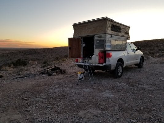
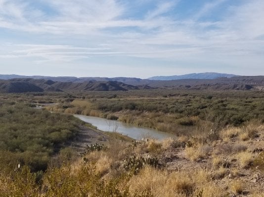
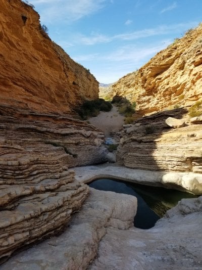
We had the pleasure of starting out the year with 49 days in the camper. The only planned portion of this trip was 2 weeks of camping at primitive backcountry sites at Big Bend National Park. Everything else we decided as we went based on weather, our moods, etc.

This was originally written as a live report for another audience.....

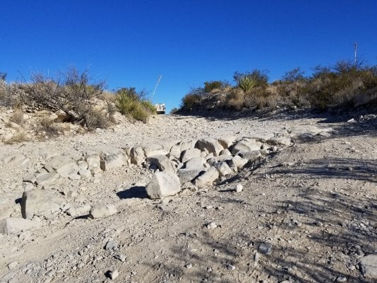
Day 1 - Today was planned as a travel day with no sightseeing stops. We left Pocatello, Idaho around 9am aiming for Green River, Utah for the first night. My (human) navigator took us on a 3 hour detour so we ended up stopping for the night at the Temple Mountain BLM area near Goblin Valley State Park. Courtesy of the detour, we pulled in after dark. There were a few free range cows, but they all had reflective ear tags and were easy to spot and avoid hitting while driving. There was maybe 8 to 12 inches of snow on the ground, and roads were a little icy in places, but we had no problems and easily pulled off to camp without getting stuck. Not the ideal campsite with temps dropping to about 10 degrees overnight, but it sufficed.

Day 2 - With the overnight temp around 10 degrees, we decided to get an early start on day 2 and hit the road around 6am. I have never seen so many rabbits as I saw between Temple Mountain Road and highway 24 this morning. If the idea of hitting a rabbit is too much to handle, then avoid this road just before dawn in late December, they will be difficult to miss. We had no issues and the sun was soon up.
Today was another planned driving day with few stops and no sightseeing. We stopped for the night at San Lorenzo BLM Recreation Area near Socorro, New Mexico, found with the help of www.freecampsites.net. Nothing special here, just a free place to camp on the way.

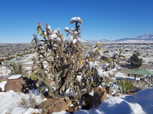
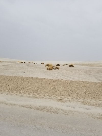
Day 3 - Another driving day, stopped for the night at Valley of Fires Recreation Area. We got there around 3pm and had time to walk the two short trails and take a shower. There were maybe a half dozen others camped here. Nice hot showers. A recent snow left a blanket of white on the lava flows and the desert landscape
 

Attachments

  • Valley of Fires.jpg
    Valley of Fires.jpg
    391.3 KB · Views: 130
Day 4 - Last driving day before a stop for a day or two at Carlsbad Caverns. Spent the night at a BLM primitive site, again courtesy of www.freecampsites.net, only 5 minutes from Whites City. The BLM site was nothing special, but super easy access to the caverns.
Day 5 - New Year's Day, one of only 3 days the caverns are closed all year. So we drove to Rattlesnake Springs, Sitting Bull Falls, and Dog Canyon Campground in Guadeloupe Mountains National Park. Nice location, but it It was a little colder here than we wanted and it was a long drive back to the caverns in the morning, so we went back and spent the night at the same BLM site as Day 4.
 

Attachments

  • BLM Carlsbad.jpg
    BLM Carlsbad.jpg
    271.1 KB · Views: 140
Day 6 - Today we toured the caverns, arriving around 9:30am. The parking lot was about half full when we arrived, but almost completely full when we left a couple hours later. We took the Natural Entrance and walked the Big Room loop. My traveling partner recently had knee surgery and had enough walking, so we took the elevator back up. The caves were fascinating and we may make reservations for a ranger guided tour of a different section of the caverns on our return trip north. After the cavern tour, we drove on to Davis Mountains State Park to camp for the night and get another shower.
 

Attachments

  • Carlsbad Cavern Entrance.jpg
    Carlsbad Cavern Entrance.jpg
    486.7 KB · Views: 122
Carlsbad Caverns - Whales Mouth
 

Attachments

  • Carlsbad Whales Mouth.jpg
    Carlsbad Whales Mouth.jpg
    180.3 KB · Views: 112
Neat formations everywhere you look.
 

Attachments

  • Carlsbad Untitles.jpg
    Carlsbad Untitles.jpg
    279.7 KB · Views: 114
Day 7 - The Davis Mountains were beautiful, but it was cold, rainy, and snowy so we didn't do any hikes (we will return here on the way home). We took a scenic drive around the mountains and decided to head on to Big Bend National Park, our main destination for this trip. I had made reservations at Chisos Camground for the first 3 nights, but we arrived a day early. We decided to try for a first come site. There were over a dozen sites available in the park at 1:30pm, but by the time we got there at 3:30 they were all taken. We took a short scenic drive then went out to Terlingua to find a commercial RV park. Everywhere we checked had vacancies, we went for the cheapest at $20 for the night for dry camping with access to bathroom and shower.

Day 8 - We drove to the Panther Junction Visitor Center and got our permit for primitive backcountry campsites. Some of these sites can be reached with most any car or RV while others require 4x4 and high clearance. We chose 13 nights at 7 different campsites, spending 2 nights at each site except for the last one on our departure day. Permits for primitive camsites cannot be reserved and are first come only (this changes February 1, 2020 to a reservation system for some sites). I reserved 3 nights at Chisos Camground just in case. Turned out it was easy to get the sites we wanted, so I ended up cancelling 2 nights at Chisos in favor of backcountry camping. We spent this first night at Chisos for easy access to the Lost Mine Trail the next morning (the popular trailhead has limited parking and this would position us nearby for an early morning hike). We checked out the Visitor Center and went for a short walk before heading to the campsite for the night. One night would be enough time at Chisos campground for us, it was a tightly packed campground with small sites very close together, no privacy at all.
 

Attachments

  • Jan 2 Chisos Campground 2.jpg
    Jan 2 Chisos Campground 2.jpg
    287.3 KB · Views: 148
Day 9 - We got an early start and were on Lost Mine Trail just a few minutes before 8am. There were only 3 other cars when we arrived, but the lot was full by the time we pulled out around 9:30. Next we drove to Persimmon Visitor center to check road conditions to our campsite at McKinney Spring, stopping at the fossil exhibit on the way. After we got our road report, we headed to our campsite. It was just over 9 miles on a rocky backcountry road that definitely requires 4x4 and high clearance, a Subaru AWD won't cut it. Took us an hour and forty five minutes to get there after leaving pavement, slow and rocky, but not too technical. McKinney Spring is a nice, isolated location with a single campsite, meaning no neighbors, and we only saw 5 other vehicles the rest of the day. There are definitely easier backcountry sites for those in RVs or regular automobiles.
 

Attachments

  • Jan 3 Sunrise Lost Mine Trail.jpg
    Jan 3 Sunrise Lost Mine Trail.jpg
    272.1 KB · Views: 95
Day 10 - Tonight is the 2nd of 2 nights we had reserved at McKinney Spring. Since the road in was so rough and slow, and considering that we were advised the road got much rougher after that, we spent the day in camp taking it easy. We took a short walk to the spring first thing in the morning while it was cool enough to leave the dogs in the truck. Dogs are allowed to be anywhere an automobile can be in Big Bend, but are not allowed on trails or offroad in the backcountry. After lunch and a nap, we walked the dogs along the dirt road, there is little to no traffic on the upper end of Old Ore Road, so it is safe to treat the road as a hiking trail. We took it easy soaking in the sun for the rest of the day.
 

Attachments

  • Jan 5 Mckinney Springs.jpg
    Jan 5 Mckinney Springs.jpg
    354 KB · Views: 114
The road out of McKinney Spring.
 

Attachments

  • Jan 7 Road out of Mckinney Spring.jpg
    Jan 7 Road out of Mckinney Spring.jpg
    448.3 KB · Views: 134
Day 11 - Today we changed campsites. We got started around 9am and took about 2 hours to drive out of McKinney Spring. Next was a stop at the general store near Rio Grande Village to do laundry and take showers. There was a large parking lot with room for any size RV setup that was mostly empty while we were there, though several people came and went. The laundry has 2 washers and one dryer, all looked a little rough, but were clean and worked fine. The washer was $1.50 per load and the dryer was 25 cents for 8 minutes. The dryer gets super hot and we dried two washer loads with only 4 quarters. Things were pretty quiet when we arrived around 11am, but it got busier after lunch with a line for the men's shower. Showers were decent and cost $2 for 5 minutes. Be sure to pay attention to which one you go in. My partner had a lukewarm shower because he accidentally chose the only stall that purposely does not have hot water and is signed as such. My shower was plenty hot. Not the nicest showers , but good enough. The store was small but decently stocked with the basic camping needs, some food, snacks, soft drinks, beer, maps, and a few souvenirs. There was gas for sale, fairly reasonably priced considering the location at just under $3 per gallon. They also had ice, so I refilled the ice in the food coolers and the 5 gallon water cooler before heading for tonight's campsite. I'm partial to cold drinking water and always add ice to refill the water cooler instead of water. There is a drinking water faucet convenient for 5 gallon jugs available at the nearby visitor center that I used for the water cube.
We camped the night at the Candelilla backcountry site. The site itself is nothing special, but it is only about a mile from pavement and easy access to the Rio Grande area of the park.
 

Attachments

  • Jan 8 Rio Grande.jpg
    Jan 8 Rio Grande.jpg
    310.7 KB · Views: 116
Day 12 - Tonight is night 2 of 2 at the Candellia campsite. First thing this morning we drove to Boquillas Canyon and hiked the short trail there. Next we took a drive to Ernst Tinaja, about 5 miles up the south end of Old Ore Road, and went on a short walk into the canyon where we saw beautiful layers of colorful rock surrounding a few pools of water. After the Tinaja, we took the dogs for a short walk along the road before heading back to the campsite to relax for the rest of the day.
The south end of Old Ore Road is in much better shape than the north end and the drive to the first three backcountry campsites and Ernst Tinaja can be reached with most any SUV or campervan. I would suggest driving slower than I see most people going on these primitive roads, there are many, many sharp rocks that can shred tires if driven over too fast. The backcountry roads guide book we bought for $4 at the visitor center suggested 15mph maximum, we have found anything over 5 to 10mph is too fast for most sections of Old Ore Road. A carefully driven sedan could probably make it to Ernst Tinaja, but I don't advise trying. Trying it with any large RV would be unwise.
Tomorrow, moving on to Glenn Spring...
 

Attachments

  • Jan 8 Ernst Tinaja.jpg
    Jan 8 Ernst Tinaja.jpg
    366.8 KB · Views: 106
Day 13 - We had a visitor in camp this morning, a wild burro was very curious about the strangers in her range. She was unafraid of humans or dogs and hung around for a few hours before wandering off. We had seen a wild horse and three wild burros in Boquillas Canyon, but otherwise no more wildlife sightings in spite of all the warnings about Mexican black bears and javelina.
We left the Candelilla campsite around 9:45 to head towards Glenn Spring. On the way, we stopped in the store at Rio Grande Village to get a few basic groceries, more ice, gas, and to put some air in a tire with a very slow leak.

We decided to take the River Road East to Glenn Spring Road to get to our campsite at Glenn Spring #1, about 17 miles of dirt, rock, and gravel that took about 2 hours. River Road East was in great shape to the junction with Glenn Spring Road and could be driven by most vehicles. Glenn Spring Road started out decent and slowly got worse, never as bad as the road to McKinney Spring, but just bad enough in a couple of spots to want high clearance. We are not really into off-roading as a sport, we just like to find primitive campsites in isolated natural settings, and the rangers warned us to avoid Black Gap Road. Turned out that we needed to go a short distance on Black Gap to get to our campsite. This required going down a short, but steep road, rutted on one side, with a hairpin turn at the bottom so tight that only Jeeps with a short wheel base can make it without backing up, there is a small but well used three point turn around area for those of us in full size pickups. Then the road goes through the spring in an area so tight that there are now more scratches on both sides of my truck. It all looked worse at first sight than it was in reality and we reached the campsite with no problems. Glenn Spring campsite #1 is definitely only accessible for those with high clearance 4 wheel drive. Glenn Spring #2 could be reached with a carefully driven SUV. Had I known all this, I probably would have chosen Glenn Spring campsite #2 for the easier access. We finished the day with our standard routine of walking the dogs before dinner and a little reading before bed.
 

Attachments

  • Jan 9 Candellia Burro.jpg
    Jan 9 Candellia Burro.jpg
    319.6 KB · Views: 109
Black Gap Road drops off to the right.
 

Attachments

  • Jan 11 View Black Gap Road to Right.jpg
    Jan 11 View Black Gap Road to Right.jpg
    442.4 KB · Views: 101
Day 14 - Night 2 of 2 at Glenn Spring #1. It was a lazy day for us as I had no intention of negotiating the road out until it was time to move to the next campsite. There was time for a couple of walks with the dogs, a nap, cleaning the camper, sun bathing, etc. We saw several Jeeps, a couple of pickup trucks, and a Suburban driving Black Gap Road, but otherwise had the place to ourselves.

Day 15 - We drove out of Glenn Spring campsite #1 with no issues. We backtracked about half a mile to check out the Glenn Spring Historic District. Then on to our next campsite at Twisted Shoe up Juniper Canyon. We continued on Glenn Spring Road to the junction with Juniper Canyon Road, it was an uneventful drive over rock and gravel passable with most SUVs. Juniper Canyon road was very rocky and slow, but otherwise not too bad, taking 45 minutes to do just under 5 miles. We had time for a short nap and to walk dogs before sunset and dinner.
 

Attachments

  • Jan 11 Campsite Twisted Shoe.jpg
    Jan 11 Campsite Twisted Shoe.jpg
    343 KB · Views: 92
Day 16 - We walked the dogs after breakfast then headed back to the store at Rio Grande Village for ice. After a 45 minute drive down Juniper Canyon road, we were back on Glenn Spring road and headed north. Glenn Spring Road only got better from this point to the junction with Pine Canyon road, going past Rice Tank and Chilicotal campsites, both of which could be accessed with an SUV without scraping rock. The last three miles of Glenn Spring road, past the Nugent Mountain campsite and all the way to the junction with the paved road, was well maintained and passable with a passenger car.
We started the trip with a solid block of ice I made inside a large Tupperware container, about the same size as a block of ice from the store. Blocks of ice last longer than cubes and this original block made it almost two weeks. The store at Rio Grande only has cubes available and these are only lasting about three days. We went ahead and took showers while at the store then headed back out to Twisted Shoe by way of Glenn Spring road. We saw several SUVs drive Juniper Canyon road and could see on our walks where they had dislodged rocks in the center of the road, even saw one guy checking the undercarriage at the trailhead. While the road is mostly good for SUVs, they did scrape a little and high clearance is recommended.
 

Attachments

  • Jan 12.jpg
    Jan 12.jpg
    386.9 KB · Views: 102
Day 17 - We took the dogs for a quick walk then went for an early morning hike up Juniper Canyon. It was a cool, overcast morning, and we hiked for about an hour total before heading to our next campsite at Pine Canyon #3. The drive to Pine Canyon was uneventful and the views are the best we've had at any campsite so far. Pine Canyon Road was easy driving all the way. Tomorrow we go to the trailhead at the end of the road to hike into Pine Canyon.
 

Attachments

  • Jan 13 Sunset.jpg
    Jan 13 Sunset.jpg
    165.9 KB · Views: 95
Day 18 - Got an early start and hiked about 3/4 of the Pine Canyon Trail, about 3 miles total. Since we're up to 4 or 5 miles of walking per day now and access to the paved park roads from Pine Canyon was an easy 20 minute drive, we decided to head over to Grapevine Hills Road to hike to Balanced Rock just before sunset. It was only 1.25 miles one way and described as easy, but the last .25 miles was quite a rock scrambling climb that many people might consider difficult. Spent night 2 of 2 at Pine Canyon #3 campsite.
 

Attachments

  • Jan 14.jpg
    Jan 14.jpg
    450.3 KB · Views: 106
Day 19 - Today was chore day. After breakfast we drove out to Study Butte Terlingua to get some groceries and hopefully take a good hot shower. The stores in the park had the basics, but we wanted a bigger selection and hopefully some fresh fruit and vegetables, and it was a shorter drive into Terlingua. And, the only showers in the park are at Rio Grande are adequate at best. On our last trip over a few days ago we got there later in the afternoon and there was no hot water, lukewarm only. We found an RV park in Terlingua with hot showers for $4 per person. It was a low budget kind of place and the "club house" with showers was a dilapidated old single wide mobile home, but the showers were clean and the water was hot. Best part was no quarters needed and no timer to shut off the water while you're in the middle of washing your hair. Next we found the Cottonwood Market for groceries, it was a small quirky kind of store, but the help there was super nice and we found what we wanted. Finally, a quick stop at the post office to mail some belated birthday cards.

Our campsite for the night was at Ocotillo Grove #1, on the Terlingua Abajo road and only 10 minutes from Santa Elena Canyon. We took the Ross Maxwell Scenic drive to get there, stopping at several of the roadside exhibits on the way. We had to take Old Maverick Road to get to the campsite, it is an improved gravel/dirt road and was in mostly good shape except for the washboards.

Day 20 - We had a quick breakfast then headed over to hike the trail into Santa Elena Canyon. Terlingua Creek was too high to cross at the first crossing, so we followed the trail up the creek to cross at a rocky spot. Then a scramble up and over a steep hill and a short walk along a high bank to tie back in to the main trail at the first crossing. After that another climb up paved switchbacks to an overlook before the final easy stroll to the end of the trail. After hiking Santa Elena Canyon, we did a loop of Ross Maxwell Scenic drive and Old Maverick Road, stopping at any exhibits we missed the day before. It was a cool, overcast day so we were able to get in several short hikes including Lower Burro Mesa Pouroff Trail, Dorgan-Sublett Trail, and Sam Nail Ranch. We pulled into camp just before sunset as usual and had dinner, then a little reading before bed. Tonight was night 2 of 2 at Ocotillo Grove. One more night in the park tomorrow at Nine Point Draw.
 

Attachments

  • Jan 15.jpg
    Jan 15.jpg
    345.5 KB · Views: 87
Day 21 - Today is our last day in Big Bend with a campsite at Nine Point Draw and nothing special planned for the day. With two weeks of exploration, we feel we have had a good overview of the park and want to take it easy. Sure, we have missed a few things, but it's not possible to see it all in just two weeks and we figure it gives us a reason to come back again.

Yesterday was overcast all day and thunderstorms finally rolled in overnight. The moisture on everything this morning highlighted the colors of the mountains and desert plants. Big Bend doesn't have the wildlife of Yellowstone or the majesty of Glacier, but the Chihuahuan Desert is beautiful in it's own way. We have enjoyed our time here, mostly for the solitude it provided. This park is still what a National Park should be, a place to enjoy nature. Many of my favorite National Parks are now so busy during all seasons that I no longer enjoy visiting them due to the crowds and traffic. The roads in Yellowstone are like driving in the city at rush hour and it's hard to find a moment to yourself on many of the hiking trails in Zion. This was not the case in Big Bend. We especially liked the backcountry campsites reachable by primitive 4x4 roads. Every campsite we stayed at was located in such a way that we could neither see nor hear another human except for the rare passerby on the road, yet we had easy access to all areas of the park including more remote locations most people never see. Ernst Tinaja was probably our single favorite location off the beaten path. It was a fairly easy drive on the south end of Old Ore Road then an even easier walk to a beautiful display of geology, yet we saw no one on the trail and only saw one other couple in the parking area after we got back to the truck.

Day 22 - On our last night in Big Bend we were finally forced to deal with one of the many illegal campers we saw in the park. A couple in an SUV pulled into our backcountry site at 1am and started to set up camp. I had to crawl out of bed and politely inform the gentleman unloading his gear that he was illegally camping without a permit, but more importantly that this was our campsite and he wasn't welcome. It took a little more explanation before I convinced him to move on. Illegal camping, both knowingly and ignorantly, is a noticable problem in Big Bend. We saw several during our stay but did not have an actual encounter until the last night. There was virtually no law enforcement presence and we saw no one receive a ticket.

Today we moved on to Davis Mountain State Park with a stop at Alpine for groceries followed by a stop for lunch at the Drugstore Restaurant in Fort Davis where we had excellent hamburgers and mikshakes. We got to the State Park in time for a nice hot shower and good walk with the dogs before dark.

Day 23 - This morning we headed to Fort Davis National Historic Site and toured the old Army Fort. It was an interesting look back at another time and place with several fully restored buildings to visit.
It was below freezing at Davis Mountain the previous night, so we decided to head up the road towards Alamogordo where it was forecast to be 10 degrees warmer. We camped for the night at Red Sands OHV Area. Easy access close to the highway meant road noise, but that mostly ended at a reasonable hour and this was an otherwise quiet location overnight. Public OHV areas on BLM land often allow camping, usually nothing more than a very large dirt parking area, which is what this was with a few sand dunes thrown in for a little privacy. There were only two other campers here though there was room for many others. It was nothing special for the humans, but the dogs really liked it because they were allowed to run free and it was all sand and no cactus with their nasty thorns. We have really good voice control over the dogs and OHV people don't seem to mind them being loose so long as we don't let them wander into other camps.

Day 24 - We wanted to see both the New Mexico Space History Museum and the White Sands Missle Range Museum. Since today was a federal holiday, the Missle Range Museum was closed. But the Space Museum was open, so that's where we went. We ended up spending about 3 hours there. I could have stayed all day trying to land the space shuttle on a free simulator, but my partner lost patience and I had to leave. We enjoyed both the museum and the live star show at the planetarium and thought it worth the entrance fees.
I wanted to check out a small set of free campsites I found online that are in the Organ Mountain Desert Monument at the Sierra Vista Trailhead near Las Cruces, so we headed there for the night. We arrived at 3:30 pm and took one of two open sites out of 6 total, choosing the last site just down a small hill offering a little privacy from everyone else. The last campsite was soon taken and there were a few latecomers in campervans that parked in the trailhead parking lot for the night. Everyone was respectful and this was a very quiet location with nice views.
 

Attachments

  • Jan 20 Sierra Vista Trailhead.jpg
    Jan 20 Sierra Vista Trailhead.jpg
    327 KB · Views: 87
Day 25 - The thought was to go for a long hike this morning, but the day started cold and rainy so we decided to go check out White Sands National Monument (Park). We stopped at the visitor center to look around and watch a short free video, walked the shorter walks, stopped at the roadside information signs, and drove the scenic loop. The heart of the dunes was like being on a different planet. It's a small park, but worth the time to see something new to me and learn a little geology.
It was still raining when we finished at White Sands, so we took the opportunity to drive into Alamogordo to do laundry. Next we decided to head for Oliver Lee State Park to camp for the night and get a hot shower in the morning. Only $10 for a basic site with no hookups. There were plenty of those sites available when we arrived around 4pm. All sites with electric hookups were full, but luckily for us we don't need any hookups.
Total expenses to date for 2 humans and 2 dogs, rounded up for simplicity, is $1600 over 25 days including campsites, fuel, food, ice, entrance fees, and a couple of souvenirs. That works out to about $64 per day.
Tomorrow, we're hoping to visit the Missle Range Museum and Dripping Springs.
 

Attachments

  • Jan 21 White Sands.jpg
    Jan 21 White Sands.jpg
    201.3 KB · Views: 68
Back
Top Bottom