Mojave Preserve trip part #1

lqhikers

Senior Member
Joined
May 18, 2007
Messages
594
Location
la quinta calif
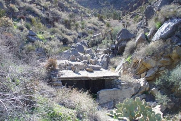
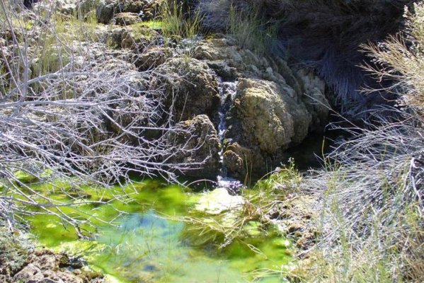
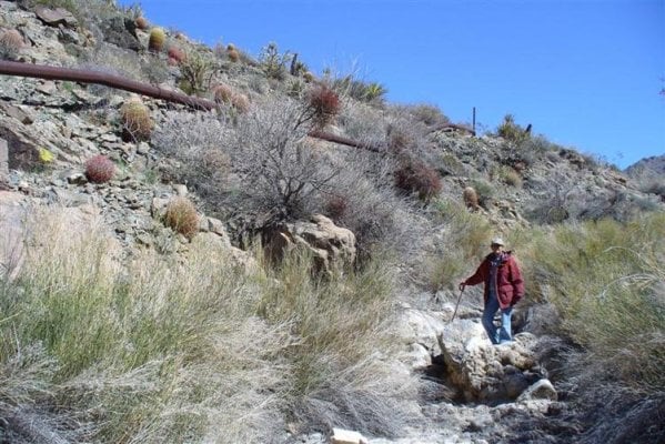
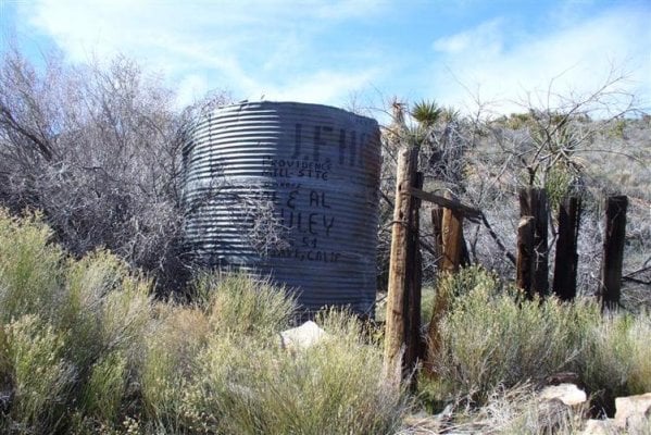
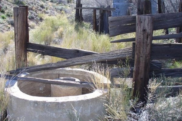
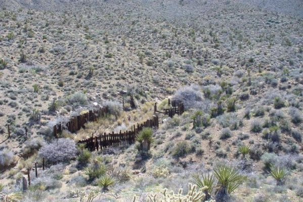
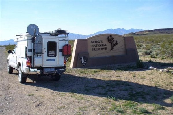
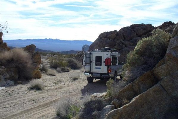
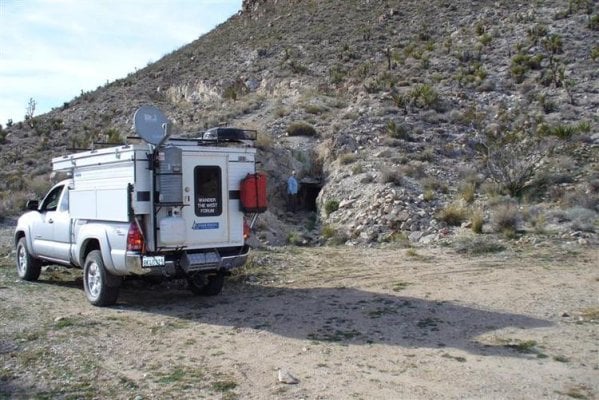
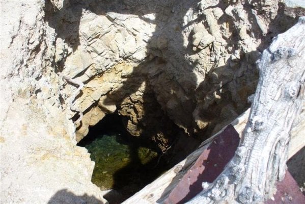
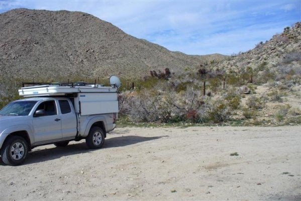
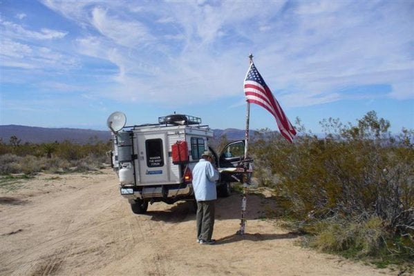
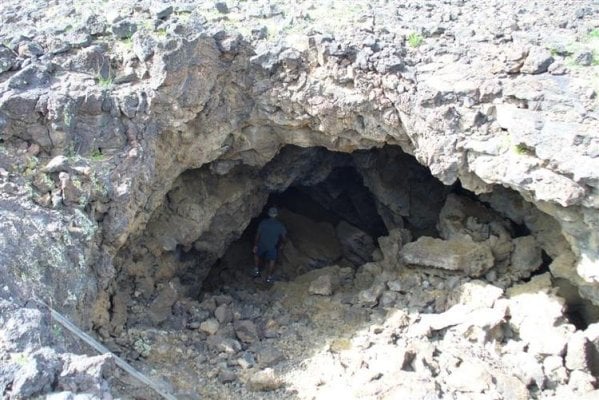
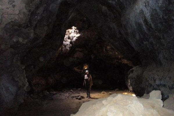
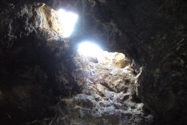
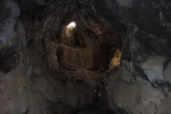
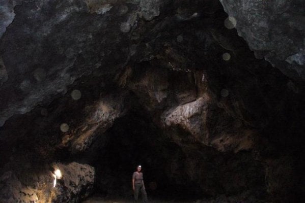
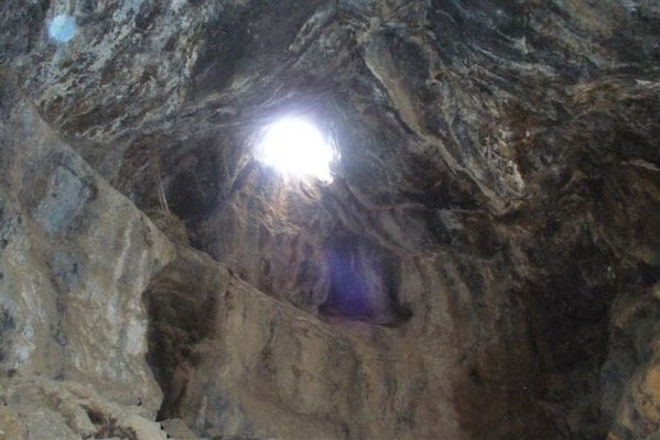
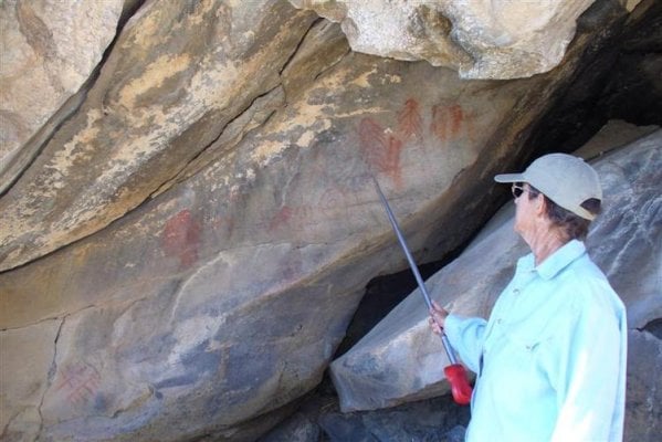
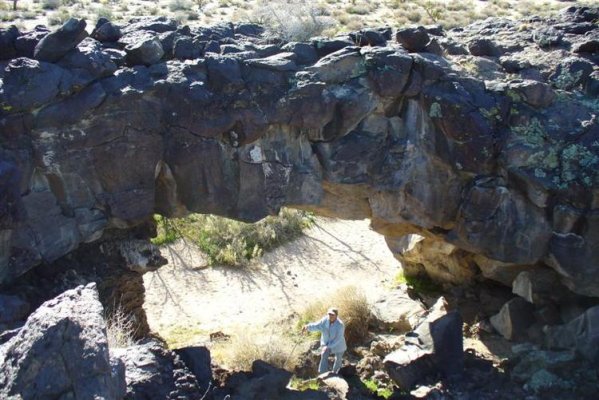
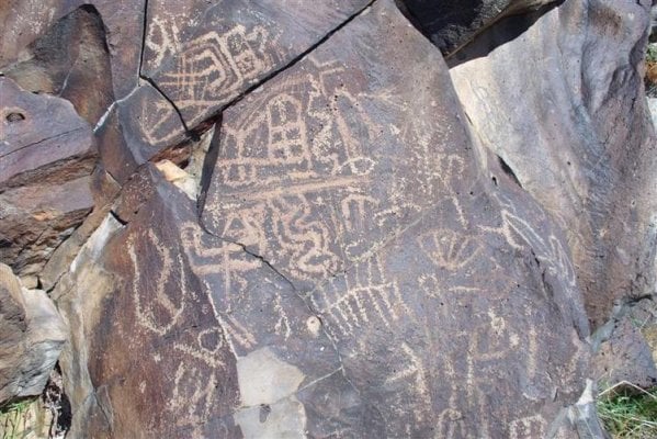
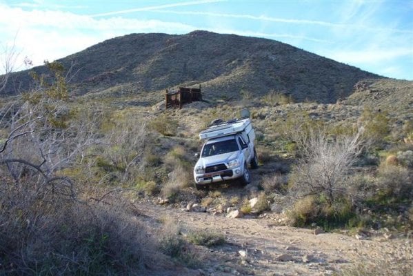
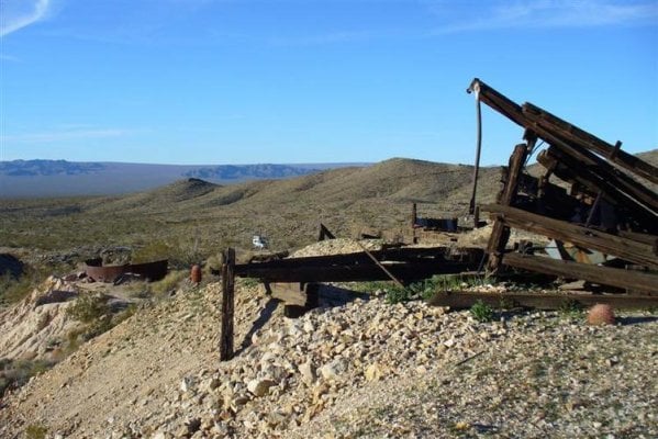
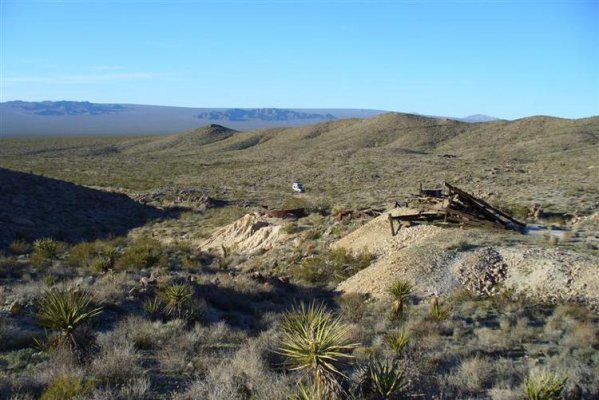
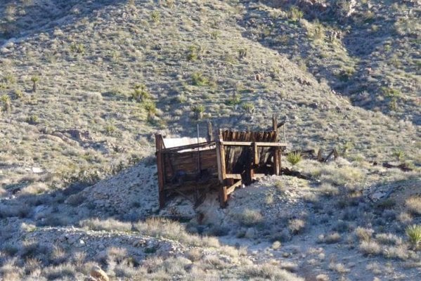
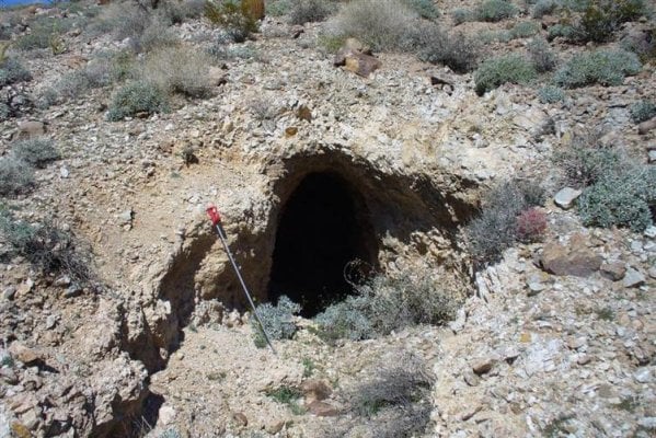
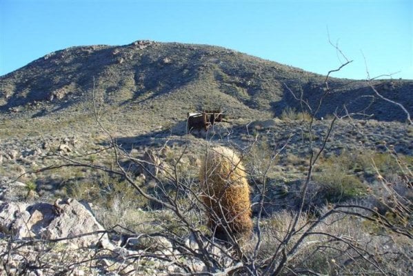
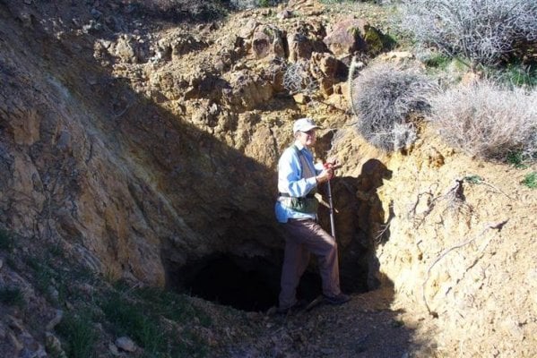
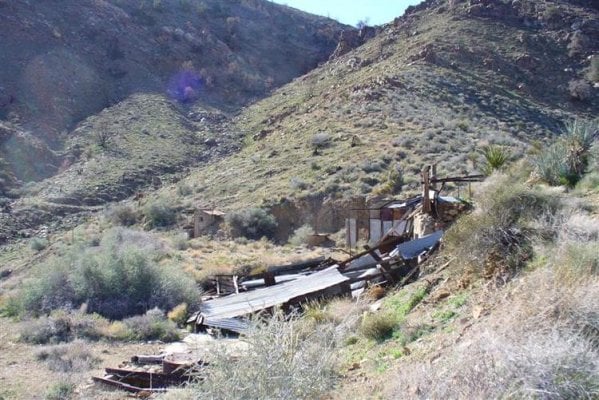
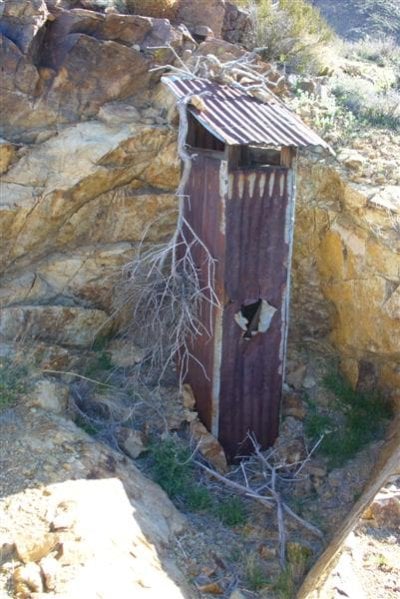
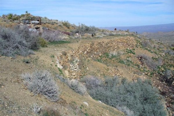
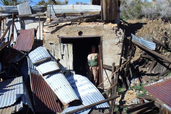
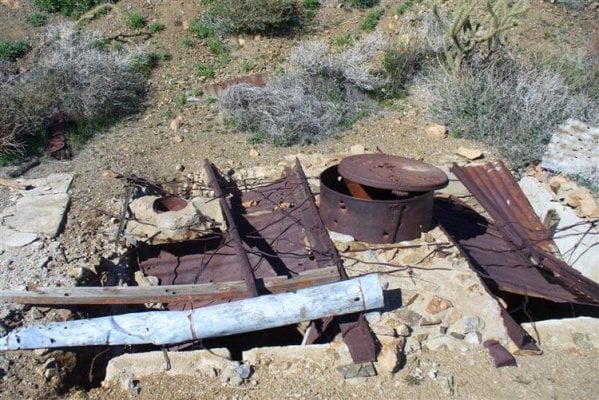
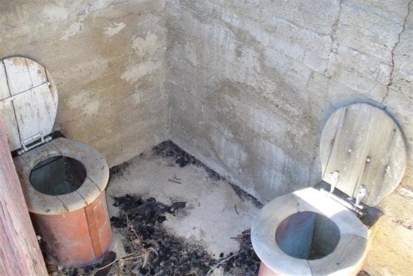
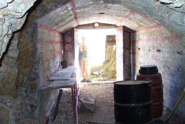
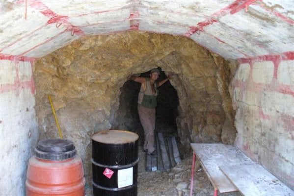
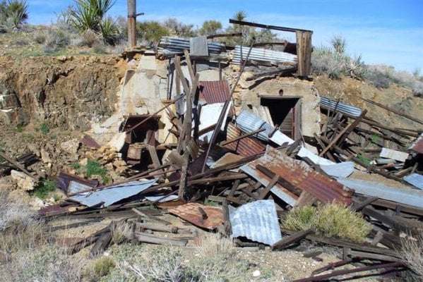
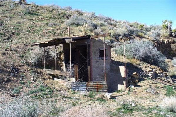
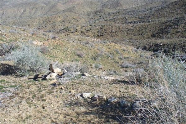
Just got back from a trip to the Mojave Preserve with my wife and thought we would share trip and pictures.The first part of trip was covering a part of the Mojave road which follows an historic Indian trail/wagon road/stage route from near bullhead city Az. to Barstow off I-15 (road to Vegas) We just did a section near Kelso (neat restored train station now Preserve information center/Museum,a must stop for first time visitors.2nd pic is mine area and 3rd camp spot ,a good place to explore and get the feel of the area. Next, 4th is Marl springs which was a important water spot and army post (1867).
I,ll post pics then continue.
Les Lqhikers
 

Attachments

  • P1010154 (Medium).jpg
    P1010154 (Medium).jpg
    60.8 KB · Views: 361
  • P1010081 (Medium) (2).jpg
    P1010081 (Medium) (2).jpg
    57.2 KB · Views: 364
  • P1010082 (Medium) (2).jpg
    P1010082 (Medium) (2).jpg
    89.6 KB · Views: 362
Mojave trip continued

Marl springs,(2 pics)Mail box(1 pic) which is a stopping place now to sign in and take a break.A little past here we took off on side trip to cinder cones lava beds to explore one of the lava tubes/caves.Set up camp here to explore caves and hike to lava arch which is an old Indian area with a lot of rock art etc.
Les lqhikers
 

Attachments

  • P1010083 (Medium).jpg
    P1010083 (Medium).jpg
    82.4 KB · Views: 348
  • P1010084 (Medium).jpg
    P1010084 (Medium).jpg
    68.5 KB · Views: 353
  • P1010085 (Medium).jpg
    P1010085 (Medium).jpg
    56.9 KB · Views: 359
Mojave trip continues

Lava tubes/caves hard to get good pics but do show size and vents.
Les lqhikers
 

Attachments

  • P1010091 (Medium).jpg
    P1010091 (Medium).jpg
    89.8 KB · Views: 340
  • P1010097 (Medium).jpg
    P1010097 (Medium).jpg
    39.4 KB · Views: 344
  • P1010099 (Medium).jpg
    P1010099 (Medium).jpg
    48.9 KB · Views: 353
Mojave trip continues.

more lava tubes .This area is always great to explore as you will always find something new and it is not over run with people,we did not run across anyone on any trail the whole week we were in area,must be the price of gas!
 

Attachments

  • P1010100 (Medium).jpg
    P1010100 (Medium).jpg
    41.1 KB · Views: 338
  • P1010102 (Medium).jpg
    P1010102 (Medium).jpg
    37.2 KB · Views: 333
  • P1010101 (Medium).jpg
    P1010101 (Medium).jpg
    54.6 KB · Views: 326
Mojave trip continues

This is the lava arch area.Lots of Indian traces in area and if you are willing to hike you can find some interesting spots that are not disturbed!Make sure you have your boots on as the lava is unforgiving!
 

Attachments

  • P1010108 (Medium).jpg
    P1010108 (Medium).jpg
    59.8 KB · Views: 340
  • P1010106 (Medium).jpg
    P1010106 (Medium).jpg
    79.7 KB · Views: 345
  • P1010113 (Medium).jpg
    P1010113 (Medium).jpg
    90.1 KB · Views: 336
Mojave trip continues(Providence mtn.area)

After exploring Lava area we headed back to Kelso and used their good history section to look up a couple of mines we have heard about but do not show up on newer maps.1st pic is of the Good Hope Mine you have to do some research as the trail is through a wash and is not visable .but with gps setting from map's we were able to find mine.A lot of old stuff and if you hike the canyons you can find a lot of shafts that are not on maps!(no off road travel is allowed so it is hiking only.
 

Attachments

  • P1010079 (Medium).jpg
    P1010079 (Medium).jpg
    80 KB · Views: 330
  • P1010070 (Medium).jpg
    P1010070 (Medium).jpg
    77.8 KB · Views: 336
  • P1010074 (Medium).jpg
    P1010074 (Medium).jpg
    72.9 KB · Views: 326
Mojave trip Continiues

I could spend days in these old mines as it is unbelievable what it took to work them (supplies,water equipt etc.) Fund so old corner markers with claims and left them for next person to find.Seems like anything next to a road is long gone so it is nice to find some old paper work.
 

Attachments

  • P1010068 (Medium).jpg
    P1010068 (Medium).jpg
    100.5 KB · Views: 331
  • P1010077 (Medium).jpg
    P1010077 (Medium).jpg
    114.3 KB · Views: 327
  • P1010069 (Medium).jpg
    P1010069 (Medium).jpg
    96.4 KB · Views: 323
On to next Mojave MIne!

After we spent 2 days at the Good Hope mine we moved about 5 miles to the end of trail that stops at the wilderness boundry.This mine is hard to find without gps and even then it took 5 hours of hiking up the mtn trails to find,But was it worth it! Since the trail up the wash was washed out for 3 miles the was no trail to let anyone know their was a trail ahead.As you can see from pics if the structure did not fall down it would of been untouched since the early 1950's.We almost turned around not 100 ft from mine as we thought the shaft in first pic was it but over the ridge was the main mine.This mine is near the Tough Nut Spring Which you can find on some of the maps of the Providence mtns.We still can't figure out the two hole out house
 

Attachments

  • P1010115 (Medium).jpg
    P1010115 (Medium).jpg
    93 KB · Views: 321
  • P1010116 (Medium).jpg
    P1010116 (Medium).jpg
    96.8 KB · Views: 326
  • P1010118 (Medium).JPG
    P1010118 (Medium).JPG
    65.5 KB · Views: 324
More Mojave mine pics

more of mine area,lucky the fire that burned this area a couple of years ago stopped just on other side of canyon!
 

Attachments

  • P1010130 (Medium).jpg
    P1010130 (Medium).jpg
    83.1 KB · Views: 317
  • P1010132 (Medium).jpg
    P1010132 (Medium).jpg
    95.6 KB · Views: 324
  • P1010135 (Medium).jpg
    P1010135 (Medium).jpg
    106.6 KB · Views: 316
More mine pics

Hope you all don't mind so many pics,explains better than words,at least my words!
 

Attachments

  • P1010124 (Medium).jpg
    P1010124 (Medium).jpg
    62.8 KB · Views: 322
  • P1010134 (Medium).jpg
    P1010134 (Medium).jpg
    62.7 KB · Views: 320
  • P1010133 (Medium).jpg
    P1010133 (Medium).jpg
    59.6 KB · Views: 316
A few more of Mojave trip

Three more for now and i will finish up trip report soon.Hope you all enjoyed.
Drive slow and enjoy "its the journey"
Les Lqhikers
 

Attachments

  • P1010126 (Medium).jpg
    P1010126 (Medium).jpg
    102.9 KB · Views: 269
  • P1010119 (Medium).jpg
    P1010119 (Medium).jpg
    105.9 KB · Views: 270
  • P1010121 (Medium).jpg
    P1010121 (Medium).jpg
    113.6 KB · Views: 262
Just amazing what is out there in the desert. How people could make a living with all that hard work. Thanks for sharing.
 
Thanks for sharing. I'm up in that area every month or so for work... maybe I'll have to bring the truck on one of my trips up there to do some exploring. hmm...

:thumb: on the pics!
 
I had to cancel a planned trip to Mojave last Fall. Seeing these pics doesn't make me feel any better about that decision....:(

Wonderful pics, what a beautiful area. Your outfit looks right at home out there.

lq, a quick semi off-topic question. With your roof rack and additional weight on the roof, have you devised a tool or anything to assist you in popping and lowering the top? Or do you just use the good old 'arm-strong' method?
 
answer to kcowyo

If you make a trip to Mojave Preserve make sure to visit the depot as it has lots of great info on area,including library with old maps etc,you could spend days going over books maps etc.I had a basic lift device that worked ok until i saw one made by star152 which gave me a reason to make new one,which is what i use now,works great even wife can use it.If you look at pic on link you will see a 2 wheel pulley,which i have now replaced with 3 wheel pulley,only because i found one at a swap meet for $1.00! Hope this helps you out.
Drive slow and enjoy "its the journey"
http://ww w.wanderthewest.com/forum/showthread.php?t=986
Les Lqhikers
 
Mojave trip final spots on trip.

When you are at Kelso (train depot) if you look up to the providence mtn,s there is a spring called cornfield springs,about 6+miles up wash/canyon/rocky ground all the way.This was where the water supply came from to supply steam trains that ran through here.What make this remarkable is that the supply system was built around 1895! when you follow this line and see what they had to do to run this line (buried most of way,exposed in canyons)its hard to believe how it was done!The pics show spring which was expanded by blasting down through rock to improve flow then cemented to keep clear.You can drive to with in 1 mile.(trail is washed out,could be done if you had more than 1 rig would not do it by myself!)also some great canyons to explore,again no people and it looks like their had not been any for a long time.We hiked up road/trail then returned along pipe line through canyon.
Les Lqhikers
 

Attachments

  • P1010147 (Medium).jpg
    P1010147 (Medium).jpg
    101.4 KB · Views: 221
  • P1010150 (Medium).jpg
    P1010150 (Medium).jpg
    118.7 KB · Views: 217
  • P1010152 (Medium).jpg
    P1010152 (Medium).jpg
    98.4 KB · Views: 208
Last Mojave report!

This is last spot we wanted to find.We had heard of a spot that was used as a water supply spot for the Tough Nut Mine,after finding spring on map we used gps to get to area,no trails all washed out over the years as this spring is in a steep wash area.This one was hand dug lined with railroad ties the first 25 feet our so then lined with rock at water level,still not caved in and water still flowing!also spot was used as a ore crusher (small crusher) then hauled out by mule or? As there is also surface seepage it also had sighs of lots of wildlife using(deer,bobcat,couger,sheep tracks.all in one spot!)This is also in wilderness are so it is hike in only! this is the end of Mojave trip,already planing next!Maybe we will run across fellow fwc/atc travelers!(somehow i missed pic of well itself)
Drive slow and enjoy "its the journey"
Les Lqhikers
 

Attachments

  • P1010136 (Medium).jpg
    P1010136 (Medium).jpg
    97.5 KB · Views: 218
  • P1010138 (Medium).jpg
    P1010138 (Medium).jpg
    89.8 KB · Views: 212
  • P1010142 (Medium).jpg
    P1010142 (Medium).jpg
    103.8 KB · Views: 217
Back
Top Bottom