Rocky Mt Overland Rally Aug 1 2019 travel route suggestions

larryqp

Senior Member
Joined
Apr 22, 2017
Messages
299
Location
Full-time RVer, anywhere USA
I will be driving from Houston, TX to the Overland Rally in Gunnison, CO at the end of July. I'm looking for suggestions as to possible easy to moderate overland travel routes. My loose plan is to stop at Guadalupe Mt National Park, then head up to somewhere near the Taos,NM area then thru Lake City, CO and on to Gunnsion.

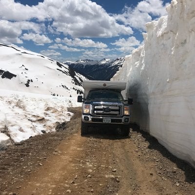
Assuming the snow pack melts, I am thinking on doing what I think is called the Alpine Loop. Leaving Lake City going up the Wagner Gulch Trail to Cinnamon Pass go Animas Forks then returning to Lake City via the Engineer Pass Trail. It sounds like a great route, except I don't make any forward progress towards the rally, which is okay.

Does anyone have any suggestions for overland routes that I could drive that would be an alternative to paved roads for forward progress.

Thanks
 
Larry,
I drove the beautiful Alpine Loop route in summer a few years ago. (Yes, it is fairly easy in a 4WD FWC.) However, if you are averse to literally of 100's of rented jeeps and (worse) rented ATV's buzzing by you at insane speeds I strongly recommend against it! Sorry!

True story- The Lake City Sheriff had a speed trap set up at Animas Forks and was handing speeding/ reckless driving tickets out virtually non-stop. He told me they were counting 2,000 vehicles a day on the Alpine Loop.

There are much better options. Most alpine routes in the South San Juans (east of Pagosa Springs) are comparatively deserted. Or if you don't mind a small detour the Bolam Pass/Ophir Pass loop to the west and north of Purgatory and is spectacular. We camped at the top of Bolam and counted less than 10 vehicles a day going by us.

Best wishes!
Steve
 
Better check the conditions. Even later this month most high elevation passes may still be closed due to record snowpack. Plus many of the trails in the San Juans experienced avalanches due to the high snow levels. Some areas are 100 FEET under snow right now. That's not an exaggeration. What isn't under snow has slide debris of downed trees crossing the trails.

A good site to check for current conditions is this one:
http://www.bushducks.com/tripreps/passopen.htm

The chart does list local ranger district phone numbers so you can get details right from the local rangers to the trail you want to target.
 
Durango 1 and Zoomad, thanks, that's great info and a great website. I am looking at some alternatives, avoiding the real trails for the reasons mentioned. I assumed even the Alpine loop was open, or a few other trails, that because so many others might be closed, the open popular ones would be crowded.

Now considering graded roads, in some of the National Forests, and checking with the Ranger stations for up to date info. I'm assuming they will work on those before they work on trails. One option is Cochetopa Pass Road.
 
Larry
We were in the Silverton, Ouray area a couple of weeks ago and almost all of the high passes and trails including the Alpine Loop were closed and according to a Ranger I talked to may not be opened this year due to the massive snow they received.
We did make it up to,Hurricane Pass. The road down the other side was still not plowed.

Good luck!
 

Attachments

  • E01AC31B-D549-48AA-B4C0-54A7579634BA.jpeg
    E01AC31B-D549-48AA-B4C0-54A7579634BA.jpeg
    398.4 KB · Views: 102
FYI
I just heard that the Alpine Loop is open. I still have it crossed off my list on the way to the Rocky Mt Overland Rally. I'm guessing that it will be a bit crowded, given the late opening and the rally close by.
 

New posts - WTW

Back
Top Bottom