slow journey to the sierra's!

lqhikers

Senior Member
Joined
May 18, 2007
Messages
594
Location
la quinta calif
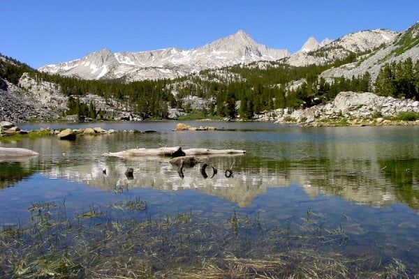
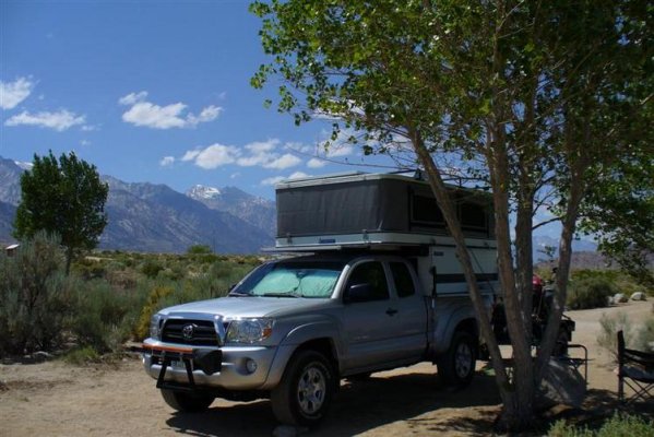
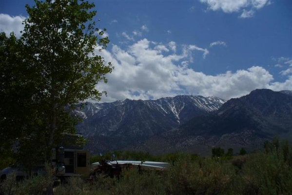
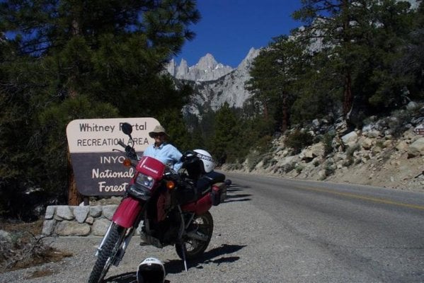
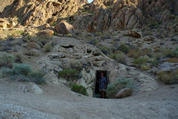
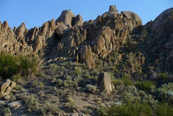
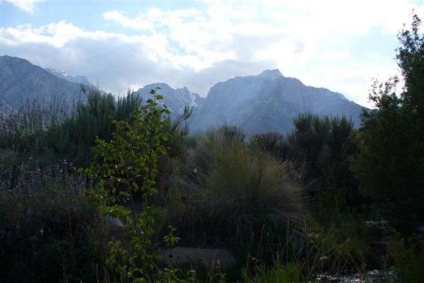
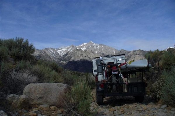
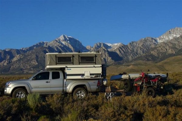
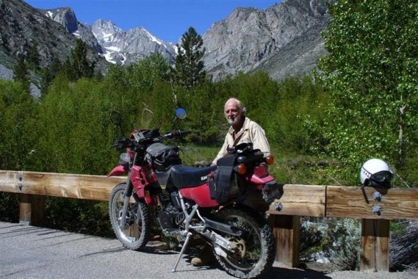
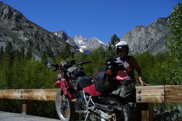
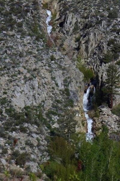
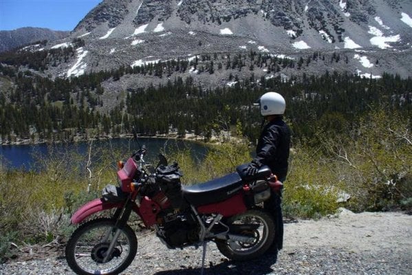
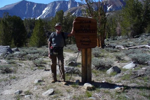
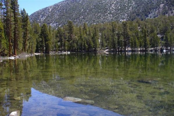
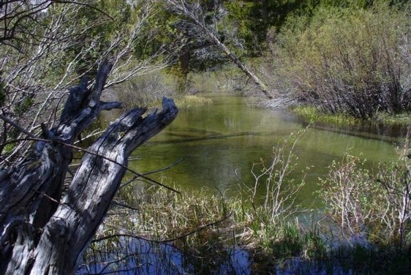
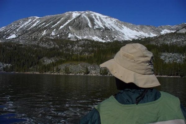
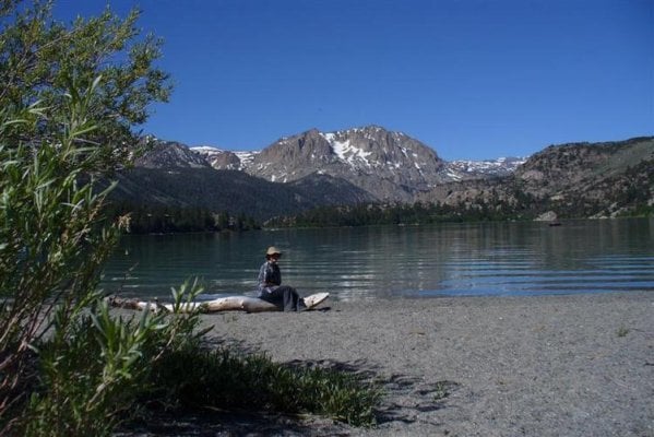
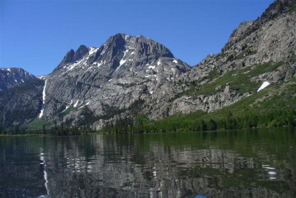
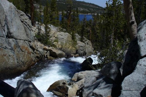
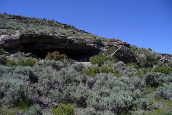
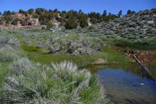
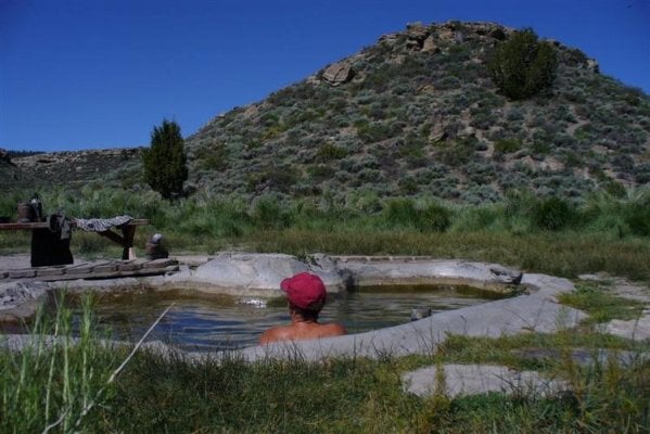
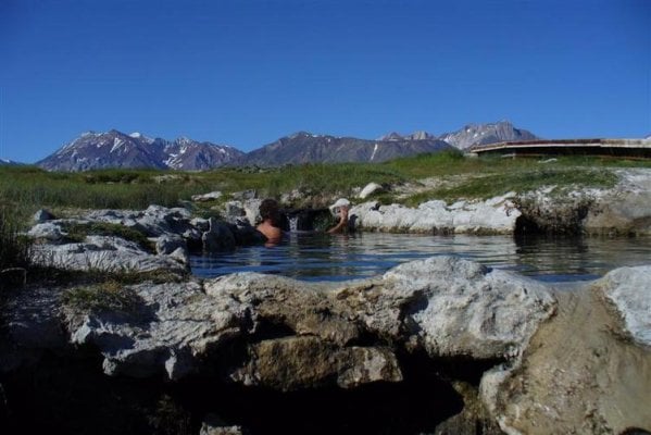
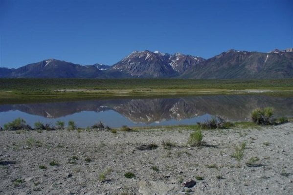
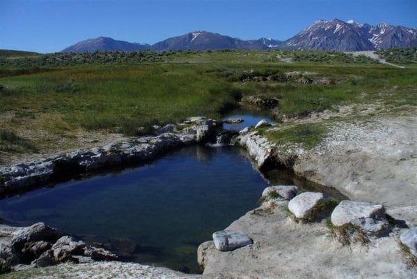
Loaded up the taco,fwc,dual sport, kayak,on june 2nd and headed to the sierra's for three weeks of enjoyment.Made it to lone pine and since the long trip from La Quinta wore us out we ended up staying at tuttle creek blm campground.This got us so relaxed that we spent 4 days in area exploring by dual sport in between relaxing at camp and fishing the stream that runs through camp.Pictures show campground,some neat areas in the alabama hills,whitney portal trail head,great place to watch all the "expert mtn climbers" gear up for the accent of the peak!(no we did not climb the peak).
As we just returned sat the 21st and have not got my mind back to earth(cell phone was turned off for the whole time and did not take sat dish,tv, so this part of trip is it for now!
Drive slow and enjoy "its the journey"
Les and Virginia Lqhikers
 

Attachments

  • P1010177 (Medium).jpg
    P1010177 (Medium).jpg
    67.9 KB · Views: 386
  • P1010179 (Medium).jpg
    P1010179 (Medium).jpg
    52.6 KB · Views: 390
  • P1010183 (Medium).jpg
    P1010183 (Medium).jpg
    72.1 KB · Views: 396
  • P1010271 (Medium).jpg
    P1010271 (Medium).jpg
    77 KB · Views: 394
  • P1010279 (Medium).jpg
    P1010279 (Medium).jpg
    74.6 KB · Views: 393
Next stop on Sierra trip.

Since we were in no hurry as we had no where to be we left Tuttle creek went up Whitney portal rd to hogback road which is along the base of mtn.If you have a calif atlas & gazetteer you can figure out just about the route we went)
I felt that we should be able to make it to bishop with out using the main paved road.Worked our way over to George's creek,which i hoped we could end up at Shepherds pass trail head which we were going to spend the night at the trail head to do a hike in the am at a spot not to many people use,had to back track a few times as trail petered out 2-3 times(had to unhook trailer twice to turn around. After working our way to trail head it was posted that the trail was wiped out due to rock slide,good excuse to keep on driving!.Spent the night at a quite spot on Independence creek (no people,not a camp ground)
This is how we covered the distance to Bishop,so will not bore with same type of pics.Last two are at Glacier lodge area on Big Pine creek,nice spot on a hot day!
Drive slow and enjoy "its the journey"
Les And Virginia,Lqhikers
 

Attachments

  • P1010182 (Medium).jpg
    P1010182 (Medium).jpg
    44.4 KB · Views: 362
  • P1010185 (Medium).jpg
    P1010185 (Medium).jpg
    47.3 KB · Views: 362
  • P1010187 (Medium).jpg
    P1010187 (Medium).jpg
    57.3 KB · Views: 366
  • P1010189 (Medium).jpg
    P1010189 (Medium).jpg
    95.2 KB · Views: 374
  • P1010188 (Medium).jpg
    P1010188 (Medium).jpg
    73.4 KB · Views: 353
lqhikers

Nice write up!!! Nice scenery. Nice way to travel!

I do have questions on that nice side table you have on your camper. How did you make it and of what? I was going to put one up as well but was thinking about the window side so that i could use the pass through. I also have the awning on that side, and since it rains a lot of up here, would be nice to get out of the weather.

Would love to build something like that!!

dave in seattle
 
I see that thread....any closeup pics of the table? how do you get it up and down. Does it rattle? do you like it on that side of the camper?

I am thinking about using the jack plates like you have. Want to use it to all support for a rear awning, as well as some antenna supports as well. I like your work, really cool.

dave
 
lq,

Three weeks in the Eastern Sierra, man you're killing me, we can hardly find a week these days. Really enjoyed the report and pictures, thanks for sharing.
 
Les thanks for the report with pictures!

I always enjoy pictures from the Sierra's. I'm not familiar with the mine opening in the picture from the Alabama Hills. How far could you go in?

Good to know about the trail. Been up that trail twice and not one I want to go anytime soon. Shepards Pass is one that is not easy.
 
Alabama hills mine?

Patrick,I do not know if it was a mine or just a storage shaft. It went in straight about 10' and had a shaft to the left about 10' also,as it was just off the road there was not any tailing's that i could tell,maybe they were used when they built the road.If you are in the area it is located on the tuttle creek road,which as you leave lone pine up the Whitney Portal rd you turn left where it says portage joe camp site,then it is about 3 miles up the road (this is the way we get to the tuttle creek blm campground),Very few people go this way and i feel it is the most pretty section of the Alabama hills!
Drive slow and enjoy "its the journey"
Les, Lqhikers
 
more Sierra trip rambles!

After stopping in Bishop to resupply (Sizzler Steak house for salad bar!)we headed up to Lake Sabrina to do some kayak fishing,but when we got there the lake was so far down that the boat ramp was closed and to get the yak to lake was to big of a hassle,shifted to plan b which was to head up Pine creek to the trail head at the Tungsten mine and hike into pine lake.Great hike if you have never been there as about 3/4 of the way in there is a neat mine in the rock face (after the zig zag trail through the shale is about done)Again if you want to get away from the crowds this is a nice hike to a great little lake.
Next day on the road again (old road up to Toms Place) where we turned and drove to Rock Creek lake,where we set up camp for 5 days.Pictures show Rock Creek lake,Dorothy Lake which is in the John Muir Wilderness area,misc. streams waterfalls etc.Should make you all pack up and head for the hill
Drive slow and enjoy "its the journey"
Les,Virginia,Lqhikers
 

Attachments

  • P1010195 (Medium) (Medium).JPG
    P1010195 (Medium) (Medium).JPG
    74.1 KB · Views: 233
  • P1010198 (Medium).jpg
    P1010198 (Medium).jpg
    95.6 KB · Views: 244
  • P1010206 (Medium).jpg
    P1010206 (Medium).jpg
    89.9 KB · Views: 245
  • P1010208 (Medium).jpg
    P1010208 (Medium).jpg
    77.4 KB · Views: 241
  • P1010230 (Medium).jpg
    P1010230 (Medium).jpg
    107.8 KB · Views: 228
Its getting close!

Close as far north we got.Spent a couple of days in the June lake area.yak fishing,Geo caching,Trail riding on dual sport, wandering around resting up (after all we drove close to 50 miles from our last camp site this driving wears a person out! But wait we have the answer for this problem as the last pictures show!Maybe next time we will get farther north!
Drive slow and enjoy "its the journey"
Les,Virginia,Lqhikers
 

Attachments

  • P1010210 (Medium).jpg
    P1010210 (Medium).jpg
    58 KB · Views: 243
  • P1010231 (Medium).jpg
    P1010231 (Medium).jpg
    65.3 KB · Views: 240
  • P1010236 (Medium).jpg
    P1010236 (Medium).jpg
    67.6 KB · Views: 240
  • P1010224 (Medium).jpg
    P1010224 (Medium).jpg
    78.2 KB · Views: 234
  • P1010249 (Medium).jpg
    P1010249 (Medium).jpg
    73 KB · Views: 235
the end of the trip!

This is the last pictures,shows why we spend a lot of time in one place their is no better way to start and end a day than in Mother Natures hot springs!!
Drive slow and enjoy "its the journey"
Les & Virginia Lqhikers
 

Attachments

  • P1010243 (Medium).jpg
    P1010243 (Medium).jpg
    83.5 KB · Views: 253
  • P1010247 (Medium).jpg
    P1010247 (Medium).jpg
    65.5 KB · Views: 235
  • P1010262 (Medium).jpg
    P1010262 (Medium).jpg
    55.9 KB · Views: 235
  • P1010269 (Medium).jpg
    P1010269 (Medium).jpg
    57.2 KB · Views: 237
  • P1010266 (Medium).jpg
    P1010266 (Medium).jpg
    62 KB · Views: 233
What a Tour!!!

Hey Les what a trip you two had for three weeks:thumb: It was a good time of year right before the Mosquitoes come and carry you off. I’m jealous. Enjoyed the pictures and story.

Here is a picture of Lower Pine Creek Lake…It is the first one you come to after that long haul up from the Union Carbide Tungsten Mine.
 

Attachments

  • PineCreek003.JPG
    PineCreek003.JPG
    178.4 KB · Views: 225
Back
Top Bottom