Southern-UT/Northern-AZ in Early-May

MarkBC

The Weatherman
Site Team
Joined
May 24, 2010
Messages
6,618
Location
Bend, Oregon
Planning a trip to southern and eastern Utah and far-northern Arizona in late April into early May. Stew has said he's interested in crossing paths with me in that area. Anyone else interested?

I don't know where or when exactly...but in my soon-to-be-retired state, I can be flexible.

Maybe a little (or not-so-little?) WTW rendezvous...

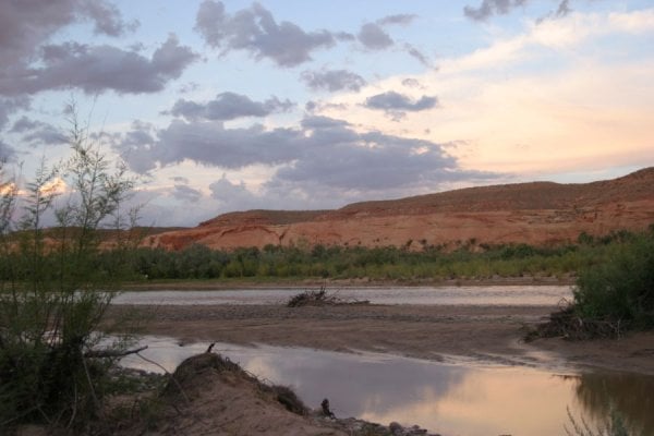
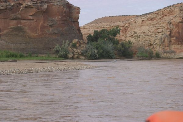
I've been to this area several times over the years: Escalante, Lake Powell, Valley o' Gods, Monument Valley, Capitol Reef, Canyonlands, Arches, Toroweep, Zion, San Rafael Reef/Swell, etc...but the last time was 6 years ago, and I don't really consider myself an expert.

So...
smile.gif
Who might be and/or want to be in the area at the same time?
 
I'll probably be due for a vacation around then... I'll caution you that my wife and I have a 2 year old though!
 
Just came back a week or so ago and am interested in another trip but I have to be in Illinois around April 20, haven't quite decided on how to travel to that, truck, bike, fly. Anyway I might suggest the South Cathedral Wash area about 9 mile NE of Goblin Valley. It is an OHV camp area, there was no one there when I visited. From there lots of roads to explore, some 2 wd, some rougher, plus single track for bikes/cycles. Lower elevations can start getting warm then but it is usually pretty easy to get a bit higher and stay comfortable. Capital Reef
1208883217_3X4dL-M.jpg
 
As always, I recommend highly the one day river trip with Wild River Expeditions. You start in Bluff Utah, ending in Mexican Hat, Az. Great trip, good food, excellent guide. http://www.riversandruins.com/

4 miles to the west of Bluff there is an excellent "secret" campsite the locals call Gold Camp. You cross the airstrip out of town, veer left and work your way down to the San Juan River. Just don't tell anyone else about it! (Wild Rivers Exp. will even pick you up from this camp for your river trip).
 

Attachments

  • IMGP2895.jpg
    IMGP2895.jpg
    153.2 KB · Views: 188
  • IMGP1537.jpg
    IMGP1537.jpg
    147.1 KB · Views: 161
  • IMGP1539.jpg
    IMGP1539.jpg
    84.1 KB · Views: 157
I'm headed that way over Easter weekend, so that gets my vote for a date.
 
The first week of April works best for me as I'll still be in Tucson the week after Easter.


Stew -- Do you mean the first week of May?...since Easter is at the end of April...?
 
Stew -- Do you mean the first week of May?...since Easter is at the end of April...?


Ya, first week of May. Sorry about that!
 
As always, I recommend highly the one day river trip with Wild River Expeditions. You start in Bluff Utah, ending in Mexican Hat, Az. Great trip, good food, excellent guide. http://www.riversandruins.com/

4 miles to the west of Bluff there is an excellent "secret" campsite the locals call Gold Camp. You cross the airstrip out of town, veer left and work your way down to the San Juan River. Just don't tell anyone else about it! (Wild Rivers Exp. will even pick you up from this camp for your river trip).

I agree with Gene take the river trip and camp at Gold Mine but Shhhhhhhhhhhhh. It's a secret.
 

Attachments

  • Copy of UNNAMED_FILE3435.jpeg
    Copy of UNNAMED_FILE3435.jpeg
    65.9 KB · Views: 138
  • Copy of UNNAMED_FILE3465.jpeg
    Copy of UNNAMED_FILE3465.jpeg
    81.5 KB · Views: 124
Some secret... Had to wait for another FWCer to clear out the last time I went down there -

842401429_HsQLw-O.jpg


But when I got my turn there, I got a nice sunset to remember it by -


842401891_K5a6L-O.jpg


I'll be headed down to that corner SoUT in a couple of weeks... No idea exactly where yet but it doesn't matter. It's all good! :)
 
ok, I have another "Secret" camping spot along the 4WD road from Comb Ridge to Moon House Ruin. But, I'm not telling.
 

Attachments

  • 163_6397.jpg
    163_6397.jpg
    326.2 KB · Views: 176
Sounds perfect.

I was planning on leaving Florida around Easter and heading that way. Not sure exctly where to go, so I am open.

Keep me posted, would love to thabnk some of you in person for all the advice!!

Randy
 
Sounds perfect.
I was planning on leaving Florida around Easter and heading that way. Not sure exctly where to go, so I am open.
Keep me posted, would love to thabnk some of you in person for all the advice!!
Randy

Sounds like you could arrive in the area at the right time.
smile.gif


It's a big area...so at some point a plan will need to gel around exactly where (and when).
 
I've been lurking, not posting much. Busy getting the funds together for the summer.

I do have 2 large dogs.........so I hope they are welcome.

Will keep my eyes on this thread for plans!

Thanks.
 
I do have 2 large dogs.........so I hope they are welcome.


Thanks.


They are probably better looking and mannered than most on here :( I usually have three or four with me. East of Monticello UT early this month.
1208888705_43TR6-M.jpg
 
Hey! Just thought I'd bump this a bit, but mainly to add a bit. Consider the Toroweap (aka Tuweep) area of the Grand Canyon in the Arizona Strip -- I am. In fact, I'm definitely hitting it on this trip.

tuweep_mainpg.jpg

The photo above is from the Grand Canyon NP page for the area.

I've been there once before, back in 1994 -- very cool (a couple of my photos from that trip below):
9405-006.jpg


9405-002.jpg


What's so cool about this spot at GC is that, while the drop to the river is "only" 3000' from the rim -- not a mile, it's an actual drop....if you got a good run at it in your rig you might be able to hit the water!
ohmy.gif
The small N.P. campground (semi-primitive) is quite-near the edge. The area is little-visited (little for an NP).
A couple of miles away is a trailhead for a day-hike down to the river. I did that last time...when I was in much better shape than now
rolleyes.gif
. I watched rafting groups -- and a couple of kayaks -- go through the enormous, house-sized, Lava Rapids, which is near the bottom of the trail.

I've already checked with the BLM and NP and they both say it's accessible now -- since it's a couple-thousand feet lower than the more-well-known "main" North Rim area there's a lot less snow. 60 miles of graded dirt/gravel road from Utah 389. The BLM tells me that the road is mostly kept open 'cause there are uranium mines in the area that need access.
unsure.gif
(I'm going to borrow one of those lead aprons from my dentist for the trip
tongue.gif
)
 
Here is some information on the uranium mining issue that is going on on the Arizona Strip area and also on the area south of Grand Canyon national park. This is a pretty big deal with mining proposed to go on for 40 years and require the ore to be trucked to a mill in Utah over the very roads you will be traveling to get to Toroweap. The sad thing is that it is just industrial greed and not need that is driving this mining.

http://www.azcentral.com/arizonarepublic/news/articles/0102uranium02.html?&wired
Dsrtrat


I am thinking with the nuclear tragedy going on in Japan and many countries stopping, even reversing their nuclear policies, uranium prices are about to crash. Hopefully, a final nail in the coffin to the uranium industry.
 
Back
Top Bottom