Transfer Trail from Dotsero to Glenwood Springs?

mtn-high

Campground Host- FUNKYTOWN
Joined
May 23, 2008
Messages
954
Location
Howard, CO
Has anyone here driven the Transfer Trail that starts at the Colorado River, goes up and over on the south edge of the Flattops, and terminates in Glenwood Springs?

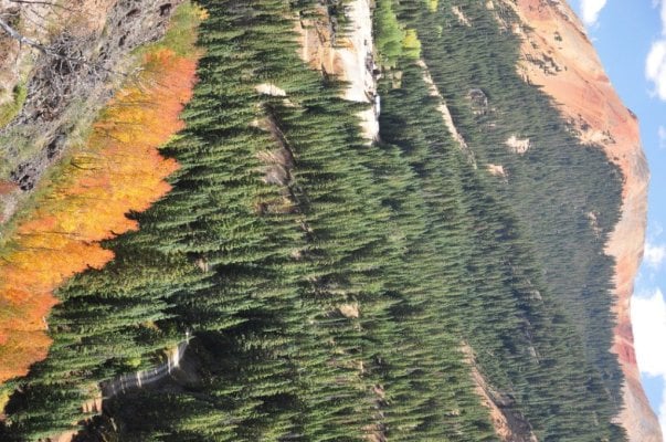
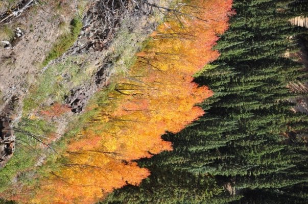
My wife is involved locally in trying to save an old farmhouse that we are learning was once a stage stop on one of the many "post roads" that ran through this area before the railroad came in sometime in the late 1880's (or later). In researching these old routes I started reading about the "Transfer Trail"....a trail that was built, evidently, because there was no viable/stage worthy route along the river/through the very rugged "Glenwood Canyon".

As I researched I found mention of the trail today as a 4-wheel drive route. From there I have Google Earth'd it and am thinking about heading down over the next few weekends/before it starts snowing (we hope) to check it out. There are reportedly a few steep sections....so I figured I'd ask if anyone had any first hand experience. Should be the driest the trail will ever be considering the winter we didn't have and the Summer that offered only a few weeks of good moisture...

someone else's pics/trip take here: http://www.wranglerforum.com/f24/transfer-trail-glenwood-springs-co-109539.html


Looks like tons of spots for multiple rigs to camp up top.... could be a great place for another CO rally @ some point.
 
I checked with Chris, our dealer in CO.

These were his thoughts ...

_______________________________________________


I don’t have any experience with that area.

I just checked my CO trail book and its not listed in there either?

The photos on the wrangler forum make it look very doable.

Probably considered an easy-moderate trail.

Flattops is a really cool area – I would suggest he check it out.

Chris

_______________________________________________


:)
 
I checked with Chris, our dealer in CO.

These were his thoughts ...

_______________________________________________


I don’t have any experience with that area.

I just checked my CO trail book and its not listed in there either?

The photos on the wrangler forum make it look very doable.

Probably considered an easy-moderate trail.


Never driven it, but I've got both a DeLorme and a Benchmark for CO and will try to remember to take a peek tonight and report back before leaving for CA by air at 0550 tomorrow.

Foy
Flattops is a really cool area – I would suggest he check it out.

Chris

_______________________________________________


:)
 
PS-

Coming out of Dotsero on www.digital-topo-maps.com I'm seeing Co Hwy 140 aka Coffee Pot Rd running generally NW from the Colorado River at Dotsero up to Heart Lake where it merges with Co Hwys 141 and 142, then turning south as Transfer Trail, without a road number, to to pass by the western side of Baxter peak enroute to Glenwood Springs on the north side of the Colorado River. I presume you're interested in the entire loop, correct?

Yeah, I'd assume late 19th century travel took such a route from Dotsero to Glenwood Springs. I-70 wasn't even completed through Glenwood Canyon (lying between Dotsero and GS) until the late 1970s, if I recall correctly. To avoid huge cut-and-fill in the canyon, I-70 is on pilings, and with the eastbound + westbound lanes "stacked" on top of one another for some miles through there. Pretty unique and cool segment of Interstate.

Foy
 
I've been up Coffee Pot quite a few times. Dotsero is about 25 miles (west) from my house.

The Coffee Pot road is only passable from roughly July to Sept....maybe a bit longer depending on the season. My first time up was in july and we were turned back by a huge snowdrift near the Deep Creep Outlook. (The Deep Creek area was and may still be a Wilderness Study area. (I think bush nixxed it but not sure). Its a 15 mile long/4000ft vertical/2000 ft deep creek/canyon that is roadless and coould easily be an extension of the Flattops wilderness)

If the map shows highways...you need a new map. The Transfer trail is marked FR 602. It cuts south just after Coffee Pot Springs campground, well before Heart Lake/Deep Lake.

I may try to hit this next weekend (it's that or the Paradise Tattoo convention in Keystone) if the weather holds. the trees are starting to turn in places....especially up high. might be an early year/early drop because of the lack of moisture. We shall see. Should be prime about next weekend in many areas though....

Right now we're loading up for a weekender to Durango/the San Juans. Not as much boonie camping as I'd like cus we'll be poppin up in his backyard a few miles outta town.... but I get to see my (remaining) son....so all is good...

thanks for the input

mtn
 
Hey mtn,

We are seeing some great colors already around Crested Butte as well. My daughter and I went to the Four Corners Folk Festival last weekend and the colors were already good going over Slumgullion and Spring Creek Passes. The music was fantastic as well. Enjoy your time with your son!

Good Camping,

Paul
 
I've been up Coffee Pot quite a few times. Dotsero is about 25 miles (west) from my house.

If the map shows highways...you need a new map. The Transfer trail is marked FR 602. It cuts south just after Coffee Pot Springs campground, well before Heart Lake/Deep Lake.


Not my Colorado Benchmark or DeLorme, but Google maps online. It shows Coffee Pot Rd as Co Hwy 140 going all the way to the Heart Lake area, becoming Co Hwys 141 and 142 and continuing west. An un-numbered trail heads south from Heart Lake and way on south picks up the Transfer Trail name. Google further shows Transfer Trail headed off to the northeast from the roughly N-S trail which shows the Transfer Trail name further south, but they show it as ending, and if it were to continue, which you indicate it does, it would intersect Coffee Pot Rd well on the Dotsero side of Heart Lake.

We had hellacious storms and lost power at home on Thursday last, cancelling my plans to pull the Benchmark & DeLorme to look at how Coffee Pot and Transfer are depicted there.

Foy

Foy
 
Right now we're loading up for a weekender to Durango/the San Juans. Not as much boonie camping as I'd like cus we'll be poppin up in his backyard a few miles outta town.... but I get to see my (remaining) son....so all is good...
Hey Mtn High,
How did your weekend go? The missus and I are looking at running up to the Andrews Lake/Molas Pass area tomorrow. How were the colors up there?

Thanks in advance,
Steve

PS Or anybody else can chime in too!
 
Things are ahead of schedule and we could see a noticable change in colors in the Fri-Sun timeframe....
 

Attachments

  • garden 030 Large e-mail view.jpg
    garden 030 Large e-mail view.jpg
    245.6 KB · Views: 143
better get out there kids!
 

Attachments

  • garden 031 Large e-mail view.jpg
    garden 031 Large e-mail view.jpg
    270.1 KB · Views: 107
We were in the San Juans last weekend. If I do the TT it will be this weekend or next....depending on what the "possible snow at pass level" means for the area midweek this week. Either way....we're gonna be out there before the show is all over (and before the Great White hunters arrive en masse' for rifle season :unsure: )
 
My husband and I camped off Coffee Pot Road last Tuesday. It was our first time and I don't think we could have timed it any better in terms of fall colors. We definitely plan on going back as all the haze obstructed what looked like would be incredible panoramic views of the Gore and Elk mountain ranges. We'll hopefully hit up the Transfer Trail our next visit. It's listed as a moderate trail in our Guide to Northern Colorado Backroads & 4 Wheel Drive Trails. It says mud is the major obstacle of the Transfer Trail but that shouldn't be a problem this year, especially this late in the season. Would love to hear how it goes.
M5A0862.jpg
M5A0792.jpg


M5A0844.jpg
M5A0806.jpg

M5A0781.jpg

M5A0788.jpg

M5A0771.jpg
 
@ this point, it's doubtful I'll make the Transfer Trail this season. A combo of too much other stuff to do and a persisting dullness from losing my son that makes >everything< harder to do than it should be...even camping. At this point I'm hittin the home improvement **** really hard so I can ready both properties for sale within the next few years and covert it all to a nice chunk of property (which I am already looking at)....and that is taking all of my energy...mentally and physically.

Thanks for sharing. Looks like you did hit it just right.
 
Back
Top Bottom