Ballarat Revisited

camelracer

Contributors
Joined
Jul 10, 2006
Messages
964
Location
Goleta, Ca
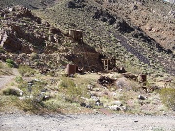
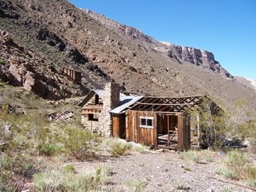
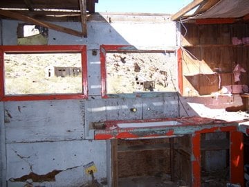
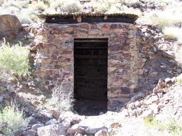
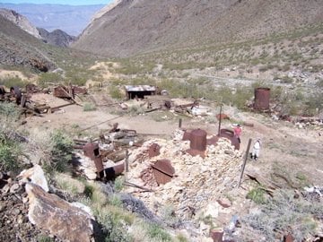
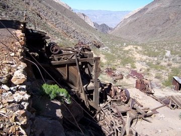
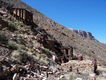
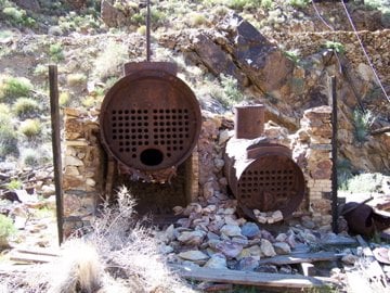
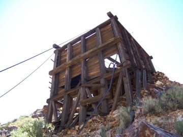
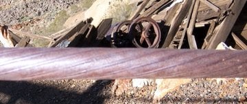
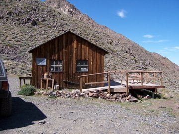
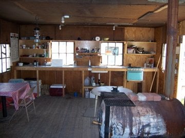
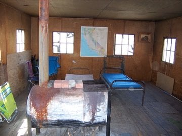
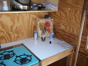
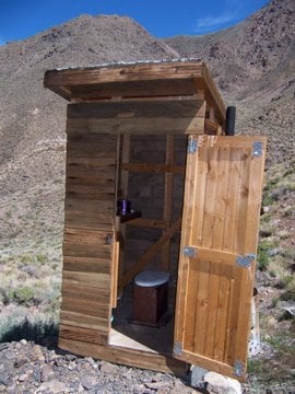
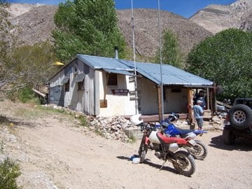
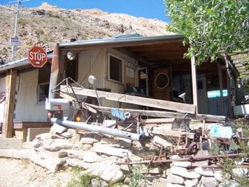
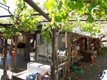
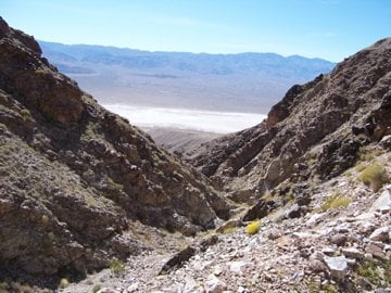
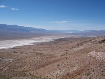
I led a group from the Santa Barbara 4x4 club out to the Panamint Valley last weekend for a run on the Pleasant Canyon / South Park trail. This trail heads east out of Ballarat up Pleasant Canyon into Death Valley National Park through Middle Park and South Park. The trail then drops back down into the Panamint Valley about 4 miles south of Ballarat. The trail goes by several mines and cabins and over a 6800 ft pass.

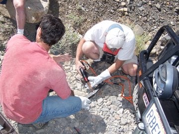
The trail up Pleasant Canyon is not too difficult but there is a lot of brush which could be a problem for a full size truck. From there to South Park the trail is rocky but easily passable in a 4x4 truck with decent clearance and low range. From South Park down to the valley the trail follows a very narrow ledge road with a log bridge (3 ton limit) and several dry waterfalls. The ledge has an area known as chicken rock that left a pucker mark in the driver's seat.

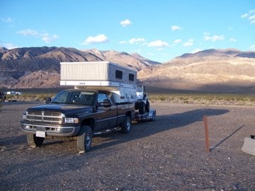
Those who were on last years Death Valley rally may recognize this spot. We set up base camp in the same place the WTW group used last year. There were some motor homes in the Ballarat campground and we have some members that hate generator noise.
 

Attachments

  • 100_2642.jpg
    100_2642.jpg
    58.2 KB · Views: 146
This is Clair Camp which serviced the Radcliffe mine in Pleasant Valley.
 

Attachments

  • 100_2645.jpg
    100_2645.jpg
    90.5 KB · Views: 147
  • 100_2647.jpg
    100_2647.jpg
    80.5 KB · Views: 168
  • 100_2649.jpg
    100_2649.jpg
    63.3 KB · Views: 153
  • 100_2656.jpg
    100_2656.jpg
    81.7 KB · Views: 148
Mining equipment from Clair Camp
 

Attachments

  • 100_2665.jpg
    100_2665.jpg
    80 KB · Views: 123
  • 100_2667.jpg
    100_2667.jpg
    77.7 KB · Views: 131
  • 100_2670.jpg
    100_2670.jpg
    75.4 KB · Views: 132
  • 100_2672.jpg
    100_2672.jpg
    87.2 KB · Views: 127
  • 100_2669.jpg
    100_2669.jpg
    48.2 KB · Views: 121
the trail follows a very narrow ledge road with a log bridge (3 ton limit)


Truck weighs 5500?, FWC, etc, guess you exceeded the weight limit in that bridge :LOL:
 
This is a close up of a cable found at Clair Camp. It's about an inch in diameter and has a smooth outside surface. I'm wondering if this was originally a standard twisted wire rope that wore smooth or was it built this way. I'm hoping one of you mining experts (DD) might know. Inquiring minds need to know.
 

Attachments

  • 100_2678.jpg
    100_2678.jpg
    44.9 KB · Views: 132
This is the World Beater mine cabin in Pleasant Canyon. There are several along the trail that are well maintained and available for use. You just run a flag up the pole to let others know it's occupied. This one had a kitchen, stove, pots and pans, lantern, heating stove, cots and a semi-stocked bar. The outhouse was also stocked with TP and reading materials.
 

Attachments

  • 100_2681.jpg
    100_2681.jpg
    71.5 KB · Views: 179
  • 100_2683.jpg
    100_2683.jpg
    57.4 KB · Views: 191
  • 100_2684.jpg
    100_2684.jpg
    54.8 KB · Views: 176
  • 100_2685.jpg
    100_2685.jpg
    59.3 KB · Views: 156
  • 100_2689.jpg
    100_2689.jpg
    71.7 KB · Views: 152
A samari broke a transfer case mounting bracket on the trail. Our club had just purchased this Readywelder and it worked great for a trail fix. Saved us from having to drag the rig back to base camp.
 

Attachments

  • 100_2696.jpg
    100_2696.jpg
    78 KB · Views: 147
This is a picture of Middle Park which is at about 6000 ft elevation. South Park looks about the same and has an airstrip.100_2700.jpg

Road down the canyon toward the ledge road.100_2702.jpg
 
This is Briggs cabin which I believe was connected to the Thorndike mine. An amazing place that sleeps 6 with full kitchen,shower and running water - hot water if you bring propane. This was nicer than many hotels I've stayed at.
 

Attachments

  • 100_2716.jpg
    100_2716.jpg
    75.2 KB · Views: 129
  • 100_2717.jpg
    100_2717.jpg
    83 KB · Views: 158
  • 100_2707.jpg
    100_2707.jpg
    98.8 KB · Views: 158
  • 100_2710.jpg
    100_2710.jpg
    88.1 KB · Views: 161
  • 100_2712.jpg
    100_2712.jpg
    57.4 KB · Views: 161
  • 100_2708.jpg
    100_2708.jpg
    75.1 KB · Views: 161
This is Stone cabin just down the road from Briggs cabin. I didn't go inside but it's suppose to sleep 3.
100_2723.jpg

Some final shots as we leave South Park Canyon and overlook the Panamint Valley.
 

Attachments

  • 100_2720.jpg
    100_2720.jpg
    88.5 KB · Views: 121
  • 100_2724.jpg
    100_2724.jpg
    70.1 KB · Views: 126
  • 100_2728.jpg
    100_2728.jpg
    44.4 KB · Views: 123
Truck weighs 5500?, FWC, etc, guess you exceeded the weight limit in that bridge :LOL:


Barko,
The truck would never had gotten that far. This was a tight squeeze pucker ride in the Jeep.
 
Yeah Dick...nice pics! Briggs Cabin looks sweet. How far up do you think a truck/camper could go up before turning around or is that not advisable at all?
 
Yeah Dick...nice pics! Briggs Cabin looks sweet. How far up do you think a truck/camper could go up before turning around or is that not advisable at all?

Suni,

The Briggs cabin could possibly be accessed from from the South Park side. The cabin is about 5 miles from the valley floor. I wouldn't take my truck up there because of its size. The trail at this point is wide enough and the traction is good but there are a couple of stair steps that would hang up my long wheelbase. Your Toyota might not have any problem.
 
CamelRacer,

Thanks for the great report and pics from your trip to the Panamints. They brought back some great memories; I love that area. Here are a few pics when we did the route in the reverse of your trip.

This is a shot of the "3000 lb" Bridge above Briggs Camp heading east toward South Park. Briggs Camp is in the trees to the right.


SPark3sm.jpg


And another of the Chicken Rock area just east of the bridge. More than one rig and driver has been flipped off here.


SPark5s.jpg


As you say, it would be difficult to get a big truck through here.
 
Back
Top Bottom