OK, after that easy-to-post starter, here's the official start of my trip report.
Part 1: THE BEGINNING
I drove from Bend, OR to Redding, CA midday Oct 9...not because that's the best route to the eastern Sierra, but in order to visit my parents, who live in the Redding area.
While still in south-central OR, driving down US 97 along the east shore of Upper Klamath Lake, I drove through huge flocks of flying bugs, thick enough that I stopped at a gas station on the north edge of Klamath Falls, mainly just to clear the windshield (though it turned out to be a good place to gas up, after seeing the gas prices just a few miles south in CA.)
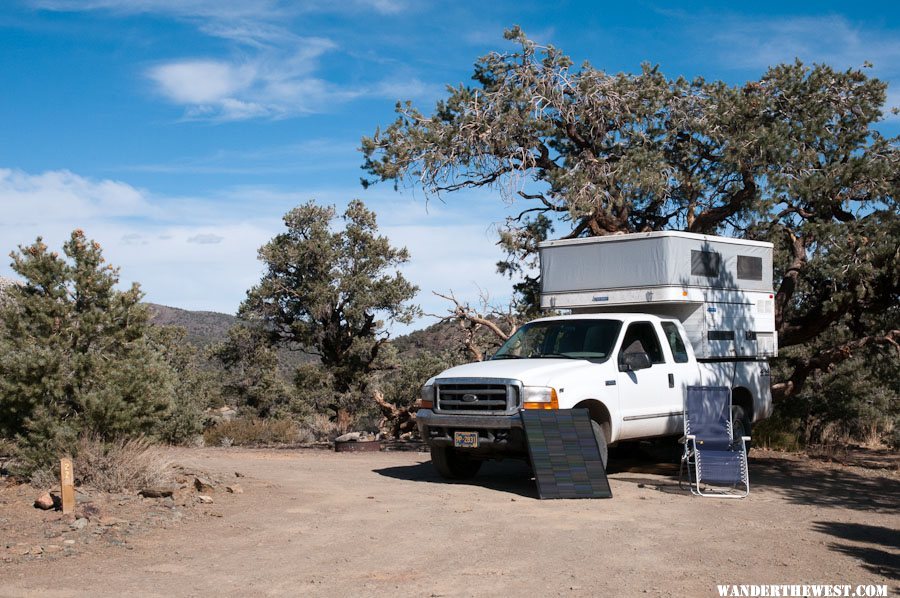
I didn't, however, clean the front of the camper:
Oh, well...I don't care much about appearances.
(In my parents' house driveway. BTW: Those tall evergreens on the right are coast redwoods, sequoia sempervirens. Who says you need the cool-and-foggy coastal environment for them to thrive? They LOVE Redding if they're watered enough!)
I spent two nights in that land of oaks, manzanita, and poison oak (spending a couple hours during the intervening day installing a set of roof-lifting shocks on the back end of my camper...learned that the aluminum frame is not continuous on the back end...drilled several "test holes" through the camper skin
) before heading east mid-morning Oct 11 on CA 44 past Lassen N.P. and joined US 395 at Susanville.
I didn't get an alpine start on that day, so it was 4pm-ish when 395 got back into California, and I managed to suppress my usual urge to find the perfect view-spot to camp and instead settled for Sonora Bridge USFS campground, a couple miles off 395 up CA 108, for the night -- one of the very few c.g. still open in mid-October.
I always take at least one photo of my campsites, just to record the historical event, whether it's photogenic or not.
This was the ONLY cloudy-and-damp night of my trip (it rained off-and-on all night), but the clouds got a little pastel-pink at sunset, so I wasn't complaining.
The next morning, Oct 12, I decided to drive up CA 108 a few miles towards/past the USMC Mountain Warfare Training Center (MWTC) at Pickel Meadows, along the West Walker River. Despite the military presence, it's a pretty area. And it's an oasis of Verizon cellular coverage, presumably so that the Marines can update their Facebook/Twitter accounts ("OMG! my feet r so sor!").
Here's a thumbnail of a ~300° panorama I shot from the western end of the Meadow:
To see the real/full-size-ish version of this panorama, click-download here:
201210_Pano-01
Full-size should display 800 pixels high (by 7000+ wide).
A couple miles further west, the Leavitt Meadows USFS c.g. was closed for the season, as expected. I stopped at the trailhead parking lot to view the view:
River sure is low...
Heading back east on 108 (towards 395), I decided to stop at the day use area on the West Walker river, between the MWTC and Sonora Bridge c.g.
I'd noticed that my new
dual-panel-in-series-240-watt solar system was not charging
...and though it was cloudy it was still light enough that there should some current flowing. Had I damaged my new charge controller by forcing too much current through it? Its capacity was rated at 10 amps, and the theoretical output of my two panels in series (at 13 volts) could be over 15 amps...
. So, I spent some time in that nice spot next to the river, fiddling with my solar-charge system...and discovered that one of the Powerpole connectors was not quite seated properly, or had come loose. Yay! Nothing burnt out!
But to prevent charge-controller-over-current in the future, I had a great idea, based on the fact that I had a second identical charge controller along with me, which I already had for my first solar panel: split the output of the panels upstream of the controllers so that each 10amp controller would process just half of the current!
I had had the foresight to bring all of my tools and parts with me since I left home with a not-quite-ready-for-prime-time project. I spent a while making a neat little Powerpole-ended current splitter:
clever, eh?
Well, maybe...but turns out that the charge controllers do not behave like simple analog circuit elements (thars sumpin digidle goin on inside, ah reckon!) -- the current went through either one or the other (randomly alternating between one or the other, as measured by the Watts Up meters I had downstream of each charge controller) but didn't split between them. Oh well...guess I just use one charge controller and hope that the 10amp rating has a conservative safety margin built in.
As I was putting away my project and lowering the camper roof I saw a group of guys walking up from the river with fishing gear in hand. These guys were in civilian fishing garb, but it turned out they they were Marines from the MWTC...apparently returning from a morning mission to make war on trout.
One of the Marines noticed the OR plates on my truck and came over, "Where in Oregon are you from?", he asked. "Bend", I said, and he said he was from Coos Bay, and we chatted a bit. He said that guys who wintered at the MWTC didn't get much real winter training since there was so little snow...
Where next? I planned to spend Saturday/night at/with a friend who lives in Bridgeport, but for Friday night I decided to cross 395 and head up Burcham Flat road into the Sweetwater Mountains. I'd been up there before, in July of 2011, and was bound for the same nice view spot as before. But I took one wrong turn...couldn't remember exactly the route from 15 months prior, "This road seems more primitive than I remember..." and I ended up wedging my camper between a couple of aspens. Not tightly wedged, but I scraped the paint off the upper edge on one side. Sigh...
Then I back-tracked and found the right turn-off, then the next turn-off, then the next turn-off. It's a nice spot, at around 9000 feet (as I recall) as seen in this pre-sunrise photo the next morning:
There's a big view to the west and north. I shot a 360° panorama from this spot. Here's a partial/segment of that full pano, looking west at the Sierras:
And here's a link to the full 360° rotatable panorama:
201210_Pano-02
(As usual, you need
QuickTime installed on your computer to view it.)
You can see Pickel Meadows and a bit of the USMC MWTC in this view if you know where to look.
...more to come...


")


