Granite Pass in Idaho near City of Rocks is on private land not open to the public. It is historically important for California because wagon train emigrants of the 1840s and 50s crossed Granite Pass, Idaho on the way into Nevada. It was a choke point in connection with finding water as they crossed the dry region. Their journals said the descent was very steep and difficult.
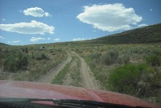
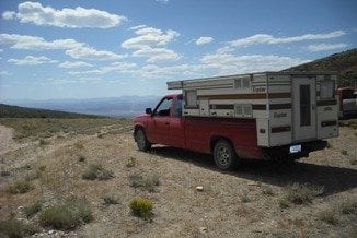
Today, the trail up, as shown, is two track, about like it was 160 years ago. The track down from Granite Pass has not been traveled for many years. We did not attempt to drive on this section of trail because we did not want to damage a historic trail. It would also have wrecked my 2WD truck.
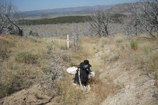
Three pictures are posted; 1) driving up to Granite Pass, 2) stopped at top of pass, and 3) hiking down the other side of the pass. (Note the California Trail marker in the picture.)
Today, the trail up, as shown, is two track, about like it was 160 years ago. The track down from Granite Pass has not been traveled for many years. We did not attempt to drive on this section of trail because we did not want to damage a historic trail. It would also have wrecked my 2WD truck.
Three pictures are posted; 1) driving up to Granite Pass, 2) stopped at top of pass, and 3) hiking down the other side of the pass. (Note the California Trail marker in the picture.)