ID-MT-WY?: Desert Rat Venturing Outside His Comfort Zone Seeks Input

MarkBC

The Weatherman
Site Team
Joined
May 24, 2010
Messages
6,618
Location
Bend, Oregon
Help, please: :)
I'd like suggestions from WTWers for places I should go/see/stay on a visit to the area, roughly, circled in the map below:

northern-rockies-01.jpg

(maybe the circle should be extended a bit further south into central Idaho -- imagine that I've drawn it so)

The mid-'90s was the last time (and to a large extent the only time) I've visited the area I'm considering visiting again, and that previous trip was a mostly-driving whirlwind road-trip tour (camping out of the back of my '92 Toyota pickup).

I'm mostly interested in input about areas not in the national parks. I may not even visit them this trip, except perhaps cutting across the northern tier of Yellowstone after crossing Beartooth Pass (as I did on that '90s trip).
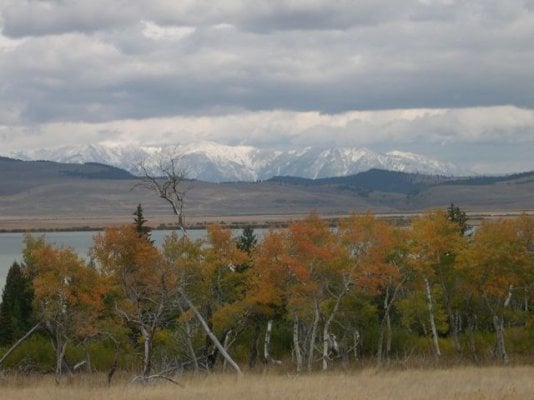
I found the area around Beartooth pass amazing, and I told myself that I'd be back to explore; that was almost 20 years ago. :rolleyes:
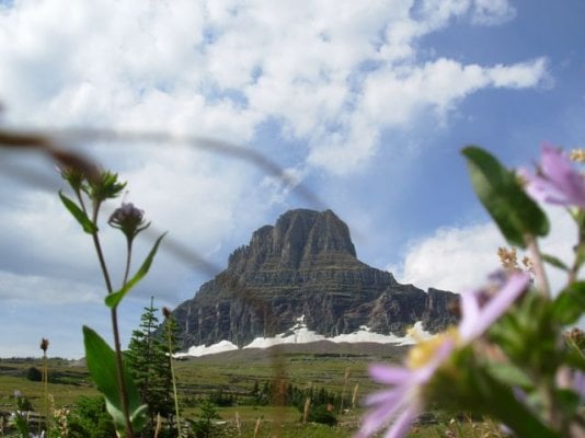
OK...and Glacier's Going to the Sun Highway was so world-class fantastic on that '90s trip that I could easily repeat that part, too.

But aside from the obvious (the national parks), what's cool to see? Or if not especially cool, what's nice, pleasant to visit?
Limitations/Qualifications: 1) I'm not going to do any river trips. 2) I'm probably not going to do any backpacking...unless absolutely necessary. That is, I'd rather do a 20-mile day hike to see something cool than two 10-mile backpack days. But I couldn't rule it out.

I've found that I don't have an image/model/map in my head of this area and its features for planning purposes (as I do for most of Nevada and Utah and Arizona and southeast California) so I'm really starting from scratch, from newbie ignorance, for any non-national-park stuff :unsure: ... Of course I have Benchmark Atlases for ID, MT, WY, and WA...but I know very little about what I'm looking at.
And so, I'd like suggestions for nice places to see and stay, nice routes to take to get there and around.

I'll be driving my F250 with FWC Hawk.
I'm considering doing this trip soon -- like, early/mid August and spend 2 weeks-ish out there.

Thanks. :)
 
Out of East Boise Hwy 21 up to Idaho City, Lowman (Ponderosa Pine Scenic Route) all the way to Stanley, is a pretty neat drive. Lots of possibilities for dispersed camping. Once you get to Stanley, drop South on Hwy 75 for about 25 miles or so, to see the Sawtooth National Wilderness (scenery, lakes, & hiking). Return to Stanley, before you end up in Sun Valley (unless you need gas & supplies), at Stanley turn east on Hwy 75, through Sunbeam, eventually reaching Hwy 93 with a left turn North to Challis. From there you can make it up to Salmon and can continue on North to Missoula and other points. Or, do it in reverse if you're returning via this more southerly route.
 
Mark,

From what I have come to believe are your traveling preferences, I can offer the following suggestions:

Rock Creek Canyon, east of Missoula- Rock Creek Canyon runs about 60 miles south from its mouth at I-90 around 20 miles east of Missoula. The first 10 miles is paved and developed, then it turns to graded gravel and runs another 31 miles upstream to MT 348 west of Philipsburg. You may also stay on gravel past MT 348 to MT 38, the Skalkaho Highway. The headwater streams branch off upstream (south) of MT 38 and drain the Anaconda-Pintlar Wilderness Area astride the Continental Divide. From the end of the pavement at MP 10, it's a beautiful drive in a fairly narrow canyon with many opportunites to see mountain sheep, moose, eagles, and deer. A good half-dozen primitive NF campgrounds are sprinkled along the way, and streamside disbursed campsites abound. From MP 0 to about MP 35 are within the Lolo NF or the Beaverhead-Deerlodge NF.

Pioneer Mountains Scenic Byway- The Byway is all paved and runs N-S from the Grasshopper Valley southeast of Jackson, MT north over a divide then down the Wise River to the village of Wise River along MT 43. There are about a half-dozen or more NF campgrounds and unless the rules have changed, some very nice streamside disbursed campsites in the vicinity of the Little Joe CG and Vista Point.

Lemhi Pass and Sharkey's Hot Spring- Lemhi Pass is where Lewis and Clark first crossed the Divide and discovered something OTHER THAN an easy glide downstream to the Pacific. The imagery is powerful driving up from the MT side to the BLM visitor's kiosk just below the pass. Park the truck there and hoof it the couple of hundred yards on up the road to the pass for the same view they saw. Two roads descend the ID side from the pass. Agency Creek Rd is straight ahead and is signed as steep and winding. Warm Springs Road runs northerly and stays high along the dividing ridge for a couple or three miles, then drops down lower on the ID side. Sharkey's Hot Spring is a natural spring within the sagebrush-covered hills at point which the BLM has piped the flow into a nice pair of large jacuzzi-like pools. There are bathrooms and changing rooms and a concrete apron around all. Pretty nice facility for having a soak, catching a few rays, and enjoying an early Fall afternoon. You can drop on down to ID 28 and enjoy the fun outdoorsy town of Salmon, ID, just a few miles north along ID 28.

Gold Bug Hot Spring- This is a gem among gems. Gold Bug is just off of US 93 at a point around 18 miles south, along the Salmon River, from Salmon, ID. A couple or three hundred yards up a gravel road from 93 is a parking area and trailhead. The trail is around a mile and a half and picks up around 1,000' in elevation, much of it in the last quarter mile or so, where it is fairly steep. The reward at the end is easily the most spectacular natural hot spring in Idaho. A steeply plunging coldwater stream accepts the high-volume hot water input from the spring, and over the years many pools have been constructed by visitors. The view from the pools is back to the west, down the valley which you ascended coming in, across the Salmon River (which you can't see from the pools), to the big brown hills on the other side of the river, several miles away. Gold Bug is clothing-optional, and it gets regular visitors. Best to depart the trailhead EARLY in the morning, as by noon-ish the entire trail and the pools are in the direct sunlight, but are shaded until then. Heading up early would provide the greatest likelihood of privacy at the pools, too. Two retired guys share the residence at the trailhead, and unless their habits have changed, they head up to the pools for a soak each morning, weather permitting. We met them and thoroughly enjoyed their company back in 2011 and look forward to soaking with them again soon.

Magruder Corridor- This may really be your style. The Magruder is a two-track FS road running 110-120 miles from Elk City, ID, to Conner, MT. It was once known as the Southern Nez Perce Trail. The Magruder bisects the Bitterroot-Selway Wilderness and the Frank Church-River of No Return Wilderness, and when those two are combined with another Wilderness which abuts them on the western side, they comprise nearly 4 million acres of Wilderness. Long spur routes lead from the dividing ridge, which much of the Magruder runs, down to the Salmon River on the south and to the Selway River on the north. Taking in some of the longer out-and-back spurs, I can easily envision spending 3-5 days traversing the Magruder.

Big Sheep Creek and the Centennial Basin-- The Big Sheep Scenic Byway is a gravel route of around 60 miles running from I-15 in the vicinity of Dell or Lima, MT, through the Tendoy Range, thence north to MT 324 west of Clark Canyon Reservoir. I've not run it, but it traverses some territory I am familiar with, and it's "on the list". Similarly, the headwaters of the Missouri River (Lewis and Clark were mistaken when they declared the spring just below Lemhi Pass as the source of the Missouri) lie south and southeast from Lima, MT, and a network of graded gravel FS and county roads take you deep into the Centennial Valley, all the way to Red Rocks Pass, where you can enter Idaho near Henry's Lake and not too far from West Yellowstone, MT. Other roads traverse the Gravelly Range and the Ruby Ranges and take you to either Dillon, MT or Virginia City, MT. It's all within the Beaverhead-Deerlodge NF.

The Big Hole- For my money's worth, there is no more spectacular alpine valley in the Lower 48 than the Big Hole. Traversed by MT 43 and MT 278 from about Wise River, MT (town) to headwaters south of Jackson, MT ("town" more like a wide spot in MT 278), the valley floor is at 6,500', the glaciated and snowcapped Beaverheads, Bitterroots, and Anacondas form the western wall, and the forested West Pioneers form the east wall. It is called the "Land of 10,000 Haystacks" due to the use of the old style "beaverslide" stacking apparatus and the 25-30' high haystacks created by the beaverslide rig. The Big Hole is around 50 miles N-S and is up to 20 miles wide. I can heartily recommend the NF campground at Twin Lakes, southwest of Wisdom. Twin Lakes CG is a good 25 miles of mostly gravel roads from Wisdom, and a fairly narrow and rocky last two miles keeps out most towed campers. The two glacial lakes are at the foot of Hirschey Peak and mark the terminal moraine of the glacier which carved the most perfect "U" shaped valley you'll find anywhere. It's like standing inside a glacial geology textbook, with a several hundred acre lake, a snowcapped peak, and a forested valley surrounding you.

That should be enough to have you perusing the MT and ID Benchmark Atlases for a while. Get back on the forum with any questions or comments. This has been my "stomping ground" since 1978, and I can provide many more suggestions as you ponder the trip.

Foy
 
Mark, Foy's routes are great ones.I wish I was taking them.
If you go to idahobyways.gov you can get a nice brochure that has all the routes in it.I picked one up 2 years ago when we were in Salmon and it was useful.
One of the routes is the Sacajawea historic byway.Runs from Salmon SE to I 15,but if you are coming out of Yellowstone by way of West Yellowstone you could intersect it at Rexberg on St.33.A pop up friend from Frenchtown Mt. told me he drove it last year and had a nice trip.The Lewis and Clark route to Lemhi intersects it just out of Salmon.
Another nice route out of south Yellowstone at Flagg Ranch is the Grassy Flat/Flagg Ranch road goes all the way into Idaho to Ashton.This road has some nice out of the way sites,it skirts the southern part of Yellowstone.
On the Beartooth Pass hwy west there are some nice campsites on some lakes.You might check that they are open.Some have been closed due to bear problems in the past
Hope my ramblings have helped.The area you have chosen has some great places to stop.
Enjoy the planing and trip.Will be waiting for the report.
Frank
 
Mark,
The Sacajawea Scenic Route which Frank so kindly mentioned is ID 28, in whole or in part. At Leadore, ID, a road leads up to the pass named Bannock (note that there are two primary spellings of the tribal name: Bannack and Bannock, and that several passes along the Continental Divide, which is the ID-MT border from Lost Trail Pass to Red Rocks Pass, carry the name Bannack or Bannock). The Bannock Pass between Leadore, ID and Grant, MT is accessed by Railroad Canyon Road on the ID side and MT 324 on the MT side. About 400' in elevation below the pass is a railroad tunnel for the long defunct Gilmore & Pittsburgh Railroad. The tunnel had a wye at each end, and the trains would enter the wye, throw the track switch, back through the tunnel, enter the wye on the opposite side, throw the switch, and descend the other side forwards. The G&P Railroad was nicknamed the Get out & Push Railroad due to the slow, slow progress it would make with a load of ore from the mines on the ID side.

The BLM has a downloadable color brochure for the Lewis & Clark Backcountry Scenic Byway and it provides more historical notes and maps for the L & C route on each side of the Pass. The Montana Benchmark Atlas shows L & C campsites along the Beaverhead River (and elsewhere) allowing the student of their journey to see the actual campsites along the way. Camp Fortunate, where they buried their boats and cached provisions for the return trip, and where Sacajawea was joyfully reunited with her family, is now beneath the waters of Clark Canyon Reservoir. Sacajawea was Shoshone and had been kidnapped by the Mandan-Hidatsa as a toddler, growing up in western North Dakota, so as they proceeded up the Beaverhead River, she began to recognize the topography of her homeland, starting with Beaverhead Rock, along MT 41 north of Dillon. L & C named the location Camp Fortunate because, due to Sacajawea's family being in the area, they were able to procure horses for the portage to the Columbia drainage there.

Near Wisdom in the Big Hole is the Big Hole National Battlefield, scene of the first large battle in the US Cavalry's pursuit of Chief Joseph and the Nez Perce Tribe from Idaho almost to the Canadian border in 1877. It is one of the more sobering places I've ever been, and I've been there 4 times since 1978. One can trace the route of the Nez Perce from the battlefield through the Big Hole and can find their campsites near Miner Lake and Skinner Meadows, and an FS road from Skinner Meadows past Reservoir Lake and down Bloody Dick Creek (named for a particularly violent settler by the name of Richard) follows their route to the foot of the range and brings you out to MT 324 just west of Grant. There the Nez Perce route crosses the Lewis & Clark route, with a nice overlook and parking area featuring signboards pertaining to the history of the area. Note that just up the mountain to the west, along MT 324, is Bannock Pass, mentioned above. MT 324 runs the route of the G & P Railroad from Clark Canyon Reservoir to the Pass.

Foy
 
Foy,you are making me want to pack up and go yesterday.I have always been interested in Lewis&Clark and have traveled much of their route.That Beverhead rock just jumped out at us one time coming back from Yellowstone.There it was a nice turn off with loads of info.I could just picture from my readings the scene from the Corps of Discovery time there.
Thanks for your time to put this info out.
That whole area has so much history.
Frank
 
Mark here are some "visuals"to help you form a route.
These are from Glacier,
Bowman Lk campground on the west side.There are some nice, less used lake campgrounds on the NW side of Glacier.
Going to the Sun Hwy.has a nice trail to some great vistas.
enjoy
Frank
 

Attachments

  • DSCN2220_2_2.jpg
    DSCN2220_2_2.jpg
    48 KB · Views: 284
  • DSCN2234_2.jpg
    DSCN2234_2.jpg
    60.9 KB · Views: 209
  • DSCN2972_2_2.jpg
    DSCN2972_2_2.jpg
    101.9 KB · Views: 247
  • DSCN2985.jpg
    DSCN2985.jpg
    66.3 KB · Views: 275
  • DSCN2987_2.jpg
    DSCN2987_2.jpg
    43.9 KB · Views: 262
Mark,these are from one of the areas Foy talked about. The Red Rocks area.There is camping at the lake in Red Rocks Lakes NWR, road Mt.509.

Frank
 

Attachments

  • yellowstone 9-2006 067.jpg
    yellowstone 9-2006 067.jpg
    69.4 KB · Views: 220
  • yellowstone 9-2006 076.jpg
    yellowstone 9-2006 076.jpg
    30.5 KB · Views: 214
  • yellowstone 9-2006 081.jpg
    yellowstone 9-2006 081.jpg
    44.9 KB · Views: 306
  • yellowstone 9-2006 082.jpg
    yellowstone 9-2006 082.jpg
    55.9 KB · Views: 217
Glacier for sure. Beartooth pass, if yellowstone, we liked lamar valley { northeast entrance}. Island lake N.P. on the way in. Beautiful country.
 
Thanks for the suggestions guys -- so far so good. :)
I am amazed (and not for the first time) by Foy's extensive and detailed knowledge of an area 2000 miles from his homeland in the Far East!

And don't let Foy's impressive contribution, and that of the other folks, inhibit the offering of more advice -- I welcome it; Please. :)

A coincidence appropriate to this topic, I saw this story today via the AP smartphone ap:
Lonely trails in Idaho have satisfying rewards
 
You're too kind, Mark. I've spent a great deal of time in the southwest corner of Montana, starting with an 8 week field mapping school in '78, so despite the distance from home base, I know the area well. And it's more like 2,400 miles from central NC, but who's counting?

Some ideas for short (or long) day hikes and drive-bys:

Sawtooth Lake-- About 8 miles north from the southern terminus of the Pioneer Mountains Scenic Byway lies the Grasshopper Inn, the only motel, restaurant, bar, and fuel supply for many miles. Across the road from the Inn is a side road to the Sawtooth Lake trailhead, just a mile or two off of the Byway. The trail is a foot and horse trail of but 4 miles in length but picking up nearly 2,000' in elevation, reaching Sawtooth Lake, a tarn, at around 8,500'. Several segments of the trail are along or in view of classic lateral moraines. I would say the lake is perhaps a couple or three dozen acres in area and is surrounded by above-timberline peaks and scree slopes. It should be a perfect spot to take a pair of binoculars and scan the higher country for sheep. I don't know because I can't stop fishing it long enough to look around a lot. In addition to native cutthroats, there are brook trout, rainbows, grayling, and California Golden Trout in Sawtooth Lake. Given the distance from a trailhead, and the abundance of vehicle-accessible fishing in the area, Sawtooth Lake gets but little pressure. The trout, then, are poorly educated and voracious.

Tower Mountain-- This is a drive-up accessed from the Birch Creek basin along the east side of the East Pioneers (off of I-15 north of Dillon). Views along the road leading in are awesome and include many of the vast Beaverhead River valley north of Dillon. A nearly 360 degree view from the summit includes the east sides of Comet, Torrey, Tweedy, and other glaciated East Pioneer crags. The road from Birch Creek connects to Argenta, thus allowing a through route, but we were blocked by a huge snow bank in mid-July 2011 when last there, so we had to double back to Birch Creek Road to exit. The entire drive is on FS roads and I would not hesitate to take your rig along it.

Comet Mountain-- Comet is accessed from the Byway just above Elkhorn Hot Springs. A road, very steep and fairly rocky, leads up a number of switchbacks to an exploration adit and drill pad above timberline at 9,600'. The last 3 or 4 pitches are pure shelf road and are thus a ton of fun to drive on. Over the decades, I've driven several vehicles up to the adit, including my current truck, a Crew Cab long bed F350. There were a few 7 to 13 point, spotter-assisted turns on the switchbacks, but the big rig made it to the top in 2010. We had to cut away about 80' of snowbank at 9,200' and were the first full-size truck to reach the adit that year. The view from the adit area is stellar, and if you can scree-hop the additional 600' of elevation to the summit, you'll be blown away. The north and east side of Comet is shorn off as if it were a melon with a quarter section cut out of it. The drop off is nearly vertical and drops 1,400' to two tarns below. You're looking at another glacial geology classroom with cirques, tarns, and aretes in abundance. The aretes are knife-edged ridges where two cirques back up to one another or are beside one another. If you don't care to pound the truck up to the adit, and I'd be fairly reluctant to do so bearing a truck camper, you can park below and hoof it up the road. You'll make about the same time walking as driving, anyway, due to the switchbacks and slow-going over the rocks.

Trails of the Rock Creek area--In the northern, lower part of Rock Creek Canyon lies the Welcome Creek Wilderness and a small network of foot trails. The area is accessed by a suspension bridge over Rock Creek at The Dalles. Further upstream (south) another network of trails encircles the Hogback Homestead Cabin and picks up 4,000' of elevation to reach Hogback Point in the John Long Mountains, then loops back to Rock Creek Rd a couple of miles south, near Wyman Creek. This is a long day's hike and I'd be stunned to see anybody on the trail, particularly during the week.

The Lolo Motorway--The Nez Perce Trail followed high ground north of the Lochsa River since the river's canyon was too difficult for travel on horseback. That being the case, it is the exact route taken by Lewis & Clark on both the outbound and homeward legs of their journey. It is also where the Nez Perce came to their aid on the outbound leg and saved their lives by generously providing food and assistance. Today the route is called the Lolo Motorway and is something like 90 miles in length from near Lolo Pass to near Pierce, ID. There are a number of historical markers and viewpoints along the way. This would be another must-see for students of the Lewis & Clark journies. There are downloadable brochures for the Lolo Motorway, too.

Foy
 
Foy's last route the Lolo byway,would be a good way for you to start from your home in Bend.Take US 26 east pick up US 95 north and work your way over to US 12 east,the Lolo byway.From Lolo pass east if you were going to Glacier that is a nice route to the west side.There are a lot of camp sites along the Lochsa River.With all the fine scenery and history that would be a good way to start your trip.
Frank
 
Casa Escarlata Robles Too said:
Bowman Lk campground on the west side.There are some nice, less used lake campgrounds on the NW side of Glacier.
Going to the Sun Hwy.has a nice trail to some great vistas.
enjoy
Frank

Agreed.

This is the Glacier no one goes to, must be the gravel washboard suicide 1 1/4 lane track. Just got back from there and add Kintla Lake to the list, just to the north of Bowman Lake. Glacier views without the people.

You've seen pics of lakes and mountains....how about food and drink?

First stop on the way to the lakes, Polebridge Merc for Huckleberry Bearclaws....ymmm spent $60 here on baked goods.
Don't miss.


JihoMIV.jpg

fHGjLzz.jpg


Walk 50' to the bar and the end of town.
HcnAVC8.jpg


If passing through Kalispell, MT stop at Mooses saloon on main street for pizza..... bring a knife or a chain saw to carve your name into the wall or table. Don't worry about all the sawdust on the floor.

RyIbPbC.jpg


I was born and raised in Montana and love it.....you will too.

Oh, one more thing.....buy bear claws in Polebridge NOT gas.

RU36eJz.jpg
 
Rotti I've heard about the bear claws from Polebridge.When we went through there in 09 it wasn't open,but spent two nights at Bowman Lk.Even over Labor day weekend there weren't many other campers there.
The day hikes from there are great.You can hike to a small lake,Lower Quartz Lk. I think is it's name.
Enjoyed our time there.Definitely recommend a stay there if in the area.
Actually the road isn't that bad.I saw regular cars driving it,but it has a lot of washboard,and loads of dust.
Frank
 
I would highly recommend the Magruder Corridor. There are excellent short to long hikes off the road, to lookouts, lakes and rivers. Parts of the road are fairly rough, especially coming down into the Selway River drainage, but that's what granny gear is for. Running down the road to Paradise Guard Station on the Selway and hiking and out and back down the river (especially if you like fishing for cutthroat) is very nice. For a great history of this area and north to Lolo Pass, read Bud Moore's book The Lochsa Story. Traveling though this section of the SBWilderness also lets you see (and maybe experience!) what the most natural fire regime left in the lower 48 looks like - a 40 year history of managing fire in the wilderness. Foy's list is excellent, especially if you have a few years!
 
TOTALLY AGREE ... u ha00ve to go to bowman lake in west glacier...road in will beat the crap out of u -- GO SLOW !!-- take a kayak if u have one u will not regret it...
 
takesiteasy said:
Wow, lots of great info in this thread! Makes me want to head that way.
And I think there's plenty of room for all who are interested. :D
 
Back
Top Bottom