ID-MT-WY?: Desert Rat Venturing Outside His Comfort Zone Seeks Input

Looking at a zoomed-out view on InciWeb this morning helped me to decide to NOT do a counter-clockwise route that goes through Boise and then north -- that's where the worst fires are burning.
inciweb_20130813-1.jpg
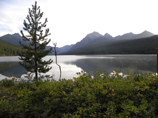
So, I'm leaving on a clockwise-ish route (exact route undefined) that starts by taking me north of most of the trouble....heading towards Lewiston, ID (not sure where I'll end up today)...then either heading east on 12 or maybe continuing north on 95 before heading east to MT. If I head north that'll bias me towards going far enough north to visit that Bowman Lake area of Glacier. We'll see.
Actually, just getting out of Oregon, if I take the best route, requires I closely skirt the west side of the GC Complex fire, burning north of (and threatened) John Day, Oregon.

The only big "complex"-size fire in an area of my prime interest is the Gold Pan Complex on the Bitterroot N.F.in Idaho. Some of the suggested destinations may be out of the running because of this fire...but there are plenty of other cool places -- or so I've been promised. ;)

By the way, a link on InciWeb brought up a different graphically-based wild-fire resource: GeoMAC viewer. Handy-cool...easily zoom-able, etc.

Happy trails, all! :)
 
Mark,you mentioned US 12 the Lolo Pass road.looks like you could skirt the fires and go through Missoula to GNP.There are some nice camps at the Clearwater area and also on the Lochsa river closer to the pass.
Enjoy Bowman,it's a nice cg.Wile there if you like to hike go to lower Quartz Lake.
Frank
 
I say Damn the Torpedoes, Mark! Go for it!

Perhaps some telephone calls to the Lolo NF, Missoula Ranger District; Beaverhead NF, Philipsburg, Wisdom, Wise River, and Dillon Ranger Districts offices can give some up-to-the-minute "smoke reports" for Rock Creek (Lolo and Beaverhead), and the Big Hole, Pioneers, and Lemhi Pass areas. That Gold Pan Complex is vexing, for sure, and may produce a lot of smoke well away from the fires. The Moose Meadows incident in upper Rock Creek is now "inactive" but may be producing some smoke. Aside from that, Rock Creek and the Big Hole look good.

The husband of the couple we explored Rock Creek and the Big Hole areas with in 2010 and 2011 just returned to his Seattle home from a week in between Pierce, ID and Superior, MT, along Kelly Creek and Moose Creek, and he did not mention smoke problems when we talked on Sunday afternoon. I've also been following some Continental Divide Trail backpacker blogs where the bloggers have reached the area between I-15 and Lost Trail Pass (US 93), and there are no current reports mentioning smoke along that part of the ID-MT border.

Looking forward to your reports, as always. Safe and enjoyable travels to you.

Foy
 
This trip didn't happen last summer -- that is, I changed plans and didn't go after all. :(

But I'm tentatively planning on doing it this summer -- early summer this time.

How is early summer -- late-June/early-July -- in western Montana and north/eastern Idaho?
 
I've just re-read this whole exciting thread while looking at my TOPO digital topos for ID & MT, and I'm getting -- excited! :LOL:

I'm probably going to head out on this trip on or about June 22 and stay out there...wandering...for about 2½ weeks.

Anyone have more information on the Beartooth Pass area of southern-MT/northern-WY?
On my previous, 20-year-ago, whirlwind tour of MT I drove from Red Lodge, MT over Beartooth Pass and across northern Yellowstone NP, and I was blown away by the spectacularness of that area crossing over from MT to WY. That trip was in September, and it was snowing...but I told myself that I'd return someday. I think it was mostly the area on the MT side of the border, near the deep valleys shown in the Google Maps screenshot and topo map below that looked coolest.
Frank mentioned Beartooth briefly here...any other experience and guidance?

Beartooth-212-1.jpg Beartooth-212-2.jpg
 
At the base of the switchbacks, take Rock Creek road to the end, hike up to Glacier Lake (few hours), nice camping spots along the way. Map says road 2421, google earth says 421. Snow may (probably) be an issue.

A couple roads before Rock Creek, the Lake Fork road (no camping) takes you to a very nice hike with excellent fishing to Keyser Brown and Rock Creek lakes, and all day hike.

The road to Clay Butte provides access to some nice ridge walking. I was there years ago, and you could drive to the tower. Last year it was closed part way up.

Last year we went to the Beartooths and when we got to Red Lodge a fire had just blown up, closing the road. So we went to the Pryor Horse Range and camped by Penn's Cabin, Nice camping and great views, it was very fun to see wild horses in that environment. Long, slow road in. The roads gets worse the further you go. Bighorn Canyon is nice as well.

Are you planning on driving along the Front, Augusta North?
 
I assume you're referring to The Beartooth Pass, traversed by US 212 between Red Lodge, MT and Cooke City, MT, but by happenstance along the segment of US 212 which dips down into Wyoming.

I've been through there 6 or 7 times since the first time in 1975. Miles of above timberline/alpine tundra topography, glacial features, pothole lakes (kettles), snow, ice, and tourists. In June, you can rely on the "kids out of school" tourist traffic reaching its peak, but it's worth a drive under any circumstances, in my opinion. I am vaguely aware of some off-highway NF roads accessible, likely on an "out and back" basis, along US 212, and of some NF campgrounds close to Cooke City. You're guaranteed to see snow and ice, and bring your long sleeves and fleece, as it'll be cold up there. I believe it's all grizzly country, so plan and think accordingly. In my opinion, the Northeast Entrance to Yellowstone, accessed by the Beartooth Highway via Beartooth Pass, is sublime in that it brings you into YNP via the Lamar Valley, with sweeping vistas and much in the way of wolf/bear/elk/antelope viewing opportunities on the benches and talus slopes along the Lamar River.

Foy
 
Foy, Yep, that Beartooth Pass. On my mid-'90s trip I spent the night in Red Lodge (motel) then drove down into WY via 212, across northern Yellowstone. I stopped where I saw a million cars parked, "Wuddya lookin' at?" Wolves...a long way off, but easy to see with binoculars. My first/only time to see those doggies.
Thanks for the suggestions, so far, guys.
 
MarkBC said:
I've just re-read this whole exciting thread while looking at my TOPO digital topos for ID & MT, and I'm getting -- excited! :LOL:

I'm probably going to head out on this trip on or about June 22 and stay out there...wandering...for about 2½ weeks.

Anyone have more information on the Beartooth Pass area of southern-MT/northern-WY?
On my previous, 20-year-ago, whirlwind tour of MT I drove from Red Lodge, MT over Beartooth Pass and across northern Yellowstone NP, and I was blown away by the spectacularness of that area crossing over from MT to WY. That trip was in September, and it was snowing...but I told myself that I'd return someday. I think it was mostly the area on the MT side of the border, near the deep valleys shown in the Google Maps screenshot and topo map below that looked coolest.
Frank mentioned Beartooth briefly here...any other experience and guidance?

attachicon.gif
Beartooth-212-1.jpg
attachicon.gif
Beartooth-212-2.jpg
We've made the drive 3-4 times but just out of Big Timber, MT to Red Lodge and then the Bear Tooth Highway into Yellowstone and back to Big Timber the same day. There are many camping spots along the way, but when you are in the Cooke City area many of the sites have hard side camper requirements due to the number of bear attacks over the past 3 years.
 
longhorn1 said:
We've made the drive 3-4 times but just out of Big Timber, MT to Red Lodge and then the Bear Tooth Highway into Yellowstone and back to Big Timber the same day. There are many camping spots along the way, but when you are in the Cooke City area many of the sites have hard side camper requirements due to the number of bear attacks over the past 3 years.
Thanks, longhorn1.

The bear hardside/softside restriction issue: Anyone ever not be able to camp in an area with your (non-Alaskan) pop-up camper because of the restrictions against soft-side camping because of bears? :unsure:

Is this going to be a something I need to worry about all over the areas -- MT/ID/WY I'm intending to visit?
(when I say "worry", I don't mean worry about the real bear-danger as much as worry about the legal restrictions: "Move along sir -- you can't camp here in that bear snack-pack")
 
Your target area all varies from "very cool" to "outright spectacular". You would need a full summer to take it all in. I just came across Yellowstone NP exiting at West Yellowstone Mt. and driving south down through Dubois and Island Park Id. Spring is coming on over there and looking at the Tetons from the west side for me was awe inspiring. Good luck and enjoy the trip.
 
LuckyDan said:
Your target area all varies from "very cool" to "outright spectacular". You would need a full summer to take it all in. ...
Yeah... I need to make an itinerary/route -- figure out where I'm actually going to go and stop.
Of course, there's about 16 hours of daylight that time of year, so maybe I can pack in two days of experience in each day of my trip -- 5 weeks in 2½ weeks! ;)

LuckyDan, do you have any more specific recommendations, any "must see" selected from the recommendations I already have? (areas not inside the national parks)
 
MarkBC said:
Of course, there's about 16 hours of daylight that time of year, so maybe I can pack in two days of experience in each day of my trip -- 5 weeks in 2½ weeks! ;)
At that latitude you're pushing 18 hours of usable light. Our regular mid-July cabin rental on Rock Creek (Lolo NF, just east of Missoula) has pre-dawn light by around 0430-0445, full light by 0530, dusk around 2100, and evening twilight finally darkening at around 2215-2230.

With that, we fish the early am, walk back to the cabin for breakfast, take a nap, go for a hike, back for lunch, take another nap, fish the late afternoon, and return to the cabin for solar showers, a good supper, wine, and cigars at 2030. Midsummer in Montana is wonderful.

Foy
 
Foy said:
At that latitude you're pushing 18 hours of usable light. Our regular mid-July cabin rental on Rock Creek (Lolo NF, just east of Missoula) has pre-dawn light by around 0430-0445, full light by 0530, dusk around 2100, and evening twilight finally darkening at around 2215-2230.

With that, we fish the early am, walk back to the cabin for breakfast, take a nap, go for a hike, back for lunch, take another nap, fish the late afternoon, and return to the cabin for solar showers, a good supper, wine, and cigars at 2030. Midsummer in Montana is wonderful.

Foy
Sounds great -- And since I don't fish, drink, or smoke there will be even more time for hiking, eating, and napping!
;)
 
MarkBC said:
Of course, there's about 16 hours of daylight that time of year, so maybe I can pack in two days of experience in each day of my trip -- 5 weeks in 2½ weeks! ;)

Now that is my kind of temporal analysis.

LuckyDan, do you have any more specific recommendations, any "must see" selected from the recommendations I already have? (areas not inside the national parks)

Unfortunately nothing specific to add to what's already been mentioned :(

While I've been to where you have circled for the most part, some of it repeatedly, Its always been for work. That said, countrywise, what I've either walked along, hiked up, driven past or flown over has always impressed me and whatever route you choose I think it would be hard to go wrong especially if you're planning to avoid the "Parks". I came across Yellowstone on a Tuesday, the route had just recently been plowed through and Yellowstone Lake still frozen solid. I stopped to eat my lunch at Old Faithful and the parking lot was still full. My other suggestion would be to not plan a lot of time in the vicinity of the "Blue Ribbon" trout waters. Not that the country or the water isn't nice but your planned itinerary will in my experience put you there when the fishing will be coming on and those areas can load up with fisher people on vacation.

Best wishes with your planning and traveling.

 
Casa Escarlata Robles Too said:
Mark, are you going to Glacier?

I saw they just had about 16" of snow.
Crazy weather.
Have fun on your trip. Hope the westside lakes are open. They sure are nice and very quiet.
Frank

Thanks to the amazingly-in-touch-with-the-West Mr. Foy, (and he's an east-coaster!) I was alerted to the fact that the Going to the Sun Road in Glacier is still being plowed...and that was before the new snow this week. Thank you, Foy! :)

So I plan to start my trip at the south end of my range -- in the Beartooth Highway area. There may be new snow there, too, but the highway itself has been open for weeks already.


ski3pin said:
Yup, launch date is getting close. Travel safe Mr. BC! :)

I'm leaving Saturday (June 21) heading towards Boise and then probably up to/through Stanley and Challis on a route headed to the northeast-of-Yellowstone Beartooth area. Probably cut across northern Yellowstone to get there, but not camp in Yellowstone -- too many tourists this time of year.

Then I'll wind and wander my way more-or-less northwest without a definite itinerary yet. May or may not get up as far north as Glacier.

Snow-covered ground may affect my itinerary...but I'd rather deal with snow -- at least it's beautiful! -- rather than the wildfires-and-their-smoke that I was going to face last year!
 
Back
Top Bottom