October 2006 Long Northern California Road Trip

DirtyDog

Captain Leisure
Site Team
Joined
Nov 10, 2005
Messages
3,157
Location
Eugene, Oregon
This is a long overdue report for a trip to California in October of 2006. This was another photography trip in support of my other site Western Mining History. As usual on these trips, I set a punishing driving schedule and didn’t have much downtime. Still had a good time though, and saw lots of great stuff.

Day 1:
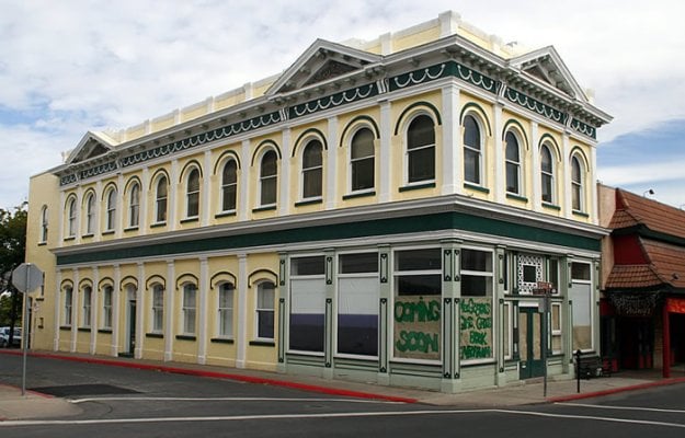
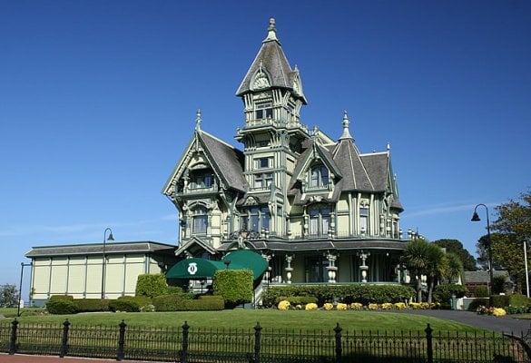
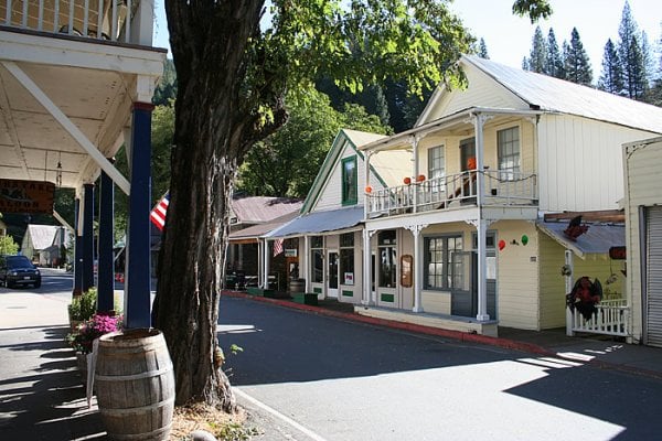
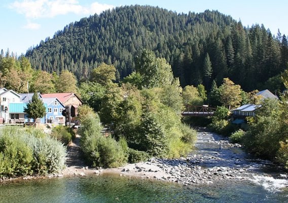
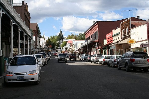
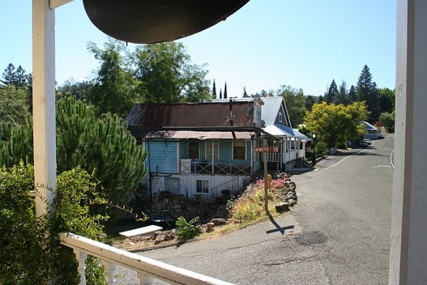
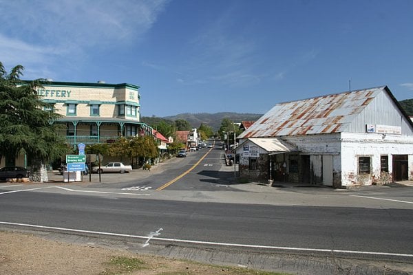
Drove south from Oregon to my first stop Yreka California. I had been to Yreka a few times growing up but had never appreciated the history of this old mining town. There are many Victorian mining-era buildings and homes here.

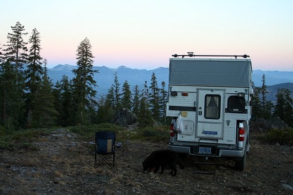
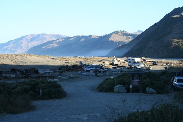
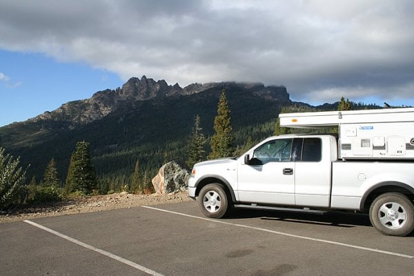
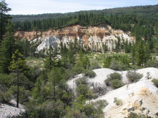
After Yreka I drove Highway 3 south into Scott Valley. This is a beautiful drive on the edge of the rugged Trinity Alps mountain range. Towns like Fort Jones and Etna are quiet and peaceful towns to visit. The Etna Brewery is always worth a stop. After Etna, I continued south on Highway 3 and camped on a dirt road near the highway summit.

More info: Yreka

Photos: Yreka California, Camping in the Trinity Alps
 

Attachments

  • yreka1.jpg
    yreka1.jpg
    108.8 KB · Views: 3,472
  • trinitycamp2.jpg
    trinitycamp2.jpg
    101.1 KB · Views: 3,403
Day 2:
Continued south to Weaverville. Weaverville is an 1850’s era mining town deep in the mountains of Northern California. The town had a large Chinese population and still has a 133 year old Joss House (Chinese temple).

I had the Dirty Dog (Diego) himself with me so I thought from Weaverville I would hit the coast and drove west on Highway 299 to Arcata. This windy and remote stretch of highway follows the Trinity River and is a great drive. Once I hit the coast, I went south to Ferndale. I was having a hard time finding a dog-friendly campground so I took Mattole Road to Petrolia and Mattole Beach. The Mattole Road is one of the steepest and windiest paved roads I have ever traveled. This is rugged terrain! The rugged terrain has stymied road development over the years and kept this area relatively little used right in the heart of busy California. The area is known as “The Lost Coast” – and for good reason. Mattole Beach Campground was not crowded and was one of the nicest places I have ever camped. The campground was eight dollars per night.

More info: Weaverville; Mattole Beach

Photos: Gold Dredge Piles North of Weaverville, Joss House - Weaverville, Mattole Beach Campground
 

Attachments

  • dredgepiles3.jpg
    dredgepiles3.jpg
    153.2 KB · Views: 3,363
  • josshouse4.jpg
    josshouse4.jpg
    186.2 KB · Views: 3,370
  • MattoleBeach5.jpg
    MattoleBeach5.jpg
    83.3 KB · Views: 3,335
Day 3:
Reluctantly left Mattole Beach and headed back north to Eureka. Eureka has more well-preserved Victorian-era buildings than any town I have been to. I headed east on Highway 36 and camped in Van Duzen County Park in a thick grove of Redwoods adjacent to the Van Duzen River. The campground was $15 per night and showers were available.

More info: Eureka

Photo - Carson Mansion - Eureka California
 

Attachments

  • EurekaMansion6.jpg
    EurekaMansion6.jpg
    111.5 KB · Views: 3,224
Day 4:
Drove east again on Highway 36. This is a long, windy road with a couple of sections that are a single lane wide. Be sure you are fed and gassed up before doing this drive – there are no services for a very long stretch of road. Eventually passed through Chico & Oroville, then took 119 to Quincy. Camped at Lakes Basin Campground on Highway 24. Numerous hiking trails start right from this great campground. As I would end up finding at several locations on this trip – the campground host had left for the season and all payment information, envelopes etc had been removed – so camping was free.

Photo - Sierra Buttes
 

Attachments

  • sierrabuttes7.jpg
    sierrabuttes7.jpg
    86.3 KB · Views: 3,284
Day 5:
Hit the road and headed for Gold Country. My first stops were Sierra City and Downieville. Downieville is one of the nicest mining towns I have visited and is very well preserved. Next I headed down river to Nevada City. Nevada City is one of the largest mining towns I have been to, and is also well preserved. Camped on Highway 20 at Scotts Flat Reservoir.

More info: Sierra City; Downieville; Nevada City

Photos: Downieville, Downieville, Nevada City
 

Attachments

  • downieville8.jpg
    downieville8.jpg
    150.1 KB · Views: 3,218
  • downieville9.jpg
    downieville9.jpg
    175.5 KB · Views: 3,221
  • NevadaCity10.jpg
    NevadaCity10.jpg
    107.4 KB · Views: 3,162
Day 6:
Photographed downtown Grass Valley, then drove to Coloma. Coloma is where the California Gold Rush started and is historically very significant. Most of the town is a state park now. Continued on to Placerville. My favorite stop in Placerville was the Cozmic Depot Cafe, which is an old soda works building that uses an old mine shaft in the back for cold storage. They had tables setup in the shaft and you could actually eat your lunch underground!

Camped east of Placerville at Sly Park – nice but a whopping $25 per night!

More info: Grass Valley; Auburn; Coloma; Placerville

Photo - entrance to old mine at Cozmic Depot Cafe
 

Attachments

  • CozmicCafe11.jpg
    CozmicCafe11.jpg
    101.7 KB · Views: 3,122
Day 7:
More mining town photography. The pleasant surprise of the day was the town of Sutter Creek. Camped at Fraser Flat Campground on Highway 108 – nice spot and 15 bucks a night.

More info: Amador City; Sutter Creek; Jackson

Photo - Knight Foundry - Sutter Creek
 

Attachments

  • knightfoundry12.jpg
    knightfoundry12.jpg
    127.7 KB · Views: 3,143
And the last few days…….
I think I was starting to get road-weary at this point because I quit writing in my notebook. Continued down Highway 49 as far south as Mariposa then headed back to Oregon. Mokelumne Hill and Coulterville were my favorite towns during this part of the trip.

Overall a good trip with perfect weather and uncrowded campgrounds. October is a great time to travel in Northern California!

More info: Mokelumne Hill; San Andreas; Angels Camp; Sonora; Jamestown; Coulterville; Mariposa

Photos: Mokulumne Hill, Coulterville
 

Attachments

  • MokelumneHill13.jpg
    MokelumneHill13.jpg
    138.3 KB · Views: 3,018
  • Coulterville14.jpg
    Coulterville14.jpg
    98.3 KB · Views: 3,004
Dog

Did you happen to take the Kentucky Mine tour in Sierra City? If not you missed a great one. The mine has one of the few or maybe the only working stamp mill in California. They turn it briefly on the tour to allow a couple of stamps to fall. We're not that into mining but have really enjoyed the tour. I was more interested in the building structure, great piece of post and beam wood construction.
 
I visit a lot of mines myself. Some real interesting stuff out in the forests. Speaking of gold mines, most shut down not for lack of gold, but because it became uneconomical to mine it. I don't remember the exact figure they bandy about, but its something like less than 10% of all the gold has been found. Of course theres not too much easy stuff left. A lot of people still go up after floods and earthquakes to see whats been unearthed.

I'm guessing you saw the hydraulic mining along hiway 299? I think its 299. Very destructive stuff. The hydraulic mining at Malakoff diggings brought about some of the first environmental laws. The gravel that was washed into the streams is still heading out to sea. I believe its something like another hundred years before it will washed out to sea (dont quote me on the figure).

It even affects how our rivers flood to this day. The Sacramento River was purposely constructed with very close in levees so the flow would run fast and deep and scour out the gravel.

Amazing some of the engineering they did back in the 1800's. If the captain the engineered the bypass hadn't done it back then, we'd be in alot of trouble. No way you could ever build something like that now.
 
I saw some of the Hydraulic damage on the roadsides but I didn't stop at any of them. I had a pretty tight schedule to keep to get the towns photographed.
 
Hydraulic damage

Here is a shot from Malakoff Diggins taken in May. The whole valley here was formed by washing the hillside away. As Craig said, they closed for environmental reasons, not for lack of gold. There were a lot of streams flowing through this washed out area. Got me to wondering about what might be in the streambeds???
 

Attachments

  • Malakoff.jpg
    Malakoff.jpg
    121.3 KB · Views: 588
Here is a shot from Malakoff Diggins taken in May. The whole valley here was formed by washing the hillside away. As Craig said, they closed for environmental reasons, not for lack of gold. There were a lot of streams flowing through this washed out area. Got me to wondering about what might be in the streambeds???

At over 800 an ounce it might be a good time to find out :)
 
DD,

Thanks for the great trip report and pictures. I wish I didn't live so far away from CA! This past summer I visited my first old mining/ghost town, Granite MT, near Philipsburg. But it won't be my last, especially since looking at your pictures of old mining towns on your other web site.

Buzzman
 
DirtyDog,

The trip narrative and photos made me homesick, particularly the far north/west and Downieville. Montana is great, but Northern Cal has some awesome spots, and the best swimming rivers I've ever found. Great photos; I can see how you make a living at this.

Thanks,
--KngBee
 
Coloma, Lotus and the Cozmic Cafe

Hey Dirty Dog,

Glad to see you enjoyed my neck of the woods. I'm from Lotus, a little town that is really indistinguishable from Coloma, as you stated Coloma is mostly the park so anyone that lives down by the river actually lives in Lotus. A few history highlights you might find interesting. Lotus was originally called Uniontown during the gold rush days and you can still visit the old Union Town cemetary, a gold rush era cemtary on Bassi Road. During the civil war the town changed it's name to Lotus so as not to appear to have taken sides or be part of the war in any way. That is a local story, I have not confirmed it in the history books. It also used to be called Marshall but that fell by the wayside to uniontown. Although gold was discovered there it wasn't really the hub of the gold rush in the area. That prize belongs to the Middle Fork of the American River which produced the most gold in the area and was dotted with mining towns. The wagon trail that took you from New York to California dumped you into the North Fork of the Middle Fork and then eventually into the Middle Fork of the American River so most weary cross country gold seakers settled in that canyon. If you're ever in the area again and want a good local history guide check out the American River Book. A side note on the Cosmic Cafe's mine shaft is that the cieling is held up by a cross section of old wagon leaf springs and metal window shutters from the 1800's. I could go on but I'll spare you the mile by mile history of the Middle Fork. Suffice it to say that it is the birthplace of California and a great place for history and especially mining history buffs as well as a great place to raft and live.
 
Back
Top Bottom