Oregon Trail/Barlow Road

UglyScout

Contributors
Joined
Sep 1, 2010
Messages
405
Location
Newberg, OR
This was supposed to be a camping trip - but the lil' dude got sick on Thursday and is still sick 4 days later - so we cancelled our camping plans - but I didn't want to ruin my buddies plans at the same time. So... I decided to drive along with him and then head home after he got through the 'offroad' portion of our trip.

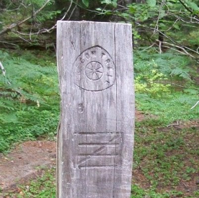
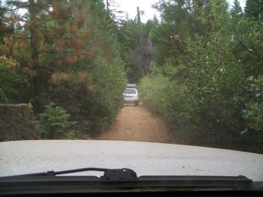
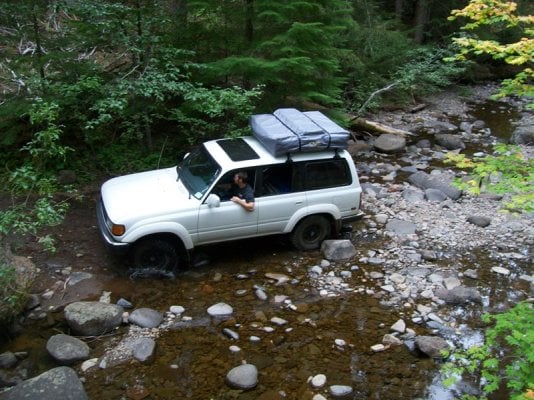
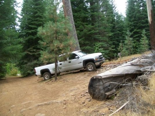
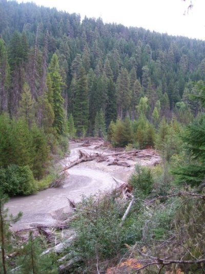
The goal was to drive the 'drivable' portion of the Oregon Trail/Barlow Road from just east of Government Camp, OR to the town of Waumic, OR. It is about 35 miles of rough unmaintained roads, nothing hardcore, but you do need 4 wheel drive and you do need more clearance than a car. He was then going to head to Badger Lake and camp and I was headed home. Everything worked out great and the offroad portion of the trip was a lot of fun. Totally doable with a FWC as long as you are willing to get a little 'custom' stripping from the bushes.
 

Attachments

  • or_trail.jpg
    or_trail.jpg
    116.9 KB · Views: 231
  • think_skinny.jpg
    think_skinny.jpg
    136.6 KB · Views: 203
  • water_crossing.jpg
    water_crossing.jpg
    179.2 KB · Views: 570
My buddy was testing out a new to him roof top tent - I was testing out my HUGE truck on tight trails. We both were happy with the results.

I also tested out my edgestar fridge in the bed of the truck being exposed to the rain, dust, dirt, mud and bouncing of the trip. It did fine and kept my lunch at an even 38 degrees.

We scouted out a couple nice campsites right on the White River and or little side creeks. We made note of the best ones and plan to head back next summer.

One note of caution - the trail starts right off Hwy 35 - BUT there are two small bridges in the first mile of the trail that are 'closed' as they are old and failing. They are only rated at 3 tons to begin with so my truck empty is over the limit and with a the camper, forget about it. You can drive a little further and get on the trail via FS Road 48.
 

Attachments

  • duramax.jpg
    duramax.jpg
    82.4 KB · Views: 181
  • white_river.jpg
    white_river.jpg
    114.7 KB · Views: 185
Great brief TR Ugly, 'specially for those of us in the hood. This sounds like a nice quick trip for me and the daughter some time. Can you share more details on the rest of his trip? Or is it obvious if I look at a map, which I don't have handy at the moment.
 
Great brief TR Ugly, 'specially for those of us in the hood. This sounds like a nice quick trip for me and the daughter some time. Can you share more details on the rest of his trip? Or is it obvious if I look at a map, which I don't have handy at the moment.


Do you do GPS? I 'think' I can pull the trail portion of the trip and post it up for you.

It is pretty striaght forward with a map and most of the major crossings are marked. You also can't get lost as there is no way across the White River until you hit a major bridge. The Barlow Road is FS 3530. There are at least 4 designated campgrounds along the 'road' and many other non-designated primative spots.

We meet at Joe's Donuts in Sandy at a reasonable hour and I was home and cleaned up in Newberg by dinner time.
 
First attempt at posting GPS data on this site... so bear with me.

It is posted up in a text file that can be imported into your GPS software - massaged - then exported to your GPS. It will not allow me to upload a .GPX file directly.

I will try one more thing.
 

Attachments

  • barlow_trail.txt
    124.2 KB · Views: 134
I have had this trip on my radar for a couple of years now, glad to see a trip report on it. Maybe I can get up there from Bend before the snow flys.

Home Skillet
 

New posts - WTW

Back
Top Bottom