Sierra Buttes

craig333

Riley's Human
Joined
Jan 12, 2007
Messages
8,154
Location
Sacramento
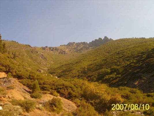
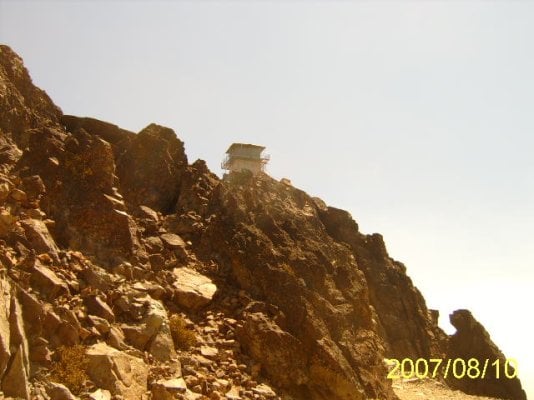
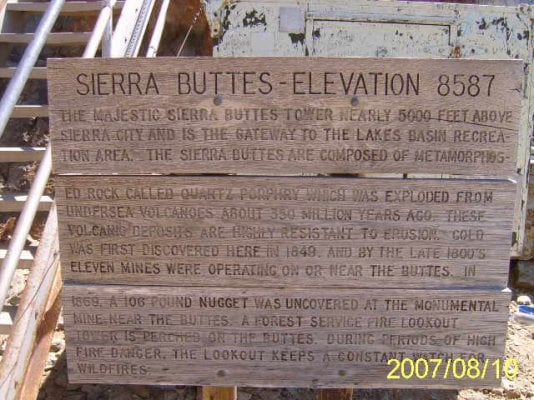
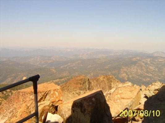
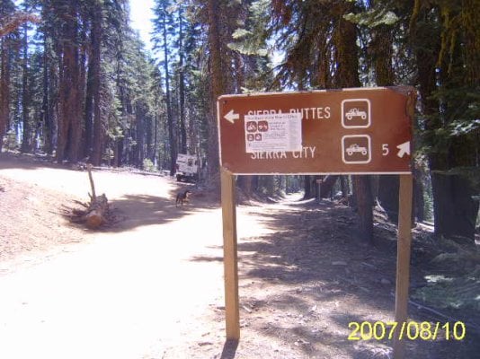
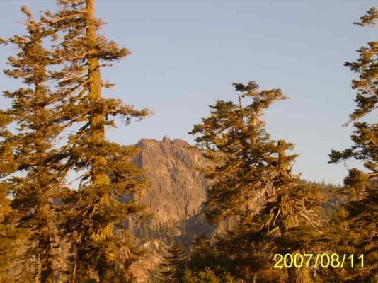
Finally made the trip up there. What a view. I went up 80 from Sacramento to highway 49 up to Sierra City. Btw, if you like touring small cities, you need to check out downieville and sierra city. From Sierra City it climbs up a fair dirt road up the side of a hill.

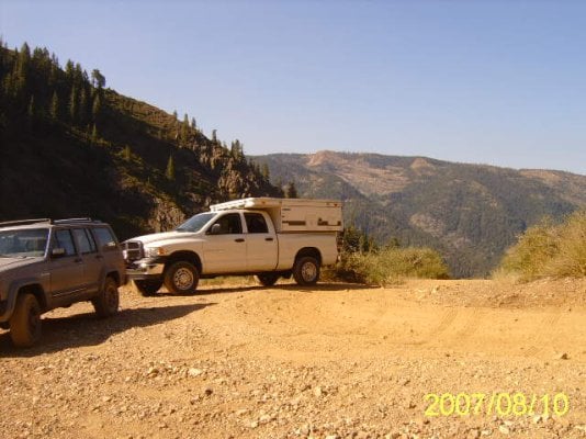
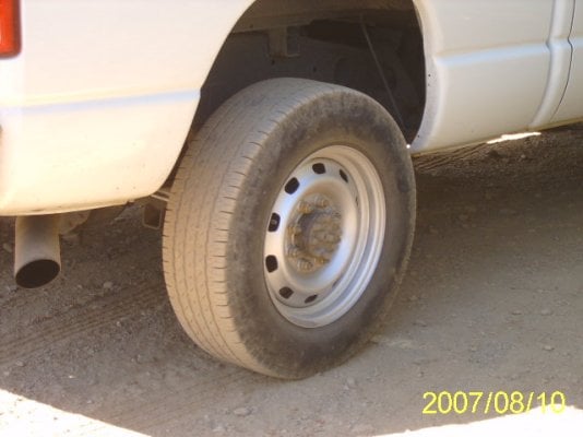
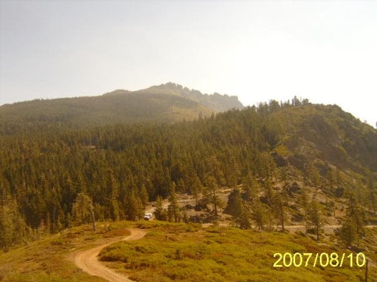
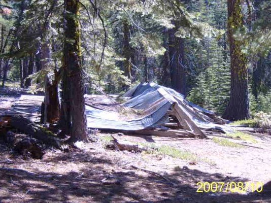
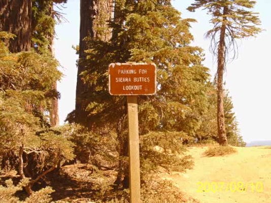
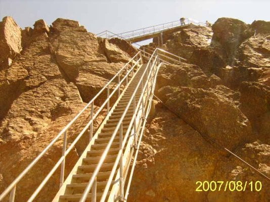
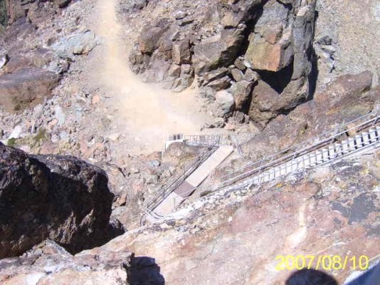
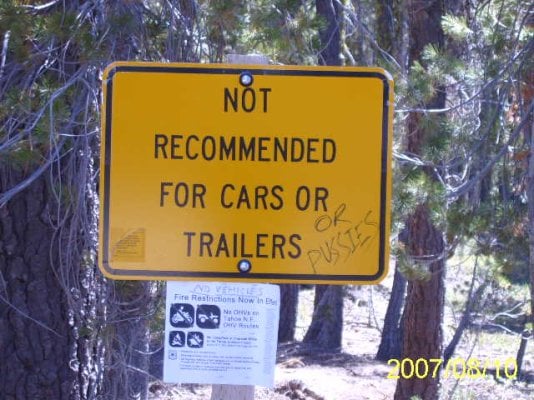
Steep and narrow, definitely a little pucker factor when you look down. I met a vehicle coming down and we had a little difficulty squeezing by. Fold in the mirrors, eat some bushes. Thats probably where I lost my hubcap. After you crest the ridge you're in some nice forested country. I missed the turn to the lookout when I stopped to check my map at some old ruins. The sign to the turnoff is missing.
 

Attachments

  • moab 012.jpg
    moab 012.jpg
    54.4 KB · Views: 316
  • moab 013.jpg
    moab 013.jpg
    54.6 KB · Views: 303
  • moab 015.jpg
    moab 015.jpg
    57.3 KB · Views: 312
  • moab 018.jpg
    moab 018.jpg
    55.3 KB · Views: 298
  • moab 023.jpg
    moab 023.jpg
    43.5 KB · Views: 320
So I get to the final turnoff to the lookout and the Forest Service has posted no vehicle signs (for fire danger). So I park and walk up. Long steep walk. I get to the parking area where the road is gated and see a couple trucks already there. Did I do the right thing? I'm still debating that. It didn't look like was any real danger in driving on up. From there it gets steeper yet. Sierra City is around 5000' and the lookout is 8547'. I'm not sure how much is gained on the way to where I parked and how much from the way on up from there (I forgot my gps) but its a steep the whole way. I didn't bring nearly enough water for the extra distance I traveled but at the stairs I bummed a bottle from a nice lady for the dog. Steep stairs on the way to the lookout. Not for the squeamish. Real nice 360' view from the lookout. On the way out I ran across some interesting things too.
 

Attachments

  • moab 026.jpg
    moab 026.jpg
    49.2 KB · Views: 288
  • moab 028.jpg
    moab 028.jpg
    47.6 KB · Views: 305
  • moab 029.jpg
    moab 029.jpg
    58.2 KB · Views: 324
  • moab 032.jpg
    moab 032.jpg
    54.3 KB · Views: 289
  • moab 033.jpg
    moab 033.jpg
    52.9 KB · Views: 300
Some more pics.
 

Attachments

  • moab 035.jpg
    moab 035.jpg
    56.3 KB · Views: 302
  • moab 038.jpg
    moab 038.jpg
    56.4 KB · Views: 310
  • moab 041.jpg
    moab 041.jpg
    56.9 KB · Views: 297
  • moab 042.jpg
    moab 042.jpg
    46.3 KB · Views: 306
  • moab 043.jpg
    moab 043.jpg
    48.2 KB · Views: 305
A few more pics.
 

Attachments

  • moab 045.jpg
    moab 045.jpg
    49.8 KB · Views: 311
  • moab 046.jpg
    moab 046.jpg
    51 KB · Views: 289
  • moab 047.jpg
    moab 047.jpg
    54.9 KB · Views: 299
  • moab 050.jpg
    moab 050.jpg
    50.2 KB · Views: 305
  • moab 051.jpg
    moab 051.jpg
    52.9 KB · Views: 308
Btw, I took a different route out. Much easier and probably preferable if you're two wheel drive (though you can certainly do the route I went in two wheel, but it was easier on the rig in four low) or don't like looking at long steep drop offs.
 
Another thing. One reason I hadn't done this till now, is because of the altitude and topography, this area just gets buried in snow. Not a trip you can make early on late in the season. Witness the patch of snow still on the mountain in the middle of august.

Also, the drive along highway 49 is very scenic. Especially once its starts following the Yuba river. Theres a number of campgrounds along the river (all looked pretty full), hotels, bed and breakfasts, resorts etc.

Up in the flat area near the lookout theres no campgrounds but plenty of spots to boondock in.

At the intersection where one way goes toward the Gold Lake area (popular with four wheelers) one way back to Sierra City and one way back to highway 49, theres a large dirt parking area and a moutain bike trail. Signage makes this one sound pretty extreme. Expert level trail.

Looking at a better map now that I'm home (i had trail guild with me) it looks like if you go right from that intersection you will go to packer lake where theres some campgrounds. Also seems to be paved all the way to Bassets (above Sierra City).

Also, kinda weird. When I was at the lookout (maybe manned during lightning storms? hard to say, its open but most of the gear is removed) it seemed like there was just one butte. But you can clearly see the other buttes from the distance shots. Odd how perspective changes like that.

And oh, those stairs and the catwalk around the lookout, you can see through underneath. Not good for your agoraphobia.
 

Attachments

  • moab 039.jpg
    moab 039.jpg
    52.8 KB · Views: 296
  • moab 052.jpg
    moab 052.jpg
    62.8 KB · Views: 297
Craig, my butt was puckering looking at the pictures. Terrific shots thanx for posting them. BTW great looking rig. I'm sure Mike will agree its the only way to go. Is it a Cummins and if so do you have cruise control?
 
Craig,

We've been up to the lookout twice. The first time we hiked it from the Packer Lake Road trail head and the second we drove my wifes old car, a '91 Subaru, as far up the dirt road as we could and then hiked the road. We sure wouldn't do that to her new Outback. Anyway, your shots of the stairs show well how hairy that last few hundred feet are. I was white knuckled each time up and down those stairs but well worth it for the view from the lookout.
 
Yep, its a cummins, only way to go. And btw, i do believe one of those towns had diesel. No cruise control. I bought the stripped down model. No power anything. Its was all (probably more but what the heck) could afford.

I'll admit, heights aren't my thing. I had the death grip on the handrail going up and down.
 
Back
Top Bottom