Colorado Jeeping -Silverton 2012

dorocks

Senior Member
Joined
Jun 25, 2009
Messages
306
Location
El Cajon CA
Jeanne and I got our next vacation in last week. We headed out to Silverton Colorado to hit the famous Jeep trails. We spent our first night at the KOA in Flagstaff and got a bit of summer rain.

We got to Silverton and drove out to the north of town and found a boondocking spot. Was right next to the stream so we were white-noised to sleep four of the next five nights. Temps were 40-50 degrees at night - very comfortable.

The days on the Trail were mixed between rainy and beautiful cloud/sun days. We hit Black Bear Pass and Ophir Monday.
Did Yankee Boy Basin Tuesday. On other days we did Porphyry Gulch, Clear Lake, Arrastra Gulch, and some of Yankee Girl/Red Mountain area. We stayed in Siverton the last night to get clean for the trip home.

Stopped at my brother's in Surprise AZ for Saturday night and headed home Sunday during 115 degree days.

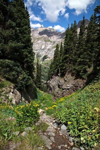
Here is a sampler of pictures.

http://keithbarnes.smugmug.com/Vacation/Colorado-Jeeping-San-Juan/24724799_DGPr5v#!i=2024875217&k=J3Kk8B2
 

Attachments

  • valley crack.jpg
    valley crack.jpg
    277.2 KB · Views: 155
Great pictures.

Leaving tomorrow for the same area. I noticed the truck/camper was used as a base camp?
I am planning to travel most of the same trails with a crew cab 3/4 ton with a Hawk. I have to say some of those pictures looked like it will be a tight squeeze especially the switchbacks and meeting other vehicles.

Any suggestions on trails to perhaps avoid with a plus size truck/camper?
Got a kick out of the AMC PacerWhatEver thing on the trails.


I would stick to the advice in Funtreks book. Guide to Colorado Backroads and 4 Wheel Drive Trails.

http://www.funtreks.com/index.php?Itemid=31&option=com_virtuemart&view=productdetails&virtuemart_product_id=3

I originally was going to go with the truck only but am glad I took the Jeep. The green trails could probably be done by anybody. Some of the blues were slippery at times since it rained several times. My truck tires are street types and probably would of been sketchy at times. The blacks had some tough areas though we never took on Poughkeepsie Gulch since most said it was pretty rough.

Wetness was not always bad. The roads there are rocky so they drain well. But the side trip to Virginius Mine made me pucker a bit. It was wet and muddy on one side of the narrow shelf road.

Enjoy the trip. Lots a great stuff to see even if you only go on the Easy runs.


X2 on fun treks. I used it last summer when we were out there. Rotti, if you are in to hiking, drive 3/4 of the way up Kendell Mtn and you will see several spots to park on the right. On the left you will see a trail which will lead you to the old hundred boarding house.

http://www.insideoutsidemag.com/issues/2006/July_August/Mining_Boardinghouses_in_the_San_Juan_Mountains/

Depending on your physical ability, the hike one way should take approximately 90-120 minutes. You are exposed on the mtn,so pack accordingly and check weather forecast first. But everyone knows how unpredictable and fast a storm system can roll through the Mtn's. Once you reach the boarding house the last 150 yard decent can be a little hairy(very steep shale rock).

Last summer was the first time the trail was not snow covered and we were able to make the trek. It was amazing, we passed a couple who spent the night, they were the only people we saw all day. It was about 6 hour trip total, 2 hrs to get there, 2 hrs to explore and have lunch, 2 hours back. I can't wait to do it again, it was an experience I'll never forget. I don't know about spending the night, especially after looking at the partially chewed through support beams. Darn marmots.
 
Dorocks, great pics. Any advice on black bear pass. Its been closed every time I've been out there. We are planning a trip out to Silverton next summer, late July/early August. Hopefully it will be opened and I would like to do it, although I get quite the pucker factor from just watching videos and looking at your pictures.
 
Dorocks, great pics. Any advice on black bear pass. Its been closed every time I've been out there. We are planning a trip out to Silverton next summer, late July/early August. Hopefully it will be opened and I would like to do it, although I get quite the pucker factor from just watching videos and looking at your pictures.


The one section that elicits the puckering is a little over hyped. It is off axis but as long as you go slowly and stay on the track it is passable. Keep in mind I have been on a lot of puckery trails so I do not normally overreact. The switchbacks were not a big deal. Just do some 3 or 4 point turns and you are through. Snow is what usually closes the pass. I would not go through there if there was snow at all.

But this was a bad snow year. I barely saw any snow even in the shade. And we only got one ski trip last season.
 
X2 on fun treks. I used it last summer when we were out there. Rotti, if you are in to hiking, drive 3/4 of the way up Kendell Mtn and you will see several spots to park on the right. On the left you will see a trail which will lead you to the old hundred boarding house.

http://www.insideoutsidemag.com/issues/2006/July_August/Mining_Boardinghouses_in_the_San_Juan_Mountains/

Depending on your physical ability, the hike one way should take approximately 90-120 minutes. You are exposed on the mtn,so pack accordingly and check weather forecast first. But everyone knows how unpredictable and fast a storm system can roll through the Mtn's. Once you reach the boarding house the last 150 yard decent can be a little hairy(very steep shale rock).

Last summer was the first time the trail was not snow covered and we were able to make the trek. It was amazing, we passed a couple who spent the night, they were the only people we saw all day. It was about 6 hour trip total, 2 hrs to get there, 2 hrs to explore and have lunch, 2 hours back. I can't wait to do it again, it was an experience I'll never forget. I don't know about spending the night, especially after looking at the partially chewed through support beams. Darn marmots.


Hi 5444. I am trying to figure out exactly how to get to the boarding house and I am hoping you can help me out. I have the Funtreks book, but I don't see the house mentioned on the Kendall Mountain pages. Any more specific info on where to look would be great. I am headed to the area in about a week and would like to see it.

I am assuming County Road 33 is where the parking is, but I am not sure. Thanks in advance for any help.
 
Alright, it's not on the the funtreks map. But I can give you a landmark to go by on the funtreks map. Page 55, Kendall Mtn. Take 33 until you get to 03 on the map in funtreks, stay left until you see the first camera pictures square on map. This is roughly where the trail to the boarding house starts. There will be 3 parking spots on the left and trail is across the road. You cant miss the parking spots. If all else fails, stop when you see these spots a scout around for trail. If there is heavy snow, the trail will be hard to find. Be careful crossing the areas where it seems like 2 mtns are meeting, (there are at least 2 I remember while hiking) if these have snow, walk around snow, you dont want to slide down 11,000 feet. It would definetely leave one hell of a mark, if you were still breathing. When you get to Silverton, stop by visitors center and purchase Map of the Mountains of SIlverton, Telluride and Ouray. On this map you will see a dotted line coming from the point I indicated on the funtreks map by the camera square. This is the trail you want. It actually crosses Swansea Gultch on the map you need to purchase. Clear as mud, well
I hope this helps a little.
 
I need to apologize. I went to the trail head of the old hundred last summer and the trail is off Stoney Pass, Galena Mountain. Once I was out there I realized I made a mistake on here. I'm very embarrassed and I hope I did not inconvenience you.
 

New posts - WTW

Back
Top Bottom