########################################################
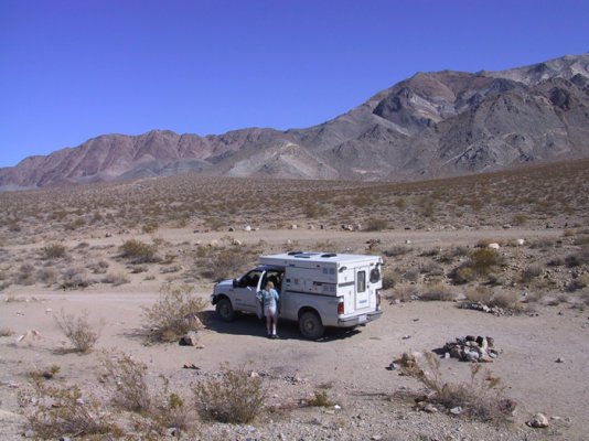
Official meeting place will be Stovepipe Wells campground on January 17th. We will plan on camping there Sat and hitting the backcountry after that.
##########################################################
Note: I had originally started posting this in an existing thread but decided that this thread would be a good resource for others planning death valley trips so I wanted the info to be at the top of a new thread.
Hey guys -
Whew, with the holidays and all this has really snuck up on me! We'll need to make a few decisions soon, mainly, where and when to rendevous/camp for the first night. It seems that many can travel on Friday, so I am going to leave Thursday so I can get there daylight Friday. We could either meet Friday eve or Sat based on peoples schedules. However, what we need to figure is WHERE we want to meet and camp that first night. It seems that our choice of camps will be influenced based on what kind of exploring we want to do.
I have seen mention in our DVR threads that Titus Canyon would be a great trip for the group. It seems many of the routes suggested are around the Stovepipe Wells area - so maybe that is a good choice for a rendevous?
Also - Furnace creek has firepits and group camping, and takes reservations. If we want to rendevous here I can try to make the reservations over the next few days
I also noticed that on Racetrack valley road there is an informal camping area known as Homestake Dry Camp - maybe that would be a good route for one of the days?
Here are some backcountry routes from the NPS:

1) Hole-in-the-Wall
Vehicle needed: high-clearance first 4 miles; 4x4 required beyond
Distance: 4 miles to the "hole"; 2 more miles to road's end
Start: 5.5 miles east of Furnace Creek Inn on Hwy 190
Camping: yes, after first 2 miles
Description: This road traverses east up a gravel wash. After passing through the 400' deep gap called Hole-in-the- Wall, the road becomes rougher.
2) Echo Canyon
Vehicle needed: high-clearance first 3 miles, 4x4required beyond
Distance: 10 miles to Inyo Mine
Start: 2 miles east of Furnace Creek Inn on H wy 190
Camping: yes, after first 2 miles
Description: The road tends to
have deep gravel and is quite rocky 3 miles from the highway. The Needle's Eye, a natural arch, is located within the canyon narrows. A side road to the left climbs over a small saddle and eventually leads to Amargosa Valley, but is very rough, requiring a short wheelbase 4x4 and an experienced driver. The main road continues to the Inyo Mine with its old structures and remnants of mining equipment.
3) Chloride City
Vehicle needed: high-clearance first 2 miles, 4x4 required beyond Distance: 14 miles
Start: 3.4 miles east of Hell's Gate on Daylight Pass Road
Camping: yes, after first 2 miles
Description: One of the earliest sites of mining in Death Valley can be reached via a loop drive. Two miles from the Daylight Pass Road is Monarch Canyon where the road becomes deeply rutted. The side road to Chloride City and Chloride Cliff beyond climbs steeply to the right at 5.3 miles. Loop back to the paved road an easier way by continuing northeast down the road from the Chloride City junction.
4) Titus Canyon
Vehicle needed: high-clearance
Distance: 27 miles
Start: Nevada Highway 374 (Daylight Pass Road), 2 miles east of park boundary
Camping: no
Description: This popular road is ONE-WAY from east to west. The road re-enters the park and winds through the Grapevine Mountains, then drops down through one of Death Valley's most spectacular canyons. Along the way watch for the ghost town of Leadfield and petroglyphs at Klare Spring. Please report sightings of Bighorn Sheep to the visitor center. A free information handout describing the trip highlights can be picked up at the visitor center.
5) Phinney Canyon
Vehicle needed: high-clearance first 21 miles, 4x4 required beyond.
Distance: 23 miles to pass
Start: 11.7 miles north of Beatty , Nevada on Highway 95, watch for gated road to the left
Camping: yes
Description: Heading west across Sarcobatus Flats, the road forks in 12 miles to Strozzi Ranch on the left, and to Phinney Canyon on the right. Pinyon pine woodlands appear after the canyon is entered, and the road quickly becomes 4x4. From the pass there are views of the Grapevine Mountains high country and glimpses of the Sierra Nevada Range.
6) The Racetrack
Vehicle needed: high-clearance Distance: 28 miles to The Racetrack Start: Ubehebe Crater Road
Camping: yes, after first 2 miles, but no camping between Teakettle Junction and Homestake Dry Camp.
Description: This road leads to The Racetrack, a dry lakebed famous for its "moving rocks." Two miles beyond the playa is the ruins of the Lippincott Mine and an informal camping area known as Homestake Dry Camp.
Do not drive onto the dry lakebed!
7) Hunter Mountain and Hidden Valley
Vehicle needed: high-clearance to Hidden Valley; 4x4 recommended over Hunter Mountain
Distance: 40 miles from Teakettle Junction to Hwy 190
Start: Teakettle Junction, Racetrack Road Camping: yes
Description: From Teakettle Junction the road becomes rougher. At the junction 3.2 miles in, the left fork (NE) continues 10 miles to White Top Mountain (4x4) while the right fork leads one mile up to the Lost Burro Mine. The main road continues through Hidden Valley and Ulida Flat, passing several abandoned mining areas. The road climbs steeply up onto the wooded plateau that is Hunter Mountain. Snow and icy conditions may make this section impassable in winter. The road improves after it joins the southern end of Saline Valley Road to Hwy 190.
8) Saline Valley
Vehicle needed: high-clearance, but may require 4x4 in winter. Subject to winter closures.
Distance: 78 miles from Hwy 190 to Big Pine Road
Start: 13.7 miles west of Panamint Springs on Hwy 190
Camping: yes
Description: One of the most remote locations in California, this desert basin is surrounded by rugged mountains on all sides. Finest Joshua tree forest in the park located 8 miles in at Lee Flat. Also salt marsh, sand dunes, warm springs, and stunning views of Inyo Mountains.
11) Cottonwood and Marble Canyons
Vehicle needed: high-clearance first 8 miles,4x4 recommended beyond Distance: 13 miles Marble Canyon; 16 miles Cottonwood Canyon
Start: east of the Stovepipe Wells airstrip Camping: yes, after first 8 miles
Description: For the first 8 miles, the
road crosses Mesquite Flat and climbs a broad alluvial fan before reaching the canyon mouth. The road drops into the wash and becomes rocky and rough. One mile past the end of the first narrows, a side road leads up to Marble Canyon. Hikers can continue up the canyon beyond road's end to see some of the finest canyon narrows in the park. Two miles beyond road's end up Cottonwood Canyon is a flowing stream lined with cottonwood trees.
10) Tucki Mine Road
Vehicle needed: 4x4 required
Distance: 10 miles
Start: 1.7 miles up Emigrant Canyon Road from Emigrant Junction. At the mouth of the canyon the road can be seen climbing up the bank on the other side
Camping: yes, after first 2 miles Description: After following along the base of the mountains the road enters Telephone Canyon. Two and a half miles from its mouth, the canyon forks. A short walk up the right fork will bring you to a natural arch and an old mill site. The road continues up the left fork to the ruins of Tucki Mine.
11) Trail Canyon
Vehicle needed: high-clearance first 4 miles, 4x4 required beyond Distance: 12 miles
Start: 5 miles from the north end of West Side Road
Camping: yes, after first 2 miles
Description: This road leads to a spring and old mining area at the forks of the canyon. After entering the wash, the first side canyon on your left (south) makes a nice short hike.
12) Hanaupah Canyon
Vehicle needed: high-clearance first 5 miles, 4x4 recommended in wash
Distance: 8 miles
Start: 11 miles from the north end of West Side Road
Camping: yes, after first 2 miles
Description: It climbs the huge alluvial fan before dropping into the gravel wash at the canyon's mouth 5 miles in. Follow the south fork of the canyon to road's end, downstream from Hanaupah Springs. Hikers can continue past the end of the road to the spring and old mining area.
13) Johnson Canyon
Vehicle needed: high-clearance first 6 miles; 4x4 beyond
Distance: 10 miles
Start: about 20 miles from either end of the West Side Road
Camping: yes, after first 2 miles
Description: Beyond the end of the road a 2 mile hike leads up the canyon to Hungry Bill's Ranch, with its rock-walled terraces and fruit trees. Continue on foot up the south fork another Y2 mile to several old mining prospects.
14) Butte Valley via Warm Springs Canyon
Vehicle needed: high-clearance first 10 miles to talc mines; 4x4 required beyond
Distance: 21 miles to Butte Valley Start: West Side Road, 2.9 miles from southern end
Camping: yes, after first 2 miles
Description: This road follows Warm Springs Canyon past several talc mines before leading into scenic Butte Valley, at an elevation of 4500' . A rough road leads out of the park over Mengle Pass and into Panamint Valley to the west via Goler Wash (4x4 required).
15) Greenwater Valley
Vehicle needed: high-clearance Distance: 28 miles
Start: Dante's View Road, 7.5 miles south of Hwy 190
Camping: yes, after 2 miles from either end
Description: From the Dante's View Road to Hwy 178, this road follows the length of this mid-elevation valley. Good for spring wildflowers if winter rains fall. Once bustling during mining booms, little remains of the ghost towns of Furnace and Greenwater accessible via side roads. A rough, dead-end road to Gold Valley (4x4 required) leads off to the west 17 miles from the north end.
Official meeting place will be Stovepipe Wells campground on January 17th. We will plan on camping there Sat and hitting the backcountry after that.
##########################################################
Note: I had originally started posting this in an existing thread but decided that this thread would be a good resource for others planning death valley trips so I wanted the info to be at the top of a new thread.
Hey guys -
Whew, with the holidays and all this has really snuck up on me! We'll need to make a few decisions soon, mainly, where and when to rendevous/camp for the first night. It seems that many can travel on Friday, so I am going to leave Thursday so I can get there daylight Friday. We could either meet Friday eve or Sat based on peoples schedules. However, what we need to figure is WHERE we want to meet and camp that first night. It seems that our choice of camps will be influenced based on what kind of exploring we want to do.
I have seen mention in our DVR threads that Titus Canyon would be a great trip for the group. It seems many of the routes suggested are around the Stovepipe Wells area - so maybe that is a good choice for a rendevous?
Also - Furnace creek has firepits and group camping, and takes reservations. If we want to rendevous here I can try to make the reservations over the next few days
I also noticed that on Racetrack valley road there is an informal camping area known as Homestake Dry Camp - maybe that would be a good route for one of the days?
Here are some backcountry routes from the NPS:
1) Hole-in-the-Wall
Vehicle needed: high-clearance first 4 miles; 4x4 required beyond
Distance: 4 miles to the "hole"; 2 more miles to road's end
Start: 5.5 miles east of Furnace Creek Inn on Hwy 190
Camping: yes, after first 2 miles
Description: This road traverses east up a gravel wash. After passing through the 400' deep gap called Hole-in-the- Wall, the road becomes rougher.
2) Echo Canyon
Vehicle needed: high-clearance first 3 miles, 4x4required beyond
Distance: 10 miles to Inyo Mine
Start: 2 miles east of Furnace Creek Inn on H wy 190
Camping: yes, after first 2 miles
Description: The road tends to
have deep gravel and is quite rocky 3 miles from the highway. The Needle's Eye, a natural arch, is located within the canyon narrows. A side road to the left climbs over a small saddle and eventually leads to Amargosa Valley, but is very rough, requiring a short wheelbase 4x4 and an experienced driver. The main road continues to the Inyo Mine with its old structures and remnants of mining equipment.
3) Chloride City
Vehicle needed: high-clearance first 2 miles, 4x4 required beyond Distance: 14 miles
Start: 3.4 miles east of Hell's Gate on Daylight Pass Road
Camping: yes, after first 2 miles
Description: One of the earliest sites of mining in Death Valley can be reached via a loop drive. Two miles from the Daylight Pass Road is Monarch Canyon where the road becomes deeply rutted. The side road to Chloride City and Chloride Cliff beyond climbs steeply to the right at 5.3 miles. Loop back to the paved road an easier way by continuing northeast down the road from the Chloride City junction.
4) Titus Canyon
Vehicle needed: high-clearance
Distance: 27 miles
Start: Nevada Highway 374 (Daylight Pass Road), 2 miles east of park boundary
Camping: no
Description: This popular road is ONE-WAY from east to west. The road re-enters the park and winds through the Grapevine Mountains, then drops down through one of Death Valley's most spectacular canyons. Along the way watch for the ghost town of Leadfield and petroglyphs at Klare Spring. Please report sightings of Bighorn Sheep to the visitor center. A free information handout describing the trip highlights can be picked up at the visitor center.
5) Phinney Canyon
Vehicle needed: high-clearance first 21 miles, 4x4 required beyond.
Distance: 23 miles to pass
Start: 11.7 miles north of Beatty , Nevada on Highway 95, watch for gated road to the left
Camping: yes
Description: Heading west across Sarcobatus Flats, the road forks in 12 miles to Strozzi Ranch on the left, and to Phinney Canyon on the right. Pinyon pine woodlands appear after the canyon is entered, and the road quickly becomes 4x4. From the pass there are views of the Grapevine Mountains high country and glimpses of the Sierra Nevada Range.
6) The Racetrack
Vehicle needed: high-clearance Distance: 28 miles to The Racetrack Start: Ubehebe Crater Road
Camping: yes, after first 2 miles, but no camping between Teakettle Junction and Homestake Dry Camp.
Description: This road leads to The Racetrack, a dry lakebed famous for its "moving rocks." Two miles beyond the playa is the ruins of the Lippincott Mine and an informal camping area known as Homestake Dry Camp.
Do not drive onto the dry lakebed!
7) Hunter Mountain and Hidden Valley
Vehicle needed: high-clearance to Hidden Valley; 4x4 recommended over Hunter Mountain
Distance: 40 miles from Teakettle Junction to Hwy 190
Start: Teakettle Junction, Racetrack Road Camping: yes
Description: From Teakettle Junction the road becomes rougher. At the junction 3.2 miles in, the left fork (NE) continues 10 miles to White Top Mountain (4x4) while the right fork leads one mile up to the Lost Burro Mine. The main road continues through Hidden Valley and Ulida Flat, passing several abandoned mining areas. The road climbs steeply up onto the wooded plateau that is Hunter Mountain. Snow and icy conditions may make this section impassable in winter. The road improves after it joins the southern end of Saline Valley Road to Hwy 190.
8) Saline Valley
Vehicle needed: high-clearance, but may require 4x4 in winter. Subject to winter closures.
Distance: 78 miles from Hwy 190 to Big Pine Road
Start: 13.7 miles west of Panamint Springs on Hwy 190
Camping: yes
Description: One of the most remote locations in California, this desert basin is surrounded by rugged mountains on all sides. Finest Joshua tree forest in the park located 8 miles in at Lee Flat. Also salt marsh, sand dunes, warm springs, and stunning views of Inyo Mountains.
11) Cottonwood and Marble Canyons
Vehicle needed: high-clearance first 8 miles,4x4 recommended beyond Distance: 13 miles Marble Canyon; 16 miles Cottonwood Canyon
Start: east of the Stovepipe Wells airstrip Camping: yes, after first 8 miles
Description: For the first 8 miles, the
road crosses Mesquite Flat and climbs a broad alluvial fan before reaching the canyon mouth. The road drops into the wash and becomes rocky and rough. One mile past the end of the first narrows, a side road leads up to Marble Canyon. Hikers can continue up the canyon beyond road's end to see some of the finest canyon narrows in the park. Two miles beyond road's end up Cottonwood Canyon is a flowing stream lined with cottonwood trees.
10) Tucki Mine Road
Vehicle needed: 4x4 required
Distance: 10 miles
Start: 1.7 miles up Emigrant Canyon Road from Emigrant Junction. At the mouth of the canyon the road can be seen climbing up the bank on the other side
Camping: yes, after first 2 miles Description: After following along the base of the mountains the road enters Telephone Canyon. Two and a half miles from its mouth, the canyon forks. A short walk up the right fork will bring you to a natural arch and an old mill site. The road continues up the left fork to the ruins of Tucki Mine.
11) Trail Canyon
Vehicle needed: high-clearance first 4 miles, 4x4 required beyond Distance: 12 miles
Start: 5 miles from the north end of West Side Road
Camping: yes, after first 2 miles
Description: This road leads to a spring and old mining area at the forks of the canyon. After entering the wash, the first side canyon on your left (south) makes a nice short hike.
12) Hanaupah Canyon
Vehicle needed: high-clearance first 5 miles, 4x4 recommended in wash
Distance: 8 miles
Start: 11 miles from the north end of West Side Road
Camping: yes, after first 2 miles
Description: It climbs the huge alluvial fan before dropping into the gravel wash at the canyon's mouth 5 miles in. Follow the south fork of the canyon to road's end, downstream from Hanaupah Springs. Hikers can continue past the end of the road to the spring and old mining area.
13) Johnson Canyon
Vehicle needed: high-clearance first 6 miles; 4x4 beyond
Distance: 10 miles
Start: about 20 miles from either end of the West Side Road
Camping: yes, after first 2 miles
Description: Beyond the end of the road a 2 mile hike leads up the canyon to Hungry Bill's Ranch, with its rock-walled terraces and fruit trees. Continue on foot up the south fork another Y2 mile to several old mining prospects.
14) Butte Valley via Warm Springs Canyon
Vehicle needed: high-clearance first 10 miles to talc mines; 4x4 required beyond
Distance: 21 miles to Butte Valley Start: West Side Road, 2.9 miles from southern end
Camping: yes, after first 2 miles
Description: This road follows Warm Springs Canyon past several talc mines before leading into scenic Butte Valley, at an elevation of 4500' . A rough road leads out of the park over Mengle Pass and into Panamint Valley to the west via Goler Wash (4x4 required).
15) Greenwater Valley
Vehicle needed: high-clearance Distance: 28 miles
Start: Dante's View Road, 7.5 miles south of Hwy 190
Camping: yes, after 2 miles from either end
Description: From the Dante's View Road to Hwy 178, this road follows the length of this mid-elevation valley. Good for spring wildflowers if winter rains fall. Once bustling during mining booms, little remains of the ghost towns of Furnace and Greenwater accessible via side roads. A rough, dead-end road to Gold Valley (4x4 required) leads off to the west 17 miles from the north end.