Winter road trip wandering out west...

takesiteasy

Senior Member
Joined
May 25, 2011
Messages
2,588
Location
Minnesota
Well the wife and I need a bit of travel advice. Our son is finishing graduate school in December. We thought we might drive out to San Francisco to celebrate with him. Then, as long as we are out there, we thought we could drive up to Corvallis, OR to celebrate Christmas with my brother and his family. Our kids would join us there (one from SF, the other from Seattle). Then, since we are so close, we could drive to Seattle to see where our daughter lives. Then we would drive back to Minnesota.

The needed advice pertains to routes and camping spots. We would probably take I-80 out. Not expecting any issues there, assuming a blizzard doesn’t maroon us somewhere. Then from SF, up I-5 to Corvallis. Assuming we go to Seattle from Corvallis, then home via I-90 and I-94. If we don't go to Seattle, then there are more route decisions to make. Clearly lots of territory to cover with many options. And a good workout for us and the camper in winter conditions.

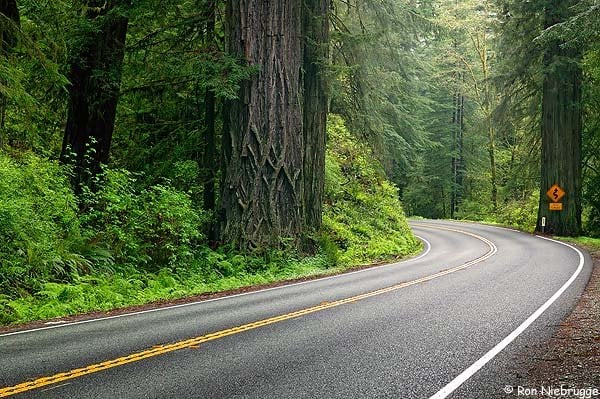
There are a lot of sights to see along the way, but I don’t think we would do much sightseeing, other than probably a side trip to Yellowstone on the way home, which seems like a place to see in the winter. Are there other must see places in winter? We would likely visit the Oregon coast for a couple of days while in Corvallis.

We would need to camp somewhere around Salt Lake City on the way out (we have relatives to stay with in Nebraska) and maybe somewhere around Reno/Tahoe/Sacramento on route to SF, depending on driving time from Salt Lake.

On the way home, we would probably need to camp somewhere between Butte and Bozeman and then probably stop in Teddy Roosevelt, assuming it is open before the final push home.

Questions:

1) Obviously, living in Minnesota we are familiar with serious winter. But still, is this a crazy idea?

2) Does the basic plan sound doable?

3) Can you recommend routes, places to camp?

4) Do we need chains? We don’t have them/ where to get them/ what kind?

5) Winter camping strategies

Anything else?

Thanks much!
 
If you have the time and no one gets car sick... I'd say avoid the "SF, up I-5 to Corvallis" and instead of go up Hwy 1. It's a slow and curvy two lane road, but, if this is your grand tour of the west coast, I don't think you should miss this route. And, there is plenty of camping along the way. I would say if you've got, maybe 3 days (easy to do) to 5 days (lots of time to stop and visit the more unique areas), you could take it easy and in that time frame would do it justice.
 
So far only a couple things come to mine.Chains YES in Calif going into snow country you are required to carry them.You could buy them in Reno or some other city in western Nevada.As for camping use DD's campingusa site and that might help you plan some stops.A lot of campgrounds are closed and have been closed since Sept,Oct.The trip north along the coast is a beautiful drive but if you don't want to drive hwy 1 most of the way it is a very slow and curvy route, you can take hwy 101 especially along the Northern Cal coast and Oregon.than head inland north of Florance,or Florance to Eugene than Corvallis.The Oregon St park campgrounds are very nice and might be open that time of the year.
Hope this helps.
Frank
 
.The Oregon St park campgrounds are very nice and might be open that time of the year.
Hope this helps.
Frank


All of the Oregon State Parks at the beach are open for camping in the winter - and pretty much empty.

The trip sounds totally doable. Get some tire chains, learn how to put them on and you'll never need them, but you will be legal! I'd also say go to the beach and skip I-5 unless you are in a hurry. If you are in a hurry take I-5 to Redding and cut over - or cut over in Oregon at Sutherlin and take 101 upto Newport - then to Corvallis. But take I-5 from Corvallis to Seattle - not a ton to see north of Newport on 101. Then maybe swing by Mt. St. Helens on the way to Seattle....
 
Guys, thanks for the advice and info. I had kind of resigned myself to driving the freeway but you all have got me thinking about the coast road again. We probably have time to do at least some of it. We definitely prefer 2 lane to freeway. The weather variable is the only thing leading to a thought about the freeway. If it is raining all the time (my preconception), camping maybe wouldn't be so attractive.

I am a total newby on chains. Are there choices to be made or are all chains created equal? From what I have read, with the Tacoma I am limited to chains on the rear wheels only (clearance issue on the front). Where is the best place to buy them? It sounds like I will rarely if ever use them, but I need to be able to show I have them. This leads me to think it is not prudent to spend a ton of money on them.

Any thoughts on visiting Yellowstone in the winter? From what I have gathered, you can't really drive around- you have to book a private shuttle to go anywhere. We aren't sure that is our cup of tea. Any other thoughts on the Seattle to Minnesota leg?

I will check out DD's campingusa resource. Thanks for the tip, Frank.
 
I use chains a lot on forest road approaches to back county ski. Tried and hated many brands/styles until I found RUD Compact chains. They are German engineered, which is enough for me! Super easy to put on and I used them in over the bumper snow and skating rink ice on steep roads with scary drops all winter with no issues. When everyone was battling their chains in the chain up lots I was like a NASCAR team. About 1.5 mins per tire. I don't always give this much praise but am truly impressed with this product.

You can check them out at Tire Chain Dealer or at RUDs fancy German site. http://www.rud.com/en-us/products/schneeketten/pkw/grip.html

Your trip sounds great, by the way.
 
Guys, thanks for the advice and info. I had kind of resigned myself to driving the freeway but you all have got me thinking about the coast road again. We probably have time to do at least some of it. We definitely prefer 2 lane to freeway. The weather variable is the only thing leading to a thought about the freeway. If it is raining all the time (my preconception), camping maybe wouldn't be so attractive.

I am a total newby on chains. Are there choices to be made or are all chains created equal? From what I have read, with the Tacoma I am limited to chains on the rear wheels only (clearance issue on the front). Where is the best place to buy them? It sounds like I will rarely if ever use them, but I need to be able to show I have them. This leads me to think it is not prudent to spend a ton of money on them.

Any thoughts on visiting Yellowstone in the winter? From what I have gathered, you can't really drive around- you have to book a private shuttle to go anywhere. We aren't sure that is our cup of tea. Any other thoughts on the Seattle to Minnesota leg?

I will check out DD's campingusa resource. Thanks for the tip, Frank.


Get a cheap set of chains that fit for an emergency only going over hwy 80 and I-5 north. TRD I assume you are 4WD, California may check for chains but will let you go with 4WD except in the worst conditions. I used to ski a lot, I only saw chains required for 4WD two times and the road closed soon after. If you go up 1 or 101 you will not need chains on the coast. If you have not gone up Hwy 1 on the coast or 101 through the red woods they are a must see. The Columbia River east of Portland (old road) is another must see.

Oregon State Parks are the best, they set the benchmark for all state parks. All but one campground will be closed when you go to Yellowstone. Below is a picture from Yellowstone October 17th last year, 25 degrees in the morning. I worked for Hormel in Austin MN so I know you may consider that T-shirt weather

15+Snow+in+Yellowstone.jpg


Edit, just wanted to say I enjoy reading your Blog Travels with Rocky the Dog.

Bill in Stockton
My Travel Blog
 
Yes, unless time is an issue stay off I5. Its the ugliest part of CA. 1 if you can, 101 is nearly as good. Worst case in CA the chain monkeys will sell you chains. Twice as much but its likely you won't need them. If you do hit a storm over the pass, just hang out in the Casino for a day until it passes. And as I tell everyone I can, if you go up highway one, pickup some bacon at roundmans in fort bragg. http://www.roundmans.com/
 
I've had the great good fortune to spend a week to 10 days in the Park City, UT area, in January, annually for the last 10 years. The last two trips were Road Trips from my North Carolina home. January 2011 was in my Superduty diesel 4WD and January 2012 was in my wife's Chevy Equinox AWD. Of the 4 out-and-back legs, we encountered lousy weather on 3 of them.

The crux point along the I-80 route is Wyoming--pretty much the whole state--but particularly between Cheyenne and Rawlins. The pass between Cheyenne and Laramie is 8,640' and for around 100 miles west of Laramie I-80 holds elevations of between 6'500' and 7'700'. This segment is frequented by very high winds, whiteout conditions, and black ice. It is regularly closed by the Wyoming DOT for few hours to half a day or so. If weather is in the forecast, I'd avoid I-80 across WY if I had a reasonable alternative.

In my opinion, I-90 across Montana and Idaho is a reasonable alternative unless your ultimate CA destination makes dropping down from I-90 illogical. While it's several hundred miles north of I-80, I-90 runs mostly in the valleys of the Yellowstone and upper Missouri Rivers east of the Divide and in the valley of the Clark Fork River west of it. Elevations run between 2,800' and 4,000' in the valleys. There are but 3 passes to deal with--Bozeman, Homestake, and Lookout, and they're at 5,700', 6,700', and 4,500', respectively. The approaches and descents are fairly short, along the order of 5-10 miles each side of the pass, so you don't have a lot of distance at higher elevations.

If you end up running I-80 outbound, be aware of the slightly longer (10-15 miles?) but much easier descent onto the Great Basin floor by taking I-84 from just inside UT at Echo Canyon, to Ogden, then pick up I-15/215 back to I-80 at the SLC airport. Doing this avoids the climb to and descent from Parley's Summit, the 7,000' pass I-80 crosses between SLC and Park City. The descent from Parley's into SLC is pretty much a banzai 3,500' drop with some fairly tight curves towards the bottom. It sees a boatload of day-skier traffic, tractor-trailer traffic, and commuter traffic. At the bottom it dumps onto the eastern side of the I-215 loop and right in downtown SLC. Hitting any or all of this at the wrong time of day can be a significant PITA.

As to Yellowstone, I think you nailed it with the "no driving" in winter. You've got the tours which enter the park and exit it. That also means you're left with an overall pass-by along either the I-80 or I-90 corridor.

Foy
 
Tried and hated many brands/styles until I found RUD Compact chains.

Thanks for the tip. Those do look pretty nice. I suppose if I got some good ones, I might use them around here in the backwoods too.

...25 degrees in the morning. I worked for Hormel in Austin MN so I know you may consider that T-shirt weather

HaHa- yeah, winter can be brutal here, but with the general warming trend, that is getting less true. I have been ice fishing at -55 below zero (actual, not windchill) but we haven't seen anything remotely close to that for probably 10 years.

...pickup some bacon at roundmans in fort bragg. http://www.roundmans.com/

Good tip. I checked out the site- looks like a must stop. Got to love the bacon.

I'd avoid I-80 across WY if I had a reasonable alternative.

If you end up running I-80 outbound, be aware of the slightly longer (10-15 miles?) but much easier descent onto the Great Basin floor by taking I-84 from just inside UT at Echo Canyon, to Ogden, then pick up I-15/215 back to I-80 at the SLC airport. Doing this avoids the climb to and descent from Parley's Summit, the 7,000' pass I-80 crosses between SLC and Park City. The descent from Parley's into SLC is pretty much a banzai 3,500' drop with some fairly tight curves towards the bottom. It sees a boatload of day-skier traffic, tractor-trailer traffic, and commuter traffic. At the bottom it dumps onto the eastern side of the I-215 loop and right in downtown SLC. Hitting any or all of this at the wrong time of day can be a significant PITA.

Yeah, I've driven that I-80 route 4 times in the past year. You are right- the Wyoming stretch can be tough. That's the only place I saw snow last January, but thankfully it was not much and not a problem. The wind and icy patches were more an issue. The I-90 route is too far north for the way out. We will take that coming home.

Thanks for the tip about the approach to SLC. It is culture shock to all of a sudden hit that downtown stretch after 2 days of open country freeway. Have you got any tips for camping spots around there?
 
As to camping in the SLC vicinity, no, I don't know of any spots, but I would speculate any and all commercial and Federal/state/local govt park system campgrounds would be long since closed by Dec/Jan. Assuming a boondock site, other factors being equal, I think I'd shoot for reaching the Great Basin starting at SLC just to lose the 3,000' of elevation from the Plateau and Wasatch range. It's pretty brutal up above 6,000' or so. Once you leave the SLC airport in the rearview, you've got a couple or three exits for towns around Toole (sp?), then you're in no man's land for something like 80 miles to Wendover. I imagine you can pull off at any other exit and snag a patch of BLM land (a Utah Benchmark Atlas may show you where) or just snag an I-80 rest area stop.

Foy
 
If you've come all the way out west to California, I'd say you gotta' take Hwy 1. Insanity to miss the California Redwoods. Oregon Coast is nice and you certainly should spend some time there but the added handful of hours you'll spend taking California's most beautiful route (Hwy 1) rather than California's least interesting route (Hwy 5) is well worth it!!
 

Attachments

  • C6CT2798..jpg
    C6CT2798..jpg
    76.5 KB · Views: 95
...Insanity to miss the California Redwoods. ...

haha, I'm convinced. Don't know what I was thinking when I wrote the original post. Glad to have everyone bring me to my senses. Highway 1 it will be.
 
An option south of the 80 that I'd suggest is I-70 (from too close to Denver) to Hwy 50 (back to the 80 near Fernley, NV). I don't know enough about the area to know what kind of weather you could/would run into cresting the Divide on the 70, but from there all the way west to the 80 near Fernley will take you through an amazing sequence of diverse country. Crystal River Gorge, San Rafael Swell, and the Great Basin to name the major POI's. Driving thru SLC during morning rush 'hour' was enough for me, but I'm known for taking the roads less traveled - even if they are longer.
Highly recommend the Benchmark State Atlas' for each state that you'll be driving thru as they have good map detail, but also have reasonably inclusive camping details.

X eleventeen on hearing that you won't miss the Coast Route. A pre-trip research suggestion: look into which Oregon lighthouse interests you the most and plan on visiting it. All of those that we saw on one trip were amazing in their own, unique ways.
It's probably too far north for your coastal travels, but Tillamook has two POI's worth visiting. The cheese factory tour is a good one (try the Marionberry Ice Cream in the cafe, it's not to be missed!), and much lessor known but very interesting (at least to gearheads like myself) is the Air Museum housed in the former Blimp Hangar on the south side of town. The hangar was built from local trees during WWII and is big enough to have it's own micro-climate inside.
I understand that shortly there is to be an RR museum adjacent to the Air Museum. From the looks of the acquired units thus far it too should be an interesting stop.
 
haha, I'm convinced. Don't know what I was thinking when I wrote the original post. Glad to have everyone bring me to my senses. Highway 1 it will be.


Now you have me green with envy! Off-season in the redwoods, what a dream! Prairie Creek State Park has that wonderful beach campground, "Gold Bluffs" or something like that. I know a lot has been said about it here on WTW, I'd love to go back there again.

The Hot Springs at Hart Mountain NWR in eastern Oregon might be a nice place to stop on your way back. Don;t know if it is along your way.
 
An option south of the 80 that I'd suggest is I-70 (from too close to Denver) to Hwy 50 (back to the 80 near Fernley, NV). I don't know enough about the area to know what kind of weather you could/would run into cresting the Divide on the 70, but from there all the way west to the 80 near Fernley will take you through an amazing sequence of diverse country.


For my own tastes, passing through DEN on I-70 would represent more of a pain than passing through the Rockies on it. I think SLC as a congested urbanized area pales by comparison to DEN. Then again, hitting it at non-rush hour times should be OK. Getting there from western Nebraska on I-76from I-80 is simple and direct, too. Now, for the Rockies:

You start at over 5,000' east of DEN and you climb continuously, or nearly so, to the Eisenhower Tunnel. Yes, there's a downgrade from Evergreen to Idaho Falls, but the gist of it is uphill all the way to the Tunnel, which is at over 11,000'. You lose 2,000' down through Dillon and Copper Mountain, pick it back up to Vail Pass (10,600), then lose much of it by the time you pass Eagle, CO (6,600'). Then you stay downhill in the Colorado River valley into UT. It's around 120 miles from middlin' DEN to Eagle. Hit it at the right time of day on a non-snowy day and it's 2 hours. Hit it at DEN rush hour + or - a Saturday or Sunday morning w/ day-trip skiers headed up and it more than that. Hit it as weather hits the higher elevations approaching the Tunnel and/or Vail Pass and I-70 can close for hours on end. The heads-up December/January traveler would study the weather map/forecast carefully while in Nebraska, where the split just west of Ogalalla effects your election to cross on I-80 vs I-70. Both WY and CO have excellent networks of live webcams and RoadWay Information Systems (RWIS), so real-time images and data are at hand for the connected traveler.

I personally rate I-70 from the west side of DEN to Vail/Beaver Creek as the most spectacular segment of alpine scenery visible from an Interstate in the Lower 48 (while admitting I've never crossed the Sierra Nevada on I-80).

I much enjoy a stay at Glenwood Springs, where the immense hot springs pools are a great soak on a cold winter night.

I-70 picks up US 50 at Grand Junction and surrenders it after crossing the southern, lower end of the Wasatch below Provo, UT, and heads out across the Great Basin as the Loneliest Road In America. I rather suspect NV & OR 140, the Winnemucca-to-the-Sea Road, could give US 50 a run for its money, but I've yet to run either route--yet.

Foy
 
...........picks up US 50 at Grand Junction and surrenders it after crossing the southern, lower end of the Wasatch below Provo, UT, and heads out across the Great Basin as the Loneliest Road In America. I rather suspect NV & OR 140, the Winnemucca-to-the-Sea Road, could give US 50 a run for its money, but I've yet to run either route--yet.

It may not have a place as the answer to the OP's question, but since Foy brought it up:
I haven't thought of comparing these two stretches... But, yeah! Both are most-excellent!
US 50 from Fallon, NV to Delta, UT -- Yes!
smile.gif

OR/NV 140 from Lakeview, OR to US 95 north of Winnemucca, NV -- Yes!
smile.gif


I've driven both of these stretches of highway quite-a-few/many times and both are fabulous Great Basin/basin-and-range middle-of-nowhere GREAT! (if you like that sort of thing). I absolutely love it.
smile.gif

Both routes can be at their most-best during fair weather in mid-winter: Cold, clear, stunning!
(I gotta get on the road again!)


It's even better if you have the time to do both on the same trip-right! Might be a bit more chancy during the winter, but why did we buy the FWC's for anyway, to camp a some resort hotel:rolleyes:!

Smoke
 

New posts - WTW

Back
Top Bottom