Fall?

Yeah, I'm wondering what that is going to do to the coast road from SF to Oregon. We are traveling that way in a couple of weeks. Hopefully the road doesn't' get washed out. :oops: Also wondering about Hwy 50 across Nevada- will it get some good snow out of this system or it going north of there?

Don't start worrying yet!
biggrin.gif


Hiwy 50 across Nevada doesn't get the amount snow like where 50 crosses the Sierras in California -- never several feet deep. It does cross several 7000+ feet passes, and those can/will get snowy, but the ranges are narrow and they get them plowed quickly...and there's rarely a crippling amount of snow there anyway.
 
Confirming it is a serious slug of warm moisture here with high snow levels, above most highway passes. It is raining.

The part of the storm that's over Idaho now passed over us last night...I could hear it on the roof and in the downspouts. Unfortunately, my rain gauge has stopped communicating with my weather base station, so I don't know how much rain we got (though in Bend we never get "interesting" amounts of rain). I recently bought a new gauge, new batteries...it worked for a couple of days and then stopped. Maybe I need a new base station, though it's communicating with the outside temperature sensor just fine.
 
Yeah, I'm wondering what that is going to do to the coast road from SF to Oregon. We are traveling that way in a couple of weeks. Hopefully the road doesn't' get washed out. :oops: Also wondering about Hwy 50 across Nevada- will it get some good snow out of this system or it going north of there?


check out the Nevada Roads website and click on the highway controls report on the upper right.
 
Here at the central coast we have had over 4" of rain since 5AM.It's coming down very steady.,have had flash flood warnings for the Big Sur area and east of there in the Soledad area.May be the local rivers will break through to the ocean and let the steelhead up river.
Just sitting here by the wood stove enjoying the rain.We have a "glass room" on the south of the house and it's nice to sit in when there is weather.
Frank
 
Don't start worrying yet!
biggrin.gif


Hiwy 50 across Nevada doesn't get the amount snow like where 50 crosses the Sierras in California -- never several feet deep. It does cross several 7000+ feet passes, and those can/will get snowy, but the ranges are narrow and they get them plowed quickly...and there's rarely a crippling amount of snow there anyway.
There is an old saying- worry is like a rocking chair- gives you something to do but doesn't get you anywhere. haha. I'm not worried so much as curious. Thanks for the reassurance.

check out the Nevada Roads website and click on the highway controls report on the upper right.

Thanks for that link! I bookmarked it for future reference.
 
A new low for the season this morning at my house: 22°F.
That's not very low for Bend...and we already had a low of 26°F way back on October.
Damn Niño! :cautious:
 
We've had temps in the teens and twenties, but it's been dry, dry, dry. Ski resorts opened late and some are still closed. Hoping for the first significant snow in the Sacramentos tomorrow. Fingers crossed.

Not a typical Niño here...
 
A new new low for the season this morning at my house in Bend: 18.5°F.

20121218-1.jpg


Finally...the low dropped down into the teens.
 
And today was the first day (at my place) this season for which the high temperature was below freezing: 31°F

20121218-2.jpg


OK, now it kinda feels like winter.
 
23° here this morning and it looks like winter is going to come in with a real storm

Winter Storm Watch

URGENT - WINTER WEATHER MESSAGE
NATIONAL WEATHER SERVICE SACRAMENTO CA
357 AM PST WED DEC 19 2012

...DELAY IN STORM WITH PERIODS OF HEAVY SNOW FOR INTERIOR NORTHERN
CALIFORNIA NOW THURSDAY THROUGH THE WEEKEND...

.A SERIES OF STORMS WILL TRACK ACROSS NORTHERN CALIFORNIA
THURSDAY THROUGH THE WEEKEND WITH LITTLE TO NO BREAK
BETWEEN WAVES. SNOW LEVELS WILL START ALONG THE NORTHERN
SACRAMENTO VALLEY FLOOR THURSDAY EVENING BEFORE GRADUALLY
CLIMBING TO 3000 TO 4000 FEET BY SATURDAY.

CAZ069-200000-
/O.EXT.KSTO.WS.A.0012.121221T1800Z-121223T1200Z/
WEST SLOPE NORTHERN SIERRA NEVADA-
357 AM PST WED DEC 19 2012

...WINTER STORM WATCH NOW IN EFFECT FROM FRIDAY MORNING THROUGH
LATE SATURDAY NIGHT ABOVE 4000 FEET...

* SNOW ACCUMULATIONS: 2 TO 4 FEET.

* TIMING: MODERATE TO HEAVY SNOWFALL BEGINS NORTH OF INTERSTATE 80
EARLY FRIDAY AND SPREADS SOUTHWARD LATER FRIDAY. MODERATE TO
HEAVY SNOW WILL CONTINUE THROUGH MOST OF THE WEEKEND.

* LOCATIONS INCLUDE: INTERSTATE 80...AND AREA HIGHWAYS.

* WINDS: SOUTH 15 TO 30 MPH WITH GUSTS UP TO 65 MPH.

* IMPACTS: SNOW WILL LIKELY IMPACT TRAVEL ON AREA HIGHWAYS SUCH
AS ALL TRANS SIERRA NEVADA HIGHWAY PASSES.

PRECAUTIONARY/PREPAREDNESS ACTIONS...

A WINTER STORM WATCH MEANS THERE IS A POTENTIAL FOR SIGNIFICANT
SNOW...SLEET...OR ICE ACCUMULATIONS THAT MAY IMPACT TRAVEL.
CONTINUE TO MONITOR THE LATEST FORECASTS.
 
I'll be driving from Bend to Redding on the 24th...and on the 26th driving from Redding east to Susanville and points south/east. Wonder what driving/road conditions will be like early next week?
huh.gif

Now, I usually don't worry much about the weather when driving -- especially when I'm driving my truck...except that I do sometimes worry that I-5 will be closed between Redding and Mt Shasta or that they'll require chains on that stretch. So much traffic on that 60-mile stretch of relatively-windy/steep interstate that they're kinda conservative in driving restrictions with snow...sometimes annoyingly conservative.
dry.gif
 
:LOL:

All I can tell you Mark is it's supposed to snow all week here and in central Nevada and be partly clear on Mon and Tuesday; it is COLD here-almost to cold and I have no idea what you will face next week on the way here and still we have a whole week to wait to see what the weather does, and before i decide whether I'll follow you over to Austin or not----and a week is an very long time in this part of the world at this time of the year ! Jingle Bells, Jingle Bells, etc.,will keep you posted on the weather!

Smoke
 
... be partly clear on Mon and Tuesday...

Yeah, I saw that part of the forecast -- same forecast for eastern Nevada, in Ely. Sounds positive so far, into Wednesday now.
smile.gif
 
Crash involving 60 vehicles closes I-5 in Siskiyou County

This happened yesterday/overnight...one of the reasons they tend to require chains on I-5 in far-northern California -- or close it altogether -- under conditions that don't seem that bad: All it takes is one mistake and they all fall down.

...This reminds me of back when I was growing up in the Central Valley (of CA), there would once in a while be huge pile-ups of cars on Highway 99 (before I-5 was there) in the thick fog that can form in the Central Valley. There were crashes involving more than 100 vehicles..as people couldn't see the car in front of them in the thick fog until it was too late to stop.
ohmy.gif

I don't know if they still do that there or if people have gotten wiser... yeah, right!
rolleyes.gif
 
It still happens. The past couple years haven't been too bad you never know when you might get socked in by fog for weeks. When all you can see is the fog line and you're rolling down your windows to listen for vehicles, thats pretty thick fog.
 
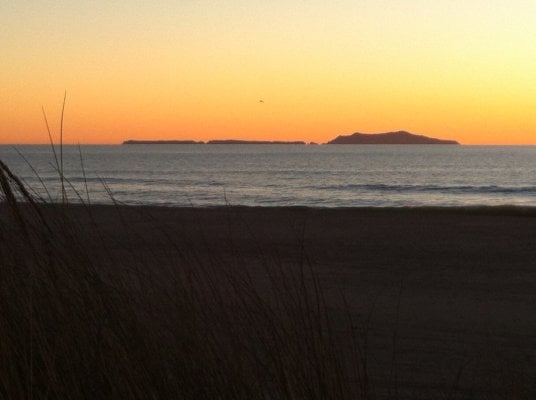
Pretty brisk the past couple of mornings, a chilly 39* here on the beach in SoCal. Makes for some brisk morning and evening walks. Fading swell but the visibility has been pretty sick though....
 

Attachments

  • image.jpg
    image.jpg
    486.4 KB · Views: 90
Today was one of the flattest temperature profiles I've ever recorded: Low of 31°F , High of 35°F

20121220.jpg
 
39° here this morning and awaiting the big storm's arrival. They have upped the possible snowfall total to five feet. But wait, its no longer fall, it is winter!
 
...But wait, its no longer fall, it is winter!

Yep, as of 3:30 this morning. I'm shutting this topic down as it's no longer appropriate.
mellow.gif
 
Back
Top Bottom