Winter Watch

WEATHER-NERDISM:
After 3 winters traveling and camping on or near the Gulf of Mexico coast I've learned this, winter-weather-wise: It's all about the wind direction. When it's blowing from the south, off the Gulf, it's going to be warm, usually humid, possibly wet. When it's blowing from the north, a continental air mass, it's going to be cold, usually dry, possibly sunny.
That may be obvious, meteorologically, but living on the west coast I never experienced it. OK, after that long intro, here's some actual data to illustrate, which I got using my new weather gadget (which I'll describe in a separate post).

Here on the central Gulf coast of Texas, it had been a south wind (off the Gulf) for a few days: warm and so humid that there was fog. The forecast showed that the wind would shift to out of the north early Thursday (yesterday) morning. Here's what my weather instrument recorded for dew point (absolute humidity) during that period:
Screenshot_20230112-111158_SensorPush.jpg
A drop in dew point of >25°F in about 3 hour!
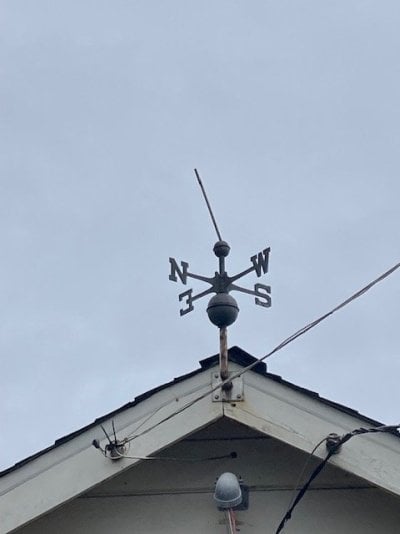
I don't have an anemometer, so I can't personally tie the wind 'cause' to the humidity 'effect', but I looked it up, and the wind direction did change from south to north between 5 and 6am.

I'm enjoying the cooler but drier: I can do something to counter cold, but I can't counter damp.

The weather: it's always sumthin!
 
Casa Escarlata Robles Too said:
Very nice,must be a hard life with all that warm weather and no snow.
I bet you miss Bend. Ha Ha.
Frank
Well, actually, week after next I'm going to fly home to Bend for a 2-week break from my winter wander. See friends, celebrate my birthday, sort through mail...etc.
No, I DON'T miss snow in Bend. I do like snow in the mountains, however.
 
Yup, we've got plenty of diesel.............................


Winter Storm Warning
Code:
URGENT - WINTER WEATHER MESSAGE
National Weather Service Sacramento CA
207 PM PST Fri Jan 13 2023

CAZ068-069-141400-
/O.CON.KSTO.WS.W.0003.000000T0000Z-230117T0600Z/
Western Plumas County/Lassen Park-
West Slope Northern Sierra Nevada-
Including the cities of Chester, Quincy, and Blue Canyon
207 PM PST Fri Jan 13 2023

...WINTER STORM WARNING REMAINS IN EFFECT UNTIL 10 PM PST
MONDAY...

* WHAT...Heavy snow possible into Monday. Total snow
  accumulations of 3 to 6 feet possible. Winds could gust as high
  as 55 mph.

* WHERE...Western Plumas County/Lassen Park and West Slope
  Northern Sierra Nevada including Interstate 80 over Donner
  Pass, Highway 50 over Echo Summit and Highway 88 over Carson
  Pass.

* WHEN...From 1 PM Friday to 10 PM PST Monday.

* IMPACTS...Travel could be very difficult to impossible. Gusty
  winds could bring down tree branches. Widespread blowing snow
  could significantly reduce visibility.

* ADDITIONAL DETAILS...Snow will move in early this afternoon
  with multiple rounds of heavy snow over the weekend into early
  next week. Snow levels will be 5000-6000 feet Friday falling
  to 3500-4500 feet Saturday night. Mountain travel will be
  difficult to impossible especially Saturday and again Monday.
 
You may have to do alternating 12 hours on / off watches, running the snow blowers every 2 hours!
 
Storm is here and we're getting hit with hard rain and wind. Temperatures drop this evening and it will turn to snow.

Light at the light of the tunnel ahead?


Thursday
Partly sunny, with a high near 41.


Thursday Night
Partly cloudy, with a low around 29.


Friday
Sunny, with a high near 45.
 
5" to blow this morning. Nice snow that blew so easy. It only took an hour to do the private road, plow berm from the County road at the top, our upper and lower driveways, and clearing out two neighbors' homes. The Lady shoveled the decks.

Now its time to put together a chicken rosemary thyme stew in the crock pot. :)
 
Unfortunately Covid has made it easy for me to stay home and not contribute to the problems our roadways are experiencing. Mild case but its made me miss the Winter Fun Festival this year.
 
ski3pin said:
5" to blow this morning. Nice snow that blew so easy. It only took an hour to do the private road, plow berm from the County road at the top, our upper and lower driveways, and clearing out two neighbors' homes. The Lady shoveled the decks.

Now it’s time to put together a chicken rosemary thyme stew in the crock pot. :)
That stew sounds so good, I went out to Chef Google and found a recipe.
 
Wandering Sagebrush said:
That stew sounds so good, I went out to Chef Google and found a recipe.
I believe I posted my recipe in the cooking section here. We love to freeze a couple of bowls full and then vacuum seal for camper trip dinners.
 
Around Christmas it got well below freezing here along the Gulf coast of south Texas... And then there's this week:
IMG_20230115_143808.jpg

I'm camped at Mustang Island State Park. There are no trees on this barrier island (giant sandbar), but I enjoy big views.
There are several national wildlife refuges in the area to check out , so this is a good base.
IMG_20230115_144045.jpg
 
Our small local reservoir (Bureau of Reclamation project sold to the local irrigation district) two miles down the road from us was a little over 60% of capacity on 30 Dec. It started spilling 10 Jan. It is maxed out now.
 
Today is the "big dump" day of this storm cycle. Woke to 9" of new this morning and more is coming down hard. Yesterday morning clearing was 5".

.......and the sound of a chain saw in the distance - trees and branches down.
 
MarkBC said:
One year ago New Bullards Bar reservoir was at roughly 600k acre feet. Now we're looking at 78% of capacity at 752k AF https://cdec.water.ca.gov/resapp/ResDetail?resid=BUL

Other reservoirs still have a long ways to go:
Shasta — 49% of capacity, 80% of historical average
Trinity — 29% of capacity, 47% of historical average
Sonoma — 57% of capacity, 99% of historical average
Oroville — 54% of capacity, 99% of historical average
New Bullards Bar — 78% of capacity, 122% of historical average
Folsom — 47% of capacity, 110% of historical average
 
It sure is nice to see these reservoir levels on the rise. Seems like it has been forever since we have seen this much rain all at once. Hoping for some good inland spring fishing once everything settles in. It has been a wild ride here up the coast from Santa Cruz. Kayaking down the roads, uprooted trees everywhere, sink holes, slides, huge surf devouring the beaches and wharfs, and docks surging over the pylons down at the harbor. I secured three boats that were adrift in the main channel.

Good news for this coming week as we get a much needed break. Hope fully they can dredge the shoaled entrance so we can get out again as crab season has finally opened up 100%.

I also was able to finally locate the Heron that took flight from my wind vane! At least I knew what direction to look.
 

Attachments

  • IMG_2213.jpg
    IMG_2213.jpg
    30.1 KB · Views: 32
craig333 said:
Anyone know it our storms are helping fill lake mead, lake powell etc?
Craig from the weather maps the news shows,the watershed
for the Colorado River is getting a lot of snow.
We'll just have to wait and see until the spring snow melt.
Frank
 
Back
Top Bottom