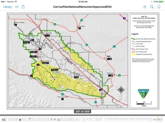
Thanks for planning this. Please count me and my wife in. We live in Santa Margarita just about 50 miles west of Carrizo. Will send PM. Can make prerun or make contact with National Monument people at the visitors center near painted rock if requested. Only two camping places, KCL and Selby. Selby has water for horses, shade structures, tables, fire rings. I'm not sure what's at KCL now, but could check it out. In the spring the hike to Painted rock from the staging parking lot requires a docent. Only about a 1/2 mile hike. Can be pre arranged. We are getting more rain right now than we have had in about 4 years. The Carrizo has been extremely dry for at least three years. This spring should be a spectacular wildflower bloom. Only time will tell.
")